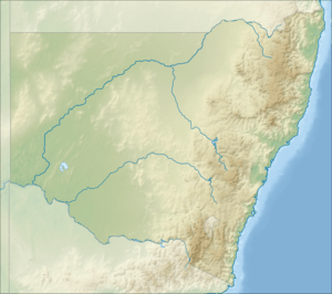
Georges River National Park
| Georges River National Park New South Wales | |
|---|---|
|
IUCN category II (national park) | |
|
Looking down from Alfords Point Bridge | |
 Georges River National Park | |
| Coordinates | 33°58′58″S 151°01′56″E / 33.98278°S 151.03222°ECoordinates: 33°58′58″S 151°01′56″E / 33.98278°S 151.03222°E |
| Established | 24 April 1992[1] |
| Area | 5.14 km2 (2.0 sq mi)[1] |
| Managing authorities | NSW National Parks & Wildlife Service |
| Website | Georges River National Park |
| See also |
Protected areas of New South Wales |
The Georges River National Park is a protected national park that is located in south–western Sydney, in eastern Australia. The 514-hectare (1,270-acre) national park is situated 25 kilometres (16 mi) southwest of the Sydney central business district and is set along the banks of the Georges River
Features and location
The entrance to the national park is on Henry Lawson Drive, immediately opposite the junction with The River Road, in the City of Bankstown. Henry Lawson Drive is a major arterial road within southern Sydney. It can be easily accessed from the south side off Alfords Point Drive on the shores of the Georges River, in the Sutherland Shire, from the west off the M5 motorway, from the north off Davies Road and from the east off Forest Road.[2]
See also
References
- 1 2 "Georges River National Park: Park management". Office of Environment & Heritage. Government of New South Wales. Retrieved 10 October 2014.
- ↑ "Georges River National Park: How to get there". Office of Environment & Heritage. Government of New South Wales. Retrieved 10 October 2014.
External links
- "Georges River National Park". NSW National Parks & Wildlife Service. Government of New South Wales.
- Georges River National Park (Map). NSW National Parks & Wildlife Service, Government of New South Wales.
- "Georges River National Park: Plan of management" (PDF). NSW National Parks & Wildlife Service (PDF). Government of New South Wales. February 1994. ISBN 0-7305-7346-X.
- "Georges River National Park". Office of Environment & Heritage. Government of New South Wales.
This article is issued from Wikipedia - version of the 4/15/2016. The text is available under the Creative Commons Attribution/Share Alike but additional terms may apply for the media files.