Northern Rivers
| Northern Rivers New South Wales | |||||||||||||
|---|---|---|---|---|---|---|---|---|---|---|---|---|---|
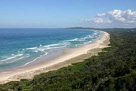 View south from Byron Bay, the most easterly point on mainland Australia. | |||||||||||||
| Population | 277,284 (2011 census) | ||||||||||||
| • Density | 13.37430/km2 (34.63928/sq mi) | ||||||||||||
| Area | 20,732.6 km2 (8,004.9 sq mi) | ||||||||||||
| State electorate(s) | |||||||||||||
| Federal Division(s) | |||||||||||||
| |||||||||||||
Northern Rivers is a region of the Australian state of New South Wales, located between 590 kilometres (370 mi) and 820 kilometres (510 mi) north of the state capital, Sydney. At its most northern point, the region is 102 kilometres (63 mi) south south–east of the Queensland capital, Brisbane.
As with all regions of New South Wales, it has no official status, although state government department offices and local governments in the area work together for purposes such as tourism, education, water catchment management and waste management.[1][2] This area has a mild, sub-tropical climate.
Geography
The Northern Rivers region is bounded by the Pacific Ocean to the east, the New England region to the west where the Great Dividing Range forms a mountainous boundary. To the north is the border between New South Wales and Queensland, where the Darling Downs are located to the north–west and South East Queensland directly to the north. The southern boundary is the Dorrigo ranges, which also mark the southern boundary for the Clarence River Basin.
The defining characteristic of the region are the fertile valleys of the Clarence, Richmond and Tweed rivers and their sources, hence the region's name; and the region's white sandy beaches.
Demography and area
The following local government areas are contained within the region:
| Richmond Tweed rank | Local Government Area | Population 30 June 2014[3] | 10 year growth rate | Population density (people/km2) |
|---|---|---|---|---|
| 1 | Tweed Shire Council | 91,210 | 14.7 | 69.8 |
| 3 | Lismore City Council | 44,629 | 4.4 | 34.7 |
| 4 | Ballina Shire Council | 41,644 | 6.5 | 85.9 |
| 5 | Byron Bay Shire Council | 32,119 | 6.6 | 56.8 |
| 6 | Richmond Valley Shire Council | 22,983 | 8.6 | 7.5 |
| 7 | Kyogle Shire Council | 9,531 | 0.1 | 2.7 |
| Richmond Tweed | 242,116 | 8.9 | 23.6 | |
| 2 | Clarence Valley Council | 51,003 | 4.9 | 4.9 |
| Northern Rivers | 293,119 | 8.2 | 14.2 | |
The region is traversed by the Pacific Highway, Bruxner Highway, Clarence Way, Summerland Way and the North Coast Line which links Sydney to Brisbane, Queensland.
Major towns

Education
The region contains the Southern Cross University, which is headquartered at Lismore and has campuses in Tweed Heads and Coffs Harbour.[4] The North Coast Institute of TAFE has campuses at Lismore, Ballina, Casino, Grafton, Kingscliff, Maclean, Trenayr and Wollongbar.[5]
Culture
The Northern Rivers has its own orchestra based in Murwillumbah the Northern Rivers Symphony Orchestra as well as the Lismore Symphony Orchestra.
The region has a history of Italian settlement. The locality of New Italy was settled in 1882 by Italian pioneers who attempted to cultivate the area's difficult interior.
See also
- Mid North Coast (New South Wales)
- New England (New South Wales)
- South East Queensland
- The Northern Rivers Vaccination Supporters
References
- ↑ Northern Rivers Tourism. "Who we are". Retrieved 11 July 2011.
- ↑ "Northern Rivers ACE Colleges". Retrieved 11 July 201. Check date values in:
|access-date=(help) - ↑ "3218.0 – Regional Population Growth, Australia, 2013–14". Australian Bureau of Statistics.
- ↑ Southern Cross University (3 May 2011). "About SCU - Lismore". Retrieved 11 July 2011.
- ↑ North Coast Institute of TAFE. "Campuses". Retrieved 11 July 2011.
External links
| Wikimedia Commons has media related to Northern Rivers. |
River systems and rivers of the Northern Rivers catchments, New South Wales, Australia | |||||||
|---|---|---|---|---|---|---|---|
| |||||||
| |||||||
| |||||||
| |||||||
| |||||||
| |||||||
| |||||||
|
Coordinates: 29°09′S 153°07′E / 29.150°S 153.117°E