Fawdon
| Fawdon | |
 Fawdon Park Centre |
|
 Fawdon |
|
| Population | 10,090 (2011 Census) |
|---|---|
| OS grid reference | NZ228688 |
| Metropolitan borough | Newcastle upon Tyne |
| Metropolitan county | Tyne and Wear |
| Region | North East |
| Country | England |
| Sovereign state | United Kingdom |
| Post town | NEWCASTLE UPON TYNE |
| Postcode district | NE3 |
| Dialling code | 0191 |
| Police | Northumbria |
| Fire | Tyne and Wear |
| Ambulance | North East |
| EU Parliament | North East England |
| UK Parliament | Newcastle upon Tyne North |
|
|
Coordinates: 55°00′50″N 1°38′42″W / 55.014°N 1.645°W
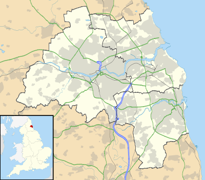
Fawdon is an electoral ward of Newcastle upon Tyne. It is also close to the A1 western bypass. The population of the ward is 10,890, reducing to 10,090 at the 2011 Census,[1] 5.7% of the total population of Newcastle upon Tyne. Car ownership in the area is 53.6% this is lower than the city average of 54.7%.
It is situated about 3.5 miles (5.6 km) north-by-west from Newcastle City Centre and is at the site of three colliery villages which were known as High Fawdon, Fawdon Square and Low Fawdon.[2] Fawdon Square was the birthplace of 19th-century poet and songwriter Marshall Cresswell.
It is the site of a Nestlé Rowntree factory on Rowan Drive, which opened in 1958, employs 600 workers and produces 40,000 tonnes of chocolate a year. It is Nestlé's second largest UK factory after York.[3] The site makes Blue Riband, Breakaway (since 1970), Caramac (since 1959), Fruit pastilles, Rolo, and Yorkie biscuits. The Munchies brand moved there in 2006, from York. The pharmaceutical company Sanofi-Aventis has premises in Fawdon.[4]
Fawdon is served by Fawdon Metro station. This is situated just behind the Fawdon Park Centre, a shopping centre that was built in 1967; it houses Fawdon Post Office and various shops.
In March 2008 the City Council took the decision to demolish Fawdon Park House whilst retaining the shops on the ground level. Fawdon Park House was originally built in the 1960s as part of the Fawdon Park Centre development.[5] Tenants left in September 2009 and demolition of the building finally commenced in late 2012 following asbestos removal.
Fawdon also has a combined library and community centre located on Fawdon Park Road. The local football team is based there, Fawdon FC. Fawdon FC play in the NABC leagues in different age groups.
Education
The Fawdon ward has two schools, Regent Farm First School and North Fawdon Primary School these are both for children under the ages of 11.
Recreation
Fawdon Library has computers with free internet access as well as books and newspapers.[6] North Kenton park, the home of Kenton sports centre, is in this ward[7] and covers 42,500 square metres. Fawdon Park is also in the ward.[4]
Ward boundaries
The boundary of Fawdon ward begins at the footbridge over the Ouseburn and it continues along the Ouseburn to the A1. The boundary heads southwest to Hazeldene Avenue where it turns and carries on east into Quentin Avenue. At the bowling green the boundary heads south to Kirkwood Drive and turns south at the east of Mountfield Primary School. It turns eastward between Kirkwood Drive and Mountfield Gardens and runs along the southern edge of the allotment gardens. At Kenton Road the boundary runs north and then east onto Souter Road. It then continues to the south of Lambert Square and on to the back of Wall Close onto Wall Street. From Wall Street it heads northwest along Jubilee Road to the Wansbeck Road roundabout. It runs north of Wansbeck Road South past Regent Farm First School and Wansbeck Park Metro onto Wansbeck Road North to the Kingston Park Road roundabout. Then the boundary runs north along the properties to Kingston Park Road.
Demographics
| Age group | Number |
|---|---|
| Under 16 | 2,239 |
| 16-24 | 1,590 |
| 25-44 | 2,916 |
| 45-64 | 2,212 |
| 65-74 | 1,051 |
| 75+ | 500 |
| Ethnicity | Number | % |
|---|---|---|
| White | 10,110 | 96.8 |
| Afro-Caribbean | 25 | 0.2 |
| South Asian | 175 | 1.7 |
| Chinese | 33 | 0.3 |
| Other | 107 | 1 |
The ward has 4,908 housing spaces of which 4.8% are vacant this is lower than the city average of 5.3%. Owner occupied property stands at 49.2% slightly lower than the city average of 53.3%. The properties are as follows.
| Property type | Number | % |
|---|---|---|
| Detached | 358 | 7.3 |
| Semi-detached | 2,040 | 41.5 |
| Terraced | 1,055 | 21.5 |
| Flats | 1,460 | 29.7 |
| Other | 0 | 0 |
References
- ↑ "Ward population 2011". Retrieved 5 July 2015.
- ↑ "Fawdon Colliery by T.W. Hair - DMM".
- ↑ Will Metcalfe (27 August 2014). "Drugs found among Jelly Tots on the production line at Nestle factory in Fawdon". nechronicle.
- 1 2 "Home". newcastle.gov.uk.
- ↑ Historic England. "Monument No. 1499638". PastScape. Retrieved 6 October 2015.
- ↑ "Fawdon Partnership Library". newcastle.gov.uk.
- ↑ "North Kenton Park". newcastle.gov.uk.
External links
- Fawdon Colliery
- The library
- Job cuts of 41 in March 2006
- Newcastle Council Ward Info: Fawdon
- Newcastle Council census 2001 Fawdon