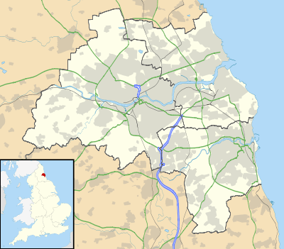
Ryton, Tyne and Wear
| Ryton | |
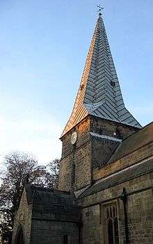 The Holy Cross Church in Ryton |
|
 Ryton |
|
| Population | 7,310 (2011)[1] |
|---|---|
| OS grid reference | NZ1464 |
| Metropolitan borough | Gateshead |
| Metropolitan county | Tyne and Wear |
| Region | North East |
| Country | England |
| Sovereign state | United Kingdom |
| Post town | RYTON |
| Postcode district | NE40 |
| Dialling code | 0191 |
| Police | Northumbria |
| Fire | Tyne and Wear |
| Ambulance | North East |
| EU Parliament | North East England |
| UK Parliament | Blaydon |
|
|
Coordinates: 54°58′23″N 1°45′47″W / 54.973°N 1.763°W
Ryton is a semi-rural small town near the western border of Tyne and Wear, England. Once an independent town in County Durham it became incorporated into the metropolitan county of Tyne and Wear and the Metropolitan Borough of Gateshead in 1974. By the 2011 Census the parish had been absorbed into the Gateshead MBC ward of Ryton, Crookhill and Stella. The total population of this ward was 8,146.[2]
Location
Ryton lies midway between Crawcrook and Blaydon, both in Tyne and Wear. Nearby settlements include Stargate, Clara Vale, Greenside, Stella and Hedgefield. Stargate is located on the outskirts of Ryton en route to Blaydon. It has a children's park, a fish shop, a Quarry, allotments and in the neighbouring town of Crookhill there is a primary school and a general store, which can also be used as a post office.
History
Traditionally, Ryton's economy was built upon agriculture and coal mining. Some think that coal-mining was taking place in the area as early as Roman times,[3] however it was not until 1239 when Henry III granted that coal may be mined outside the walls that mining became extensive. The agricultural industry in Ryton was mixed and included both pastoral farming and arable farming.
Ryton's position south of the Scottish Borders and Hadrian's Wall made it a target for Scottish attacks in the area, and it is said to have been burned by William Wallace in 1297. A further attack by David II of Scotland was recorded in 1346, during which the church was plundered.[4]
As well as its coal industry, Ryton formerly contained the lead-smelting reverberatory furnaces of the Ryton Company, whose mines were on Alston Moor. This business was amalgamated into the London Lead Company in 1705.
Ryton soon became a place of migration for the wealthy, who wanted to escape the urban sprawl of the Industrial Revolution in Gateshead and Newcastle-Upon-Tyne.
A reminder of Ryton's affluent past is found in some of the old mansions at old Ryton village, a place rich in rural qualities because of its proximity to Ryton Willows on the banks of the River Tyne.
After the decline of the coal industry during the second half of the twentieth century Ryton became increasingly suburbanised and is now used as a commuter village for those that work in the more urban areas of Tyneside.
Local politics
In local government, Ryton is located in the 'Ryton, Crookhill and Stella ward'. The ward is in the outer west of the borough. The ward is served by three councillors, two Liberal Democrats and one Labour. Gateshead Council is Labour controlled.
Ryton is located within the parliamentary constituency of Blaydon. Its current MP is Labour's Dave Anderson.
Geography
The neighbouring village of Crawcrook is a nexus of coal mining nostalgia also. Remnants of several old pits across Ryton and Crawcrook, including Emma, Clara and Addison can still be found. Within a couple of hundred metres of both Crawcrook and Ryton main street there is rich countryside.
Perhaps the most impressive section of this countryside is Ryton Willows Local Nature Reserve located on the banks of the Tyne, just past Old Ryton Village. It consists of 43 hectares of grassland, ponds, woodland and locally rare species of flora and fauna. Because of this it has been designated as a site of special scientific interest.[5]
Other areas of countryside include nearby Stargate pond and Addison and Hedgefield woods. It is at Addison woods that Alexander Graham Bell made one of his pioneering telephone calls.[6]
Further up the Tyne Valley, past the village of Crawcrook and into the border of Northumberland, there are rural market towns such as Prudhoe, Corbridge and Hexham.
Ryton today
A relatively affluent area of Gateshead, Ryton has experienced suburbanisation in recent years and is now used as a commuter area for those that work in the more urban areas of Tyneside.
Despite being a provincial suburb, Ryton remains a vibrant area, with a variety of local amenities. In the more central part of Ryton these include a Cooperative supermarket, a Sainsbury's Local store and a selection of independent shops such as Dominic Pizza's, Coffee Johnny's, a small gift shop and a deli as well as a chiropodist, dentist and various hair and beauty salons. Ryton also boasts the only Thai Restaurant between Newcastle and Hexham with Yim Siam based at The Half Moon Inn in Old Ryton Village. There is also a community library. Ryton also boasts several restaurants and six public houses, four of which are located away from Ryton Main Street, in Ryton Old Village. The nearby village of Crawcrook offers more services, including a doctor's surgery, two veterinary surgeries, another chiropodist, another dentist and a restaurant.
Ryton also has an extensive Edwardian park which includes children's playing equipment, a bowling green and an aviary.
Away from the town centre there is a country club hotel and two golf courses, Tyneside golf club at Ryton, and Ryton golf club in nearby Clara Vale. Both are situated in tranquil areas, near the banks of the Tyne.
Ryton is home to three schools, Ryton Infant's School, Ryton Junior School and Thorp Academy, all of which occupy the same site in the town. Nearby Crawcrook offers two more primary schools. Crookhill primary is also nearby.
Sport also plays a role in the local community. Apart from its golf facilities and its Edwardian park, Ryton has its own football club, Ryton F.C., who play at Crawcrook, its own rugby union team, Ryton Rugby Football Club at nearby Barmoor. Ryton also has its own cricket club, situated opposite Charles Thorp.
Ryton also benefits from good public transport with regular bus services.The R3/R4 which regularly travels to Winlaton, Blaydon and Rowlands Gill via Stargate is a good example of this excellent transport. Buses also travel to Crawcrook, Prudhoe and Hexham to the west, and the MetroCentre, Gateshead and Newcastle to the east.
Other features of Ryton
Both John Wesley and Charles Wesley preached at Ryton's village green, which has a rich history with religious and social significance. Like many greens in similar villages, it played host to an annual fair which included jugglers, dancers and local stalls.
The old pinfold dates back to the twelfth century. During the second half of the twentieth century the pinfold was restored.
Charles Thorp set up a Savings Bank in 1815 in a building within the old village known as the White house which still stands there today. It is thought to have been the first bank of its kind in England.[7]
The annual Ryton Music Festival, held over February and March, has been held in the village for more than 60 years. It offers a variety of music and drama including choral singing and mime.
The Ryton Summer Festival, held at the local comprehensive school usually includes live music, sport and arts and crafts stalls.
Each year on the Tuesday before Christmas Eve villagers gather on the village green to sing traditional carols accompanied by a local brass band.
There are two air raid shelters in Ryton Willows, as well as other Second World War features such trenches and shower/toilet rooms with tiles, etc. still visible, next to a railway line that was apparently used to bring children up from London. A dirt road hidden under trees leading up to the bottom of the village may have been a checkpoint.
Notable residents
- George Hepplewhite – Furniture designer
- Howard Kendall – footballer
- Stan Ramsay – footballer
- Thomas Secker – Archbishop of Canterbury
- Charles Thorp – Founder of Durham University
- Robert Thorp – Clergyman
- Rachel and Becky Unthank – Folk singers, grew up in Ryton
- Nicholas Wood – Civil and Mining engineer
- Charles Algernon Parsons – Engineer and inventor of the steam turbine[8]
References
- ↑ Ryton is made up of 25 output areas in this ward http://www.ukcensusdata.com/ryton-crookhill-and-stella-e05001082#sthash.JDBbmHOn.RCXri12s.dpbs
- ↑ "Gateshead MBC ward of Ryton,Crookhill and Stella population 2011". Retrieved 5 July 2015.
- ↑ Local History Gateshead: Ryton Retrieved 2 November 2013
- ↑ The Church of the Holy Cross, Ryton, published by The Church of England in the Diocese of Durham Retrieved 3 May 2013
- ↑ Cycle-routes
- ↑ Gateshead BC
- ↑ Local History Gateshead: Ryton Retrieved 2013-27-02
- ↑ iSee Gateshead Retrieved 2 April 2013
External links
- Census 2001 Summary of the Ryton, Stella and Crookhill ward. Provided by Gateshead Council.
- Ryton Methodist Church
- An account of the local history of Ryton and its surrounding area.
- Ryton Annual Christmas Carol event