Eastern Tepuis
| Eastern Tepuis (Roraima–Ilú range) | |
|---|---|
 Landsat image of the southern part of the Eastern Tepuis. The two large central plateaus are Kukenán-tepui (left) and Roraima-tepui. Wei-Assipu-tepui is the small peak to the northeast of Roraima, and Yuruaní-tepui is visible in the top left of the frame. | |
| Highest point | |
| Peak | Roraima-tepui |
| Elevation | 2,810 m (9,220 ft) |
| Geography | |
 Location in Venezuela | |
| Location | Roraima, Brazil / Cuyuni-Mazaruni, Guyana / Bolívar, Venezuela |
| Range coordinates | 5°15′N 60°50′W / 5.25°N 60.83°WCoordinates: 5°15′N 60°50′W / 5.25°N 60.83°W |
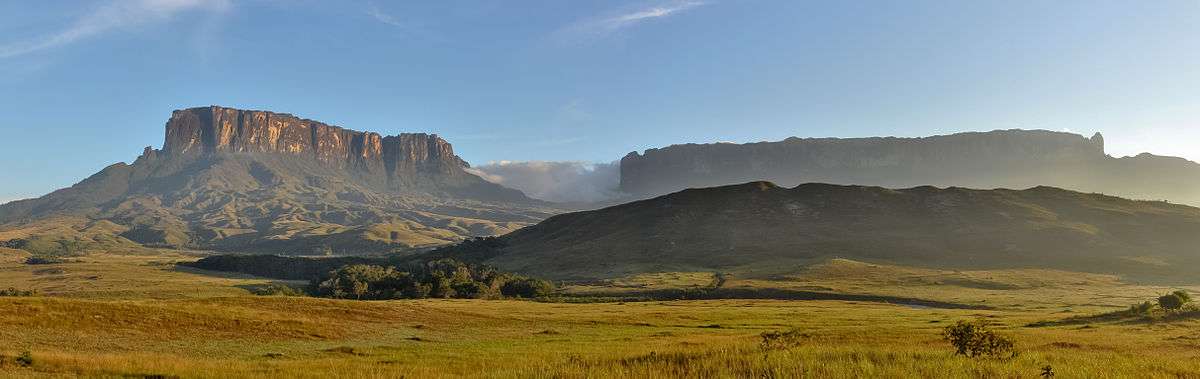
The Eastern Tepuis (Spanish: Tepuyes Orientales[1]), also known as the Roraima–Ilú range, is a mountain chain stretching for some 60 kilometres (37 mi) along the border between the disputed territory of Guayana Esequiba in Guyana, Venezuela and, to a small extent, Brazil.[2] It runs in a northwesterly direction from the tripoint of these countries, closely following the Guyana–Venezuela border, with a single major peak (Uei-tepui) to the south, on the Brazil–Venezuela border. Moving northwest from Uei-tepui (2,150 m), the main summits of this chain are Roraima-tepui (2,810 m), Kukenán-tepui (2,650 m), Yuruaní-tepui (2,400 m), Wadakapiapué-tepui (2,000 m), Karaurín-tepui (2,500 ), Ilú-tepui (2,700 m), and Tramen-tepui.[2] The minor peak of Wei-Assipu-tepui lies entirely outside Venezuela, on the border between Brazil and Guyana. Additionally, there are a number of minor plateaus which form a chain between Uei-tepui and Roraima-tepui.[3] Ilú- and Tramen-tepuis are often treated together since they are joined by a common base.[2]
The Eastern Tepuis chain has a total summit area of around 70 km2 (27 sq mi) and an estimated slope area of 320 km2 (120 sq mi).[2] It includes some of the best known and most widely visited tepuis, particularly Roraima and nearby Kukenán.

See also
References
- ↑ (Spanish) Brewer-Carías, C. (2012). "Roraima: madre de todos los ríos." (PDF). Río Verde 8: 77–94.
- 1 2 3 4 Huber, O. (1995). Geographical and physical features. In: P.E. Berry, B.K. Holst & K. Yatskievych (eds.) Flora of the Venezuelan Guayana. Volume 1. Introduction. Missouri Botanical Garden Press, St. Louis. pp. 1–61.
- ↑ McPherson, S., A. Wistuba, A. Fleischmann & J. Nerz (2011). Sarraceniaceae of South America. Redfern Natural History Productions, Poole.