Cryna, Queensland
| Cryna Queensland | |||||||||||||
|---|---|---|---|---|---|---|---|---|---|---|---|---|---|
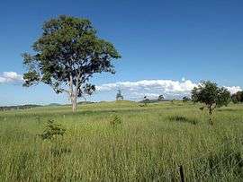 Fields, Markwell Creek Road, 2016 | |||||||||||||
 Cryna | |||||||||||||
| Coordinates | 28°1′42″S 152°59′20″E / 28.02833°S 152.98889°ECoordinates: 28°1′42″S 152°59′20″E / 28.02833°S 152.98889°E | ||||||||||||
| Postcode(s) | 4285 | ||||||||||||
| LGA(s) | Scenic Rim Region | ||||||||||||
| State electorate(s) | Beaudesert | ||||||||||||
| Federal Division(s) | Wright | ||||||||||||
| |||||||||||||
Cryna is a locality in the Scenic Rim Region of South East Queensland, Australia.[1]
Geography
Part of the western border is marked by the Mount Lindesay Highway. Part of the northern boundary follow Spring Creek. The main land use in the area is agriculture. Parts of the central area are elevated along a ridge marking the northern extent of Jinbroken Range.
History
The Beaudesert Shire Tramway passed through the area but did not have a station. The closest station was at Josephville or the terminus in Beaudesert.
References
- ↑ "Cryna - Locality Bounded". Queensland Place Names. The State of Queensland. Retrieved 30 March 2016.
External links
![]() Media related to Cryna, Queensland at Wikimedia Commons
Media related to Cryna, Queensland at Wikimedia Commons
This article is issued from Wikipedia - version of the 4/16/2016. The text is available under the Creative Commons Attribution/Share Alike but additional terms may apply for the media files.