Munbilla, Queensland
| Munbilla Queensland | |||||||||||||
|---|---|---|---|---|---|---|---|---|---|---|---|---|---|
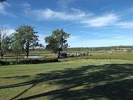 Farm on Kengoon Road, 2015 | |||||||||||||
| Population | 434 (2011 census)[1] | ||||||||||||
| Postcode(s) | 4309 | ||||||||||||
| LGA(s) | Scenic Rim Region | ||||||||||||
| State electorate(s) | Beaudesert | ||||||||||||
| Federal Division(s) | Wright | ||||||||||||
| |||||||||||||
Munbilla is a rural suburb in the local government area of Scenic Rim Region in Queensland, Australia.[2] At the 2011 Australia Census the locality and surrounds recorded a population of 434.[1]
History
The suburb takes its name from the former Munbilla railway station, whose name was "coined" in 1886 by the Railways Department using the Yuggera words mun (meaning much) and billa (meaning water) to mean a large lagoon.[2]
Munbilla railway station was on the Ipswich-to-Dugandan and the Ipswich-to-Mount-Edwards railway lines; it was the last station before the two lines branched. The complete Dugandan line operated from 1886 to 1964 (some earlier stages being open from 1882). The Mount Edwards line operated from 1922 to 1960.
References
- 1 2 Australian Bureau of Statistics (31 October 2012). "Munbilla (State Suburb)". 2011 Census QuickStats. Retrieved 9 April 2015.
- 1 2 "Munbilla (entry 23412)". Queensland Place Names. Queensland Government. Retrieved 11 February 2014.
Coordinates: 27°52′27″S 152°39′36″E / 27.8743°S 152.660°E