Chilworth, Surrey
| Chilworth | |
 Chilworth Manor House (2007) |
|
 Chilworth |
|
| Population | 1,928 |
|---|---|
| OS grid reference | TQ021471 |
| District | Guildford |
| Shire county | Surrey |
| Region | South East |
| Country | England |
| Sovereign state | United Kingdom |
| Post town | Guildford |
| Postcode district | GU4 |
| Dialling code | 01483 |
| Police | Surrey |
| Fire | Surrey |
| Ambulance | South East Coast |
| EU Parliament | South East England |
| UK Parliament | Guildford |
Coordinates: 51°12′51″N 0°32′18″W / 51.2141°N 0.5383°W
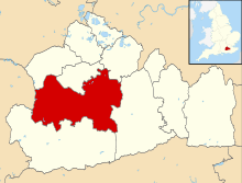
Chilworth is a village in the Guildford borough of Surrey, England, southeast of Guildford. Chilworth has three churches, two pre-secondary education schools, an independent pub-restaurant and a railway station. The village occupies both sides of the Tillingbourne between outcrops of the Greensand Ridge including St Martha's Hill. Footpaths lead through fields and woodlands along the ranges of hills. Chilworth is split between two civil parishes, Shalford CP to the west and St Martha's CP to the east. It also has a recreation ground with a park that has a sports pavilion used for football and cricket.
Benedictine monks occupy a monastery on the outskirts of the parish of St Martha's. Saint Augustine's Abbey was designed by Frederick Walters and founded as a Franciscan friary in 1892. The monks took over in 2011. The monastery buildings are actually in Wonersh CP, but the parish and borough boundary runs through the grounds.
Geography
The village occupies both sides of the Tillingbourne between northerly sections of the Greensand Ridge such as Tangley Hill and a steep knoll St Martha's Hill with has St Martha's Church and the North Downs Way. The North Downs are immediately north, east and west of that knoll. Footpaths lead through fields and woodlands along the ranges of hills.[1] Chilworth is split between two civil parishes, Shalford CP to the west and St Martha's CP to the east, and is in the south-east of Guildford borough.
Amenities
Chilworth has three churches, two schools (Chilworth Infant School and Tillingbourne Junior School), a gastro-pub (The Percy Arms) and a railway station
In sports, the village has a recreation ground with a park that has a sports pavilion used for football and cricket.[2]
History
Chilworth as a landholding appears in Domesday Book as Celeorde. It was held by Odo of Bayeux the Bishop of Bayeux. Its Domesday assets were: 1 mill worth 7s, 3 ploughs. It rendered £3 10s 0d.[3]
The settlement has an interesting industrial past. At various times in history it has been the location of a wire mill, paper mill and gunpowder factory.[4] The wireworks was built in 1603[5] by Thomas Steere and others, who seduced workmen from the Tintern wireworks of the Company of Mineral and Battery Works. This infringed the company's patent and enabled it to have the wireworks suppressed in 1606.[6] The gunpowder works are listed by English Heritage as a scheduled monument.[7]
Chilworth Gunpowder works was established in 1625 by the East India Company and finally closed in 1920. It was worked by a number of private companies, and became an important supplier of gunpowder to the Government. A significant number of buildings belonging the gunpowder factory can still be found. The buildings and area are now partially looked after by Guildford Borough Council and English Heritage.
Before the railway was built, Chilworth was a hamlet of a few cottages around the bridge over the Tillingbourne on the direct lane to Guildford via Tyting, where the main entrance to the gunpowder works was located.[8] The second nucleus of settlement was the railway station, with its pub. A third nucleus was around a post office on the A248 in Shalford CP, which was known as "Shalford Hamlet" until around the Second World War.[9]
Benedictine monks occupy a monastery towards the outskirts of Chilworth in Saint Augustine's Abbey, which was for over a century a Franciscan order friary, designed by Frederick Walters, founded in 1892.[10]

Chilworth Manor
Chilworth Manor is a large house between the 'village' (clustered centre) and St Martha's Hill to the north. It was part of the patrimony granted to Newark Priory when this monastery was founded in the late 12th century,[11] and was administered as a monastic manor until the abbey was destroyed by Henry VIII. By 1580 the property was owned by one William Morgan. William's son, John was knighted at Cadiz in 1596. In 1725 Sarah, the widow of the Duke of Marlborough, became owner. She added the Marlborough Wing and developed a tiered garden excavated in the sloping hillside and still known as the "Duchess's Garden".
Chilworth Manor is grade II listed by English Heritage and has recently been extensively restored and refurbished by new owners, following the death of its previous occupant, Lady Heald.[12]
Transport

Chilworth railway station is on the North Downs Line, and is served every two hours by trains to Redhill and Reading. Trains are operated by First Great Western.
Bus route number 32 connects Chilworth to Guildford, and Redhill via Dorking and is a basic hourly service, with a reduced service on Sundays. It is now operated by Compass Travel, after the route was given up by Arriva Guildford & West Surrey in 2014.
Buses also run to Godalming (503) and Cranleigh (525), but these are very infrequent.
Telecommunications
Chilworth is covered by ADSL and Mobile Broadband based High Speed Internet services. A Vodafone phone mast sits near the centre of the village, at the playing fields, just to the south of one of the Railway Crossings. Other mobile services in the village are patchy, there also being a Vodaphone mast in nearby Shalford, but no other signal not of land shadow.
ADSL based services only offer a maximum of ~4Mbit/s to the village.
BT have extended their Fibre to the Cabinet expansion plans to cover Guildford. Chilworth now benefits from these improvements and extensive BT work took place in April and May 2011 resulting in installation of new FTTC cabinets in at least 3 locations in the village. These works, now complete, allow for 12Mbit/s+ services and service to those at the Eastern end of the village and up to 70Mbit/s to those towards the West end of Dorking Road and New Road.
Environment
The village is in the Surrey Hills AONB and most of its land is outside the settlement boundary within the Metropolitan Green Belt. These are the main safeguards against building on most of the two civil parishes' green fields and woodlands.[13] The nearest airport is small, Farnborough Airport, approximately 10 miles (16 km) WNW. Unlike most Surrey districts the borough has no Air Quality Management Areas.[14] The gunpowder works closed in the 19th century leaving few heavy industries in the civil parish and neighbouring areas. No shooting or ordnance ranges are within five miles. Flooding from the Tillingbourne (alluvial flooding) is a rare occurrence with small parts of the north and west having been identified by the Borough Council as being at risk.[15]
See also
External links
| Wikimedia Commons has media related to Chilworth, Surrey. |
- St Augustine's Abbey, Chilworth
- Chilworth Infant School
- Chilworth Community Playgroup
- St Martha Parish Council
 |
Guildford | Merrow | East Clandon West Clandon |
|
| Shalford | |
Albury | ||
| ||||
| | ||||
| Bramley | Wonersh | across Blackheath Common: Farley Green, Albury |
References
- ↑ Ordnance Survey Explorer map 145 edition B1 revised 2004.
- ↑ Ordnance Survey Explorer map 145 edition B1 revised 2004.
- ↑ Surrey Domesday Book Archived 15 July 2007 at the Wayback Machine.
- ↑ Gunpowder Mills
- ↑ K R Fairclough and Glenys Crocker – Chilworth gunpowder mills in the period of the Dutch Wars
- ↑ M. B. Donald, Elizabethan Monopolies: the history of the Company of Mineral and Battery Works from 1565 to 1604 (Oliver and Boyd, Edinburgh 1961), 136–7.
- ↑ National Heritage list entry for Chilworth gunpowder works (downloaded September 2012)
- ↑ Ordnance Survey, 1st edn.
- ↑ Ordnance Survey 1945 edn.
- ↑ English heritage review of diocesan churches
- ↑ VCH Surrey Vol 3, p104
- ↑ National Heritage list entry for Chilworth Manor (downloaded September 2012)
- ↑ Tillingbourne ward Guildford Borough Council. Retrieved 20 March 2015
- ↑ Defra – Air Retrieved 19 March 2015.
- ↑ Major Village Expansions options in the Borough – Current Local Plan Guildford Borough Council. Accessed 20 March 2015.