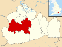
Pirbright
| Pirbright | |
 Statue near Pirbright village hall |
|
 The Basingstoke Canal divides the communities of Pirbright |
|
 Pirbright |
|
| Area | 19.01 km2 (7.34 sq mi) |
|---|---|
| Population | 3,691 (Civil Parish 2011)[1] |
| – density | 194/km2 (500/sq mi) |
| OS grid reference | SU950550 |
| Civil parish | Pirbright |
| District | Guildford |
| Shire county | Surrey |
| Region | South East |
| Country | England |
| Sovereign state | United Kingdom |
| Post town | Woking |
| Postcode district | GU24 |
| Dialling code | 01483 |
| Police | Surrey |
| Fire | Surrey |
| Ambulance | South East Coast |
| EU Parliament | South East England |
| UK Parliament | Woking |
Coordinates: 51°17′10″N 0°38′20″W / 51.286°N 0.639°W
Pirbright /pɜːrbraɪt/ is a village in Surrey, England. Pirbright is in the borough of Guildford and has a civil parish council covering the traditional boundaries of the area. Pirbright contains one buffered sub-locality, Stanford Common near the nation's farm animal disease research institute. Explorer Henry Morton Stanley has his imposing boulder grave at the end of the grounds of the grade II* listed medieval church. The nearby Hodge Brook is marked as Congo Stream, between Ruwenzori and Stanley Hills.
Geography

Pirbright has two communities: army training barracks and designated homes are north of a London main axis (south-west) railway and the slightly dispersed village is south. The village is almost entirely surrounded by heathland, much of it owned by the Ministry of Defence and used by the Army Training Centre, Pirbright.[2][2][3] The south and south-east of the parish is mostly woodland and has three small farms. The south-west of the parish has a large military training area, Pirbright Common. Near to the church are several features due to Stanley's association with the village: Hodge Brook is equally marked as Congo Stream, between Ruwenzori Hill and Stanley Hill. Mazamboni Farm is next to Aruwimi Wood.
History
Name
Its name had three medieval variants (each involving the letter 'f' where there is currently a 'b').[4] It came from Anglo-Saxon (Old English) Pirige-fyrhþ = "sparse woodland where peartrees grow".
Medieval and tudor periods
The manor of Pirbright does not seem to occur earlier than the 13th century, when it was reported to be held of the honour of Clare by Peter de Pirbright. John Trenchard died seised of it (holding) under the Earl of Gloucester in 1301–2.[4] In this time it had a medieval deer park, disparked under Richard II. During the reign of Henry VIII the manor changed hands several times: it formed part of the marriage portion of Queen Katharine of Aragon and was successively in the possession of Sir Thomas Boleyn and Sir William Fitz William. Finally it was granted to Sir Anthony Browne, afterwards Viscount Montagu, with whose family it remained until the middle of the next century.
18th century and afterwards
The locality saw development in the form of brick labourers' cottages with a few Georgian large homes, some with modest estates of land. Of the last sort, Vice-Admiral the Hon. John "Foulweather Jack" Byron, explorer, grandfather of George Gordon Byron, 6th Lord Byron (usually known as 'the poet, Lord Byron') planted in the late 18th century an avenue of Scotch firs to the foot of a tower hill, Crown Prince Hill, in the woods, still called Admiral's Walk or 'road', which extends for 1 mile (1.6 km), half within the Danger Area owned by the Ministry of Defence of Pirbright Common.[4]
Heatherside was the early 20th century home of Mr. F. C. Selous, the African big-game hunter, and contained a "remarkable collection of hunting spoils and native African curiosities."[4]
Pirbright's traditional churchyard contains the large block of granite, 11-foot high, marking the grave of British Empire soldier and explorer Henry Morton Stanley, who died in London aged 63. This is partly inscribed with the words "Henry Morton Stanley Bula Matari 1841–1904 Africa". Bula Matari was another of his names and translates as "Breaker of Rocks" or "Breakstones" in Kongo.[5]
Pirbright Institute
The Pirbright Institute is a research establishment that investigates diseases in farm animals. It consists of two sites, one close to Pirbright and one in Compton, Berkshire and is one of eight UK research institutes supported by the UK's Biotechnology and Biological Sciences Research Council (BBSRC). The Pirbright site includes international reference laboratories for the diagnosis of livestock diseases exotic to the UK, including the World Reference Laboratory for foot and mouth disease. The site also conducts research on viruses including foot and mouth disease and bluetongue virus.
On Saturday 4 August 2007 it was announced that the a strain of foot-and-mouth disease detected in cattle three miles (5 km) away was similar to that in use at the Pirbright site. Professor Brian Spratt's report found that more likely than not the strain of the virus understandably came from the Merial vaccine production facility or the Pirbright Institute laboratory: whose shared "effluent pipes [leading to final small treatment plant were] not contained, as they should be as part of Category 4 containment at Pirbright."[6] This poor condition of pipes and incursion of trees in the site has since been rectified and significant investment (over £170 million) is taking place at Pirbright to provide new laboratory and animal facilities.
Education
Pirbright has non-secondary schools, including two on School Lane, and a small all-through school, Knowl Hill School, for children with dyslexia which provides education for around fifty pupils. The largest school is the centrally located, Pirbright Village Primary School, which educates children from the age of 4 to 11.
Youth outreach
The Normandy Youth Centre serves the wider area by sponsoring community-based programmes targeting youth in the area for the purpose of increasing exposure to educational opportunities and building a stronger community.[7]
Landmarks
_(9).JPG)
Church of St Michael and All Angels
The small church stands by Church Cottage in the meadows directly west of the village centre. It is built of brick dressings to a galleted 'heathstone' walls to its Nave, with a galleted heathstone tower to west and chancel to east. Plain tiled roof with lead spike over tower. Box nave with square tower to west, gabled porch to south, aisle to north, chancel to east with vestry to north and organ bay to south.
Moated 'manor house' which held the manorial courts
The manorial courthouse was renamed in the 19th century[4] and has a moat, and a great proportion of the building was built in the 16th century, is timber-framed however the building is partially clad in red and blue brick and in brown and red brick on its non-timber framed cross wing.[8]
Sport

Cricket has been played on the village green since 1780.[9] The principal cricket club is Pirbright Cricket Club which has a 1st XI, and a Sunday team.
Pirbright is the home of Pirbright Tennis Club which was formed in 1976. Initially playing in the Burrow Hill part of the village, the club soon moved to its ground on School Lane. Pirbright Tennis Club currently has nearly 400 members and five adult teams;[10] the courts are also used by students from the local schools.
Famous residents
- Ross Lowis Mangles, first civilian recipient of the Victoria Cross who has a brass memorial on the north wall of St Michael and All Angels Church, Pirbright.[11]
- James Pearce, presenter for BBC Sport
- Henry de Worms, Lord Pirbright PC, DL, JP, FRS chose to relate his peerage to his later life home when elevated to the peerage in 1895 however he died without male heirs in 1903.
- Sir G. A. H. Branson (1871–1951), a High Court judge and the grandfather of Richard Branson, lived at Bullswater House, Pirbright.[12]
- Sir Edmund Thiele, a famous geologist, lived out his later years with his wife until he died in 1971.
Demography and housing
| Output area | Detached | Semi-detached | Terraced | Flats and apartments | Caravans/temporary/mobile homes | shared between households |
|---|---|---|---|---|---|---|
| (Civil Parish) | 360 | 449 | 253 | 37 | 2 | 0 |
The average level of accommodation in the region composed of detached houses was 28%, the average that was apartments was 22.6%.
| Output area | Population | Households | % Owned outright | % Owned with a loan | hectares[1] |
|---|---|---|---|---|---|
| (Civil Parish) | 3,691 | 1,101 | 23.9% | 24.5% | 1,901[1] |
The proportion of households in the civil parish who owned their home outright compares to the regional average of 35.1%. The proportion who owned their home with a loan compares to the regional average of 32.5%. The remaining % is made up of rented dwellings (plus a negligible % of households living rent-free).
Twinning
Pirbright is twinned with :
 Cagny, Calvados, France
 |
Deepcut across West End Common/Chobham Ridges | Bisley, Surrey | Brookwood | |
| Mytchett across Pirbright Common SSSI (as described MoD) | |
Fox Corner, Worplesdon | ||
| ||||
| | ||||
| Normandy across Pirbright Common SSSI (as described MoD) | Normandy – part of then Wood Street Village | Worplesdon |
Further reading
- The Story of Pirbright Church by J.H. Curtis, 1930
References
- 1 2 3 4 Key Statistics; Quick Statistics: Population Density United Kingdom Census 2011 Office for National Statistics Retrieved 21 November 2013
- 1 2 Pirbright is also situated near small villages surrounding Guildford.Pirbright Parish Council
- ↑ Church of England parish map. Accessed 23 April 2012
- 1 2 3 4 5 H.E. Malden (editor) (1911). "Parishes: Pirbright". A History of the County of Surrey: Volume 3. Institute of Historical Research. Retrieved 24 November 2013.
- ↑ Stanley's resting place Historic England. "Details from listed building database (1029623)". National Heritage List for England.
- ↑ Independent Review of the safety of UK facilities handling foot and mouth disease virus Professor Brian Spratt, August 2007
- ↑ Award for Mother Who Transformed Her Village; 18 October 2010 article; at Get Surrey News; retrieved 30 January 2013.
- ↑ The Manor House Historic England. "Details from listed building database (1188635)". National Heritage List for England.
- ↑ Pirbright cricket club
- ↑ Pirbright Tennis Club
- ↑ Julia Douëtil Welcome to St Michael and All Angels Church, Pirbright
- ↑ 'BRANSON, Rt Hon. Sir George Arthur Harwin' in Who Was Who 1951–1960 (London: A. & C. Black, 1984 reprint, ISBN 0-7136-2598-8)
External links
| Wikimedia Commons has media related to Pirbright. |