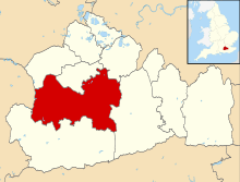
Shalford, Surrey
| Shalford | |
_(3).jpg) St Mary the Virgin's Church, Shalford |
|
 Shalford |
|
| Area | 6.51 km2 (2.51 sq mi) |
|---|---|
| Population | 4,142 (Civil Parish 2011)[1] |
| – density | 636/km2 (1,650/sq mi) |
| OS grid reference | TQ0046 |
| Civil parish | Shalford |
| District | Guildford |
| Shire county | Surrey |
| Region | South East |
| Country | England |
| Sovereign state | United Kingdom |
| Post town | Guildford |
| Postcode district | GU4 |
| Dialling code | 01483 |
| Police | Surrey |
| Fire | Surrey |
| Ambulance | South East Coast |
| EU Parliament | South East England |
| UK Parliament | Guildford |
Coordinates: 51°12′40″N 0°34′05″W / 51.211°N 0.568°W
Shalford is a village and civil parish in Surrey, England on the A281 Horsham road immediately south of Guildford. It has a railway station which is between Guildford and Dorking on the Reading to Gatwick Airport line.
It has one named locality, occupying the west of the area, Peasmarsh.
History
Shalford appears in Domesday Book of 1086 as Scaldefor. It was held by Robert de Wateville from Richard Fitz Gilbert. Its domesday assets were: 4 hides; 1 church, 3 mills worth 16s, 11½ ploughs, 4 acres (1.6 ha) of meadow, wood worth 20 hogs. It rendered £20.[2]
The village also became well known for "the Great Fair of Shalford" which was set up by a charter issued by King John. In its heyday, it was said to have covered 140 acres (570,000 m²) and attracted merchants from across the country.
The mills continued to be built and operated there for hundreds of years. One still survives intact today.
The original church, mentioned in the Domesday survey, no longer exists. An early Victorian church now stands in its place. St Mary's was built in 1846 with a lychgate and stained glass.[3] Many older cottages do survive. One of the finest properties, Shalford House, dated back to the Tudor period and featured a carved stone fireplace dated 1609. Unfortunately, Shalford House was demolished in 1967 to make way for a water treatment plant. There are many Grade II listed structures including stocks and whipping post.[4]
Geography
The River Tillingbourne joins the River Wey at Shalford adjacent to the parish church. For centuries, the river provided an important source of income for the village demonstrated by the industries mentioned by those articles, such as gunpowder manufacture. Cranleigh Waters joins the Wey at the northern terminus of the Wey and Arun Canal/East Branch of the Wey. Shalford was a landing place for barges, and continues to be visited by boats today – but for pleasure rather than trade.
The surviving mill is now preserved as a tourist attraction: Shalford Mill, listed II*, situated in the centre of the village opposite the Sea Horse public house, was built in the 18th century[5] and is now owned by the National Trust.
Inhabitants
Some claim that the author of The Pilgrim's Progress, John Bunyan, once lived in the village and drew his inspiration from the fair, and from the ancient route known as the Pilgrims' Way, which passes nearby, on its way to Canterbury. Lt.Col. Henry Haversham Godwin-Austen (1834–1923), topographer, geologist, naturalist and explorer who surveyed the Himalayan region including K2, sometimes known as Mt. Godwin-Austen, for a time had an estate in Shalford.
A watercolour sketch titled 'In Captain Pierrepont's Grounds' was painted by Anthony Devis (1729–1817) not long after Captain William Pierrepont of HMS Naiad acquired Shalford Manor in 1800.
Brigadier George Roupell, a Victoria Cross recipient, died in Shalford in 1974.
The Genesis, singer/drummer Phil Collins had a home in Shalford named Old Croft, where he wrote music which would end up on his first solo album Face Value and also the Genesis album Duke.
Localities
Peasmarsh
The settlement of Peasmarsh on the west bank of the river Wey between Artington and Godalming is contained in the parish. It consists of a large retirement home; Astolat and Weyvern business parks which include a large Land Rover service centre, Volkswagen Commercial Vehicles, SMC Renault, Harley Davidson, IGuzzini Illuminazione (lights), Marchon UK, Maui Jim (eyeware companies), Integrian security, WHSmith plc and Efamol essential fatty acids, and Doble powertest HV testing and equipment; and four short residential roads close to the River Wey Navigation including Tilthams Green. A woodland surrounding the rebuilt manor house, being higher up than most of the reclaimed marshland, is named Peas Marsh. A barn at Littlemarsh Farm, one at Tilthams Farm and Tilthams farmhouse are grade II listed.[6][7][8] There is also a C of E church; St Michael's.
Demography and housing
| Output area | Detached | Semi-detached | Terraced | Flats and apartments | Caravans/temporary/mobile homes | shared between households[1] |
|---|---|---|---|---|---|---|
| (Civil Parish) | 623 | 511 | 287 | 270 | 30 | 0 |
The average level of accommodation in the region composed of detached houses was 28%, the average that was apartments was 22.6%.
| Output area | Population | Households | % Owned outright | % Owned with a loan | hectares[1] |
|---|---|---|---|---|---|
| (Civil Parish) | 4,142 | 1,721 | 36.6% | 35.7% | 651[1] |
The proportion of households in the civil parish who owned their home outright compares to the regional average of 35.1%. The proportion who owned their home with a loan compares to the regional average of 32.5%. The remaining % is made up of rented dwellings (plus a negligible % of households living rent-free).
See also
References
- 1 2 3 4 Key Statistics; Quick Statistics: Population Density United Kingdom Census 2011 Office for National Statistics Retrieved 21 November 2013
- ↑ Surrey Domesday Book
- ↑ Historic England. "Details from listed building database (1294444)". National Heritage List for England. St Mary's Church
- ↑ Historic England. "Details from listed building database (1029494)". National Heritage List for England. Fosters Row Historic England. "Details from listed building database (1029314)". National Heritage List for England. Tilehouse Farm Barn Historic England. "Details from listed building database (1029498)". National Heritage List for England. Stone base to cross Historic England. "Details from listed building database (1029499)". National Heritage List for England. Mill Cottage, Watermill Cottage Historic England. "Details from listed building database (1029500)". National Heritage List for England. Mill Lane Cottages Historic England. "Details from listed building database (1029501)". National Heritage List for England. Debnershe Historic England. "Details from listed building database (1029502)". National Heritage List for England. The Mill House Historic England. "Details from listed building database (1029503)". National Heritage List for England. The First School Historic England. "Details from listed building database (1377773)". National Heritage List for England. Gate to First School Historic England. "Details from listed building database (1029504)". National Heritage List for England. Beech House Historic England. "Details from listed building database (1029505)". National Heritage List for England. 20–22 The Street Historic England. "Details from listed building database (1029506)". National Heritage List for England. Shalford Park Cottage Historic England. "Details from listed building database (1189242)". National Heritage List for England. Whitnorth Historic England. "Details from listed building database (1189247)". National Heritage List for England. The Seahorse public house Historic England. "Details from listed building database (1189256)". National Heritage List for England. 36–40 The Street Historic England. "Details from listed building database (1189261)". National Heritage List for England. 24–30 The Street Historic England. "Details from listed building database (1189301)". National Heritage List for England. 16–18 The Street Historic England. "Details from listed building database (1246023)". National Heritage List for England. Cemetery Chapel Historic England. "Details from listed building database (1246024)". National Heritage List for England. Cemetery Lychgate Historic England. "Details from listed building database (1294358)". National Heritage List for England. Lemon Bridge Cottage Historic England. "Details from listed building database (1294391)". National Heritage List for England. Stocks and whipping post Historic England. "Details from listed building database (1294392)". National Heritage List for England. Bridge over Tillingbourne Historic England. "Details from listed building database (1294443)". National Heritage List for England. 69 Station Road Historic England. "Details from listed building database (1377772)". National Heritage List for England. 49 & 51 The Street Historic England. "Details from listed building database (1377774)". National Heritage List for England. 32–34 The Street Historic England. "Details from listed building database (1029494)". National Heritage List for England. Cemetery wall Historic England. "Details from listed building database (1391835)". National Heritage List for England. The Firs Historic England. "Details from listed building database (1393082)". National Heritage List for England. War Memorial
- ↑ Historic England. "Details from listed building database (1294360)". National Heritage List for England. Shalford Mill
- ↑ Historic England. "Details from listed building database (1188371)". National Heritage List for England. Barn in Peasmarsh
- ↑ Historic England. "Details from listed building database (1189307)". National Heritage List for England. Barn in Peasmarsh
- ↑ Historic England. "Details from listed building database (1377775)". National Heritage List for England. Farmhouse in Peasmarsh
External links
| Wikimedia Commons has media related to Shalford, Surrey. |
- Shalford
- The River Wey and Navigations
- Shalford Choral Society, 1905 founding member of the Leith Hill Music Festival
 |
Guildford Wood Street Village |
Guildford | Merrow | |
| Compton | |
Albury | ||
| ||||
| | ||||
| Peasmarsh, Shalford Godalming |
Bramley | across Blackheath Common: Farley Green, Albury |