Candia, New Hampshire
| Candia, New Hampshire | ||
|---|---|---|
|
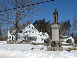
Civil War monument on High Street | ||
| ||
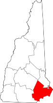
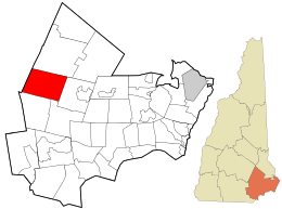 Location in Rockingham County and the state of New Hampshire. | ||
| Coordinates: 43°04′40″N 71°16′36″W / 43.07778°N 71.27667°WCoordinates: 43°04′40″N 71°16′36″W / 43.07778°N 71.27667°W | ||
| Country | United States | |
| State | New Hampshire | |
| County | Rockingham | |
| Incorporated | 1763 | |
| Government | ||
| • Board of Selectmen |
Boyd Chivers, Chair Susan Young Russell Dann Scott Komisarek Mark Laliberte | |
| Area | ||
| • Total | 30.6 sq mi (79.2 km2) | |
| • Land | 30.3 sq mi (78.5 km2) | |
| • Water | 0.2 sq mi (0.6 km2) 0.79% | |
| Elevation | 351 ft (107 m) | |
| Population (2010) | ||
| • Total | 3,909 | |
| • Density | 130/sq mi (49/km2) | |
| Time zone | Eastern (UTC-5) | |
| • Summer (DST) | Eastern (UTC-4) | |
| ZIP code | 03034 | |
| Area code(s) | 603 | |
| FIPS code | 33-09300 | |
| GNIS feature ID | 0873558 | |
| Website |
www | |

Candia is a town in Rockingham County, New Hampshire, United States. The population was 3,909 at the 2010 census.[1] The town includes the villages of Candia, Candia Four Corners and East Candia.
History
Settled in 1743, Candia was once part of Chester and known as "Charmingfare", probably because of the many bridle paths or "parades" through the pleasant scenery. Charmingfare was incorporated in 1763 and named "Candia" by Colonial Governor Benning Wentworth, possibly after the old name under Venetian domination of the principal city of Crete, which he had visited after graduation from Harvard. Another account holds, "The town received its present name in compliment to Governor Benning Wentworth, who was once a prisoner on the island of Candia, in the Mediterranean Sea."[2]
Candia was served by the Portsmouth & Concord Railroad, which stretched between its namesake cities. In 1862 the segment between Candia and Suncook was abandoned, coinciding with the opening of a new segment between Manchester and Candia. Therefore, the new line ran from Manchester to Portsmouth via Candia. In 1895 ownership of the line passed to the Boston & Maine Railroad who made it their Portsmouth Branch. Passenger service ended in 1954. The last trains passed through Candia in the early 1980s. The track was abandoned in 1982 and removed between 1983 and 1985. Today the railbed is part of the Rockingham Recreational Trail.
Geography
According to the United States Census Bureau, the town has a total area of 30.6 square miles (79 km2). 30.3 square miles (78 km2) of it is land and 0.2 square miles (0.52 km2) of it is water, comprising 0.79% of the town. The town is bordered by Deerfield to the north, Hooksett (in Merrimack County) to the west, Auburn and Chester to the south, and Raymond to the east. Notable villages in the town include Candia proper, near the town's northern border; Candia Four Corners, closer to the geographic center of the town; and East Candia, near the town's eastern border.
Candia is drained by the North Branch River, a tributary of the Lamprey River. The town lies almost fully within the Piscataqua River watershed except for the western and southern edges, which are in the Merrimack River watershed.[3] The highest point in town is Hall Mountain, at 941 feet (287 m) above sea level, located in Bear Brook State Park in the northwestern part of the town. (The main entrance to the state park and most of its facilities are in neighboring Allenstown.)
Candia is bisected by two state highways, Route 43 running north from Route 101 through the Candia Four Corners to the Deerfield town line, and Route 27, running east/west from the Hooksett town line through the Candia Four Corners to the Raymond town line. Route 101 is the major east/west thoroughfare through southern New Hampshire and travels through the south part of Candia.
Demographics
| Historical population | |||
|---|---|---|---|
| Census | Pop. | %± | |
| 1790 | 1,040 | — | |
| 1800 | 1,186 | 14.0% | |
| 1810 | 1,290 | 8.8% | |
| 1820 | 1,273 | −1.3% | |
| 1830 | 1,362 | 7.0% | |
| 1840 | 1,430 | 5.0% | |
| 1850 | 1,482 | 3.6% | |
| 1860 | 1,575 | 6.3% | |
| 1870 | 1,456 | −7.6% | |
| 1880 | 1,340 | −8.0% | |
| 1890 | 1,108 | −17.3% | |
| 1900 | 1,057 | −4.6% | |
| 1910 | 993 | −6.1% | |
| 1920 | 780 | −21.5% | |
| 1930 | 812 | 4.1% | |
| 1940 | 965 | 18.8% | |
| 1950 | 1,243 | 28.8% | |
| 1960 | 1,490 | 19.9% | |
| 1970 | 1,997 | 34.0% | |
| 1980 | 2,989 | 49.7% | |
| 1990 | 3,557 | 19.0% | |
| 2000 | 3,911 | 10.0% | |
| 2010 | 3,909 | −0.1% | |
| Est. 2015 | 3,902 | [4] | −0.2% |

As of the census[6] of 2000, there were 3,911 people, 1,359 households, and 1,108 families residing in the town. The population density was 129.0 per square mile (49.8/km²). There were 1,384 housing units at an average density of 45.6 per square mile (17.6/km²). The racial makeup of the town was 98.11% White, 0.43% African American, 0.46% Native American, 0.59% Asian, 0.03% Pacific Islander, 0.10% from other races, and 0.28% from two or more races. Hispanic or Latino of any race were 0.87% of the population.
There were 1,359 households out of which 40.0% had children under the age of 18 living with them, 72.0% were married couples living together, 5.2% had a female householder with no husband present, and 18.4% were non-families. 12.7% of all households were made up of individuals and 3.2% had someone living alone who was 65 years of age or older. The average household size was 2.88 and the average family size was 3.14.

In the town the population was spread out with 26.6% under the age of 18, 6.0% from 18 to 24, 33.6% from 25 to 44, 26.5% from 45 to 64, and 7.2% who were 65 years of age or older. The median age was 38 years. For every 100 females there were 102.1 males. For every 100 females age 18 and over, there were 102.0 males.
The median income for a household in the town was $61,389, and the median income for a family was $67,163. Males had a median income of $43,260 versus $31,127 for females. The per capita income for the town was $25,267. About 2.3% of families and 2.6% of the population were below the poverty line, including 2.3% of those under age 18 and 5.3% of those age 65 or over.
Education

Candia is part of School Administrative Unit 15, along with Hooksett and Auburn. There is one public school in Candia, a K-8 school named the Henry W. Moore School, located near the Candia Four Corners on Deerfield Road. High school education students from Candia attend school outside of the district, currently under contract at Manchester Central High School. Candia is also home to Jesse Remington High School, a private Christian school that offers grades 9-12. Some Candia residents send their children to other private high schools in the area, including Trinity High School in Manchester.
Sites of interest
- Fitts Museum, operated by the Candia Historical Society
- Candia Vineyards, an award winning vineyard with unique varietals
- Charmingfare Farm, a farm and petting zoo
- Candia Springs Adventure Park, formerly Liquid Planet water park
- Stephen Clay Homestead, bed and breakfast
- Candia Woods Golf Links, an 18 hole public golf course. Voted in Golf magazine as New Hampshire's "Friendliest Course"
Emergency services

Fire and Emergency Medical Services are provided by the Candia Volunteer Fire Department, an all-volunteer department organized in 1925. This department provides fire suppression, rescue, and first-responder Emergency Medical Services to the citizens of Candia and the surrounding communities. The closest hospitals are the Elliot Hospital, a Level Two trauma center, and Catholic Medical Center, one of the most advanced cardiac care centers in New England. Both of these facilities are located approximately 20 minutes away in Manchester. Exeter Hospital is also located about 20 minutes away in Exeter.
Police protection is provided by the Candia Police Department, assisted by the New Hampshire State Police and other local municipal police departments.
Notable people
- Harry Cobe (1885–1966), race car driver who ran in the inaugural Indianapolis 500
- Joe Duarte (born 1941), member of the New Hampshire House of Representatives
- Sam Walter Foss (1858–1911), poet
- Albert Palmer (1831–1887), 29th mayor of Boston
- Frederick Smyth (1819–1899), 30th governor of New Hampshire
References
- ↑ United States Census Bureau, American FactFinder, 2010 Census figures. Retrieved March 23, 2011.
- ↑ Article in Statistics and Gazetteer of New-Hampshire (1875)
- ↑ Foster, Debra H.; Batorfalvy, Tatianna N.; Medalie, Laura (1995). Water Use in New Hampshire: An Activities Guide for Teachers. U.S. Department of the Interior and U.S. Geological Survey.
- ↑ "Annual Estimates of the Resident Population for Incorporated Places: April 1, 2010 to July 1, 2015". Retrieved July 2, 2016.
- ↑ "Census of Population and Housing". Census.gov. Archived from the original on May 11, 2015. Retrieved June 4, 2016.
- ↑ "American FactFinder". United States Census Bureau. Archived from the original on 2013-09-11. Retrieved 2008-01-31.
External links
- Town of Candia official website
- Candia Fire Rescue
- New Hampshire Economic and Labor Market Information Bureau Profile