Derry, New Hampshire
| Derry, New Hampshire | ||
|---|---|---|
|
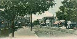
Broadway c. 1905 | ||
| ||
| Nickname(s): "Spacetown" | ||
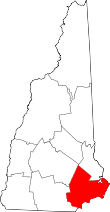
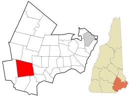 Location in Rockingham County and the state of New Hampshire. | ||
| Coordinates: 42°52′50″N 71°19′38″W / 42.88056°N 71.32722°WCoordinates: 42°52′50″N 71°19′38″W / 42.88056°N 71.32722°W | ||
| Country | United States | |
| State | New Hampshire | |
| County | Rockingham | |
| Incorporated | 1827 | |
| Government | ||
| • Town Council |
Brian Chirichiello, Chair Richard P. Tripp Charles Foote David Fischer James Morgan Joshua Bourdon Phyllis Katsakiores | |
| • Acting Town Administrator | Stephen Daly | |
| Area | ||
| • Total | 36.5 sq mi (94.5 km2) | |
| • Land | 35.6 sq mi (92.2 km2) | |
| • Water | 0.9 sq mi (2.3 km2) 2.39% | |
| Elevation | 282 ft (86 m) | |
| Population (2010) | ||
| • Total | 33,109 | |
| • Density | 910/sq mi (350/km2) | |
| Time zone | Eastern (UTC-5) | |
| • Summer (DST) | Eastern (UTC-4) | |
| ZIP code | 03038 | |
| Area code(s) | 603 | |
| FIPS code | 33-17940 | |
| GNIS feature ID | 0873578 | |
| Website |
www | |

Derry is a town in Rockingham County, New Hampshire, United States. The population was 33,109 at the 2010 census.[1] Although it is a town and not a city, Derry is the fourth most-populous community in the state. The town's nickname, "Spacetown", derives from the fact that Derry is the birthplace of Alan Shepard, the first astronaut from the United States in space.[2] Derry was also for a time the home of the poet Robert Frost and his family.
The primary settlement in town, where 22,015 people resided at the 2010 census,[1] is defined by the U.S. Census Bureau as the Derry census-designated place (CDP) and includes the densely populated portions of the town centered on the intersection of New Hampshire Route 28 and New Hampshire Route 102.
History
Although it was first settled by Scots-Irish families in 1719, Derry was not incorporated until 1827. It was originally a part of Londonderry, as was Windham and portions of Manchester, Salem and Hudson. The town was named after the city of Derry in Ireland,[3] the Irish word "Doire" meaning "oak woods." The first potato planted in the United States was planted here in 1719. The town is the location of two of America's oldest private schools, Pinkerton Academy, founded in 1814 and still in operation, and the closed Adams Female Seminary.
Derry was once a linen and leather-making center until New England textile industries moved south in the 20th century. As recently as World War II, Derry was also a sleepy farming community. From 1900 to 1911, poet Robert Frost lived with his family on a farm in Derry purchased for him by his grandfather. The Robert Frost Farm is now a National Historic Landmark and state park and is open to the public for tours, poetry readings and other cultural events from spring through fall.[4]
The post-war suburban boom, the town's proximity to Boston in the south and Manchester to the northwest, and the construction of Interstate 93 through town led to a huge population boom. Although this growth has slowed somewhat, the population of Derry still increased by 15 percent during the 1990s.
The Manchester and Lawrence branch of the B&M ran through Derry, but is now abandoned. The New Hampshire Department of Transportation stated in its I-93 corridor transit study[5] and its 2012 statewide rail plan[6] that it could be feasible to reopen the line.
Antique postcards
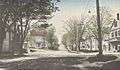 Thornton Square c. 1915
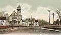 Birch Street c. 1905
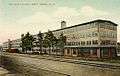 HEH Shoe Factory in 1909
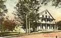 Hildreth Hall in 1914
Geography
According to the United States Census Bureau, the town has a total area of 36.5 square miles (94.5 km2), of which 35.6 square miles (92.2 km2) is land and 0.9 square miles (2.3 km2) is water, comprising 2.39% of the town.[7] Derry is drained by Beaver Brook. The highest point in the town is Warner Hill, at 605 feet (184 m) above sea level, where from the top one can see the Boston skyline on a clear day. Derry lies almost fully within the Merrimack River watershed, with a small section along the northern border of town lying in the Piscataqua River watershed.[8]
The urban part of the town, defined as a census-designated place (CDP), is located near the western border of the town and covers an area of 15.7 square miles (41 km2), about 42.8% of the area of the town. 15.4 sq mi (40 km2) of the CDP is land, and 0.2 sq mi (0.52 km2) of it is water, about 1.60% of the total area of the CDP. The village of East Derry is located approximately 2 miles (3 km) east of the CDP and close to the geographic center of the town.
Derry is crossed by Interstate 93 and New Hampshire routes 28 and 102.
Neighboring cities and towns
 |
Auburn | Chester | Sandown | |
| Londonderry | |
Hampstead | ||
| ||||
| | ||||
| Windham | Salem | Atkinson |
Climate
| Climate data for Derry, New Hampshire | |||||||||||||
|---|---|---|---|---|---|---|---|---|---|---|---|---|---|
| Month | Jan | Feb | Mar | Apr | May | Jun | Jul | Aug | Sep | Oct | Nov | Dec | Year |
| Average high °F (°C) | 32 (0) |
36 (2) |
44 (7) |
56 (13) |
68 (20) |
77 (25) |
82 (28) |
80 (27) |
72 (22) |
61 (16) |
50 (10) |
37 (3) |
57.9 (14.4) |
| Average low °F (°C) | 5 (−15) |
8 (−13) |
18 (−8) |
29 (−2) |
40 (4) |
50 (10) |
55 (13) |
53 (12) |
44 (7) |
32 (0) |
24 (−4) |
12 (−11) |
30.8 (−0.6) |
| Average precipitation inches (mm) | 3.07 (78) |
2.27 (57.7) |
2.95 (74.9) |
3.32 (84.3) |
3.51 (89.2) |
3.57 (90.7) |
3.58 (90.9) |
3.59 (91.2) |
3.28 (83.3) |
3.74 (95) |
3.66 (93) |
3.28 (83.3) |
39.82 (1,011.4) |
| Source: The Weather Channel[9] | |||||||||||||
Demographics
| Historical population | |||
|---|---|---|---|
| Census | Pop. | %± | |
| 1830 | 2,178 | — | |
| 1840 | 2,034 | −6.6% | |
| 1850 | 1,850 | −9.0% | |
| 1860 | 1,995 | 7.8% | |
| 1870 | 1,809 | −9.3% | |
| 1880 | 2,140 | 18.3% | |
| 1890 | 2,604 | 21.7% | |
| 1900 | 3,583 | 37.6% | |
| 1910 | 5,123 | 43.0% | |
| 1920 | 5,382 | 5.1% | |
| 1930 | 5,131 | −4.7% | |
| 1940 | 5,400 | 5.2% | |
| 1950 | 5,826 | 7.9% | |
| 1960 | 6,987 | 19.9% | |
| 1970 | 11,712 | 67.6% | |
| 1980 | 18,875 | 61.2% | |
| 1990 | 29,603 | 56.8% | |
| 2000 | 34,021 | 14.9% | |
| 2010 | 33,109 | −2.7% | |
| Est. 2015 | 33,199 | [10] | 0.3% |
As of the census of 2010,[12] there were 33,109 people, 12,537 households, and 8,767 families residing in the town. The population density was 924.8 people per square mile (357.2/km²). There were 13,277 housing units at an average density of 143.2/km² (370.9/sq mi). The racial makeup of the town was 94.5% White, 1.0% African American, 0.2% American Indian and Alaska Native, 1.5% Asian, 0.0% Pacific Islander, 0.9% some other race, and 1.7% from two or more races. 3.3% of the population were Hispanic or Latino of any race.
There were 12,537 households, out of which 35.0% had children under the age of 18 living with them, 52.4% had a married couple living together, 12.2% had a woman whose husband does not live with her, and 30.1% were non-families. 23.0% of all households were made up of individuals and 6.4% had someone living alone who was 65 years of age or older. The average household size was 2.62, and the average family size was 3.10.
In the town the population was spread out with 24.7% under the age of 18, 9.3% from 18 to 24, 27.0% from 25 to 44, 30.4% from 45 to 64, and 8.7% who were 65 years of age or older. The median age was 38.2 years. For every 100 females there were 98.6 males. For every 100 females age 18 and over, there were 95.9 males.
At the 2000 census the median income for a household in the town was $54,634, and the median income for a family was $61,625. Males had a median income of $41,271 versus $30,108 for females. The per capita income for the town was $22,315. 4.6% of the population and 3.3% of families were below the poverty line. Out of the total people living in poverty, 5.0% were under the age of 18 and 7.1% were 65 or older.
Town center
As of the census of 2010,[13] there were 22,015 people, 8,806 households, and 5,704 families residing in the CDP (census-designated place), the urban center of Derry. The population density was 1,429.5 people per square mile (550.4/km²). There were 9,339 housing units at an average density of 233.5/km² (606.4/sq mi). The racial makeup of the town center was 94.2% White, 1.0% African American, 0.3% American Indian or Alaska Native, 1.6% Asian, 0.0% Pacific Islander, 1.1% some other race, and 1.8% from two or more races. 3.6% of the population were Hispanic or Latino of any race.
There were 8,806 households, out of which 32.8% had children under the age of 18 living with them, 45.6% had a married couple living together, 13.5% had a woman whose husband does not live with her, and 35.2% were non-families. 27.3% of all households were made up of individuals, and 7.6% had someone living alone who was 65 years of age or older. The average household size was 2.48 and the average family size was 3.03.
In the CDP the population was spread out with 23.6% under the age of 18, 9.8% from 18 to 24, 28.2% from 25 to 44, 28.9% from 45 to 64, and 9.6% who were 65 years of age or older. The median age was 37.5 years. For every 100 females there were 98.6 males. For every 100 females age 18 and over, there were 94.1 males.
At the 2000 census the median income for a household was $49,792, and the median income for a family was $56,332. Males had a median income of $40,185 versus $28,580 for females. The per capita income for the town was $21,938. 6.0% of the population and 4.3% of families were below the poverty line. Out of the total people living in poverty, 6.9% were under the age of 18 and 7.6% were 65 or older.
Economy
Top employers
According to the Town's 2012 Comprehensive Annual Financial Report,[14] the top employers in the town are:
| # | Employer | # of Employees |
|---|---|---|
| 1 | Derry Cooperative School District | 620 |
| 2 | Parkland Medical Center (HCA) | 531 |
| 3 | Pinkerton Academy | 477 |
| 4 | Town of Derry | 364 |
| 5 | Walmart | 200 |
| 6 | Hannaford | 142 |
| 7 | Fireye | 125 |
| 8 | Shaw's | 116 |
| 9 | Biosan Laboratories | 115 |
| 10 | Sanmina-SCI | 90 |
Education
Public schools
- Administration:
- Elementary:
- Middle:
Private schools
- Pinkerton Academy, serving as the public high school for Derry, Chester, Hampstead, Auburn, and Hooksett
- Nutfield Cooperative School (pre-school and kindergarten)
- Saint Thomas Aquinas School (pre-kindergarten through grade 8)
- Derry Montessori School (age 3 through grade 3)
- Calvary Christian School operated from 1970 to 2009 and educated an average of 400 students in grades K-12.
Media
Derry is home to three media sources, the weekly Derry News, which is owned by The Eagle-Tribune, the weekly Nutfield News, which is locally owned by Nutfield Publishing, and independently owned television station WBIN-TV. Derry is located within the Boston broadcast media market. Derry Community Television is the town's Public-access television station on local cable TV.
Notable people
- Samantha Brown, host of Travel Channel[15]
- Caleb Chapman, musician[16]
- Tricia Dunn-Luoma, hockey player; Olympic gold medalist[17]
- Charles Miller Floyd, 51st governor of New Hampshire[18]
- Robert Frost, poet[19]
- Brendan James, singer-songwriter and pianist
- David Nelson, world-record-holding video game competitor
- William Patterson, US congressman[20]
- Joe Seiders, musician
- Alan B. Shepard Jr., astronaut, first American in space
- Pamela Smart, convicted conspirator to murder
- John Stark, Continental Army major general in the Revolutionary War
- Aaron Fletcher Stevens, brigadier general and US congressman
- Matt Taven, professional wrestler
- Matthew Thornton, signer of the Declaration of Independence
- Nikki Tilroe, performer and puppeteer
- Ryan Tuerck, Formula Drift driver
Sites of interest
- Adams Memorial Opera House
- Derry Historical Society & Museum
- Robert Frost Farm, a National Historic Landmark
- Taylor Mill State Historic Site, a reconstructed water-powered sawmill
- Rockingham Recreational Trail, a rail trail to Fremont
References
- 1 2 United States Census Bureau, American FactFinder, 2010 Census figures. Retrieved March 23, 2011.
- ↑ "Derry, NH". NewHampshire.com. Retrieved January 27, 2011.
- ↑ Gannett, Henry (1905). The Origin of Certain Place Names in the United States. Govt. Print. Off. p. 104.
- ↑ "Frost, Robert, Homestead". National Park Service - National Historic Landmarks Program. Retrieved January 27, 2011.
- ↑ HNTB Corporation (November 2009). "I-93 Corridor Multi-Modal Transit Investment Study" (PDF). New Hampshire Department of Transportation. Retrieved September 28, 2015.
- ↑ "New Hampshire State Rail Plan" (PDF). New Hampshire Department of Transportation. 2012. Retrieved September 28, 2015.
- ↑ "Geographic Identifiers: 2010 Demographic Profile Data (G001) - Derry town, New Hampshire". U.S. Census Bureau American Factfinder. Retrieved November 14, 2011.
- ↑ Foster, Debra H.; Batorfalvy, Tatianna N.; Medalie, Laura (1995). Water Use in New Hampshire: An Activities Guide for Teachers. U.S. Department of the Interior and U.S. Geological Survey.
- ↑ "Monthly Averages for Derry, NH". Weather.com. 2010. Retrieved 2010-08-18.
- ↑ "Annual Estimates of the Resident Population for Incorporated Places: April 1, 2010 to July 1, 2015". Retrieved July 2, 2016.
- ↑ "Census of Population and Housing". Census.gov. Retrieved June 4, 2016.
- ↑ "Profile of General Population and Housing Characteristics: 2010 Demographic Profile Data, Derry town, New Hampshire". U.S. Census Bureau, American FactFinder. Retrieved September 20, 2011.
- ↑ "Profile of General Population and Housing Characteristics: 2010 Demographic Profile Data, Derry CDP, New Hampshire". U.S. Census Bureau, American FactFinder. Retrieved September 20, 2011.
- ↑ Town of Derry CAFR
- ↑ "Samantha Brown". New Hampshire.com. Retrieved March 12, 2014.
- ↑ "Younger Lions: Caleb Chapman". Jazzed. Retrieved March 12, 2014.
- ↑ "Tricia Dunn-Luoma". Sports Reference LLC. Retrieved March 12, 2014.
- ↑ Marquis, Albert Nelson (1915). Who's who in New England: A Biographical Dictionary of Leading Living Men and Women of the States of Maine, New Hampshire, Vermont, Massachusetts, Rhode Island and Connecticut. A.N. Marquis. p. 415.
- ↑ "Robert Frost Farm State Historic Site". Parks & Recreation New Hampshire. Retrieved March 12, 2014.
- ↑ "Patterson, William (1789 - 1838)". Biographical Directory of the United States Congress. Retrieved March 12, 2014.
Further reading
- Town of Derry by Town Historian Richard Holmes
- Rev. Edward L. Parker, History of Londonderry, Comprising the Towns of Londonderry and Derry; Perkins & Whipple; Boston 1851
- A. J. Coolidge & J. B. Mansfield, A History & Description of New England; Boston, Massachusetts 1859
External links
| Wikimedia Commons has media related to Derry, New Hampshire. |
- Town of Derry official website
- Derry Public Library
- Derry News, covering Derry and Londonderry
- Nutfield News
- Derry Community Television
- New Hampshire Economic and Labor Market Information Bureau Profile