Kingston, New Hampshire
| Kingston, New Hampshire | |
|---|---|
|
Town Hall | |
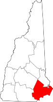
 Location in Rockingham County and the state of New Hampshire. | |
| Coordinates: 42°56′11″N 71°03′12″W / 42.93639°N 71.05333°WCoordinates: 42°56′11″N 71°03′12″W / 42.93639°N 71.05333°W | |
| Country | United States |
| State | New Hampshire |
| County | Rockingham |
| Incorporated | 1694 |
| Government | |
| • Board of Selectmen |
Mark Heitz, Chair Peter Broderick George A. Korn |
| Area | |
| • Total | 20.9 sq mi (54.1 km2) |
| • Land | 19.6 sq mi (50.8 km2) |
| • Water | 1.3 sq mi (3.3 km2) 6.03% |
| Elevation | 135 ft (41 m) |
| Population (2010) | |
| • Total | 6,025 |
| • Density | 288.3/sq mi (118.6/km2) |
| Time zone | Eastern (UTC-5) |
| • Summer (DST) | Eastern (UTC-4) |
| ZIP code | 03848 |
| Area code(s) | 603 |
| FIPS code | 33-40100 |
| GNIS feature ID | 0873638 |
| Website | www.kingstonnh.org |

Kingston is a town in Rockingham County, New Hampshire, United States. The population at the 2010 census was 6,025.[1]
History
Kingston was the fifth town to be established in New Hampshire. Originally, it was a part of Hampton, New Hampshire. After King Philip's War, the establishment of new settlements was made possible by peace treaties with the local Indian tribes and, in 1692, by geographical and jurisdictional agreements between the provinces of Massachusetts and New Hampshire. Consequently, certain residents of Hampton, New Hampshire petitioned for a grant of a separate township to be created from the western part of Hampton. And so, in 1694, King William of England granted a royal charter establishing the town of "Kingstown", so named in honor of the King. Use of the title rather than the King's name was common at the time. The original charter still exists to this day.
Historic district
The Kingston historic district encompasses the town center of Kingston. Historic buildings and sites within the district include the Kingston town hall; the Josiah Bartlett House, home of the second signer of the U.S. Declaration of Independence; the First Universalist Church; the Sanborn Seminary; the Nichols Memorial Research Library; the Kingston Historical Museum (housed in the town's first fire house); The 1686 House restaurant; the Masonic building; the Cemetery at the Plains (where Josiah Bartlett is buried); the Church on the Plains, and the Grace Daley House and barn, home to the town's first church owned parsonage (1835).
West Kingston
West Kingston is located along the road to Danville, in the western section of town, southwest of Great Pond. Evidence of the early inhabitants was manifested by the construction of a log garrison house on the present Great Pond Road. This well-built house consisted of two large rooms downstairs and a huge open chamber on the second floor. In later years a small ell was attached to the north side. The historic house was demolished at the beginning of the 20th century. The stone step at the main entrance and what must have been the "cellar hole" of this dwelling are still visible.
In the midst of an agrarian society, the charcoal manufacturing industry took root and became a major business in West Kingston. Charcoal was carried by horse-drawn wagons to the Massachusetts cities of Haverhill, Lawrence, North Andover, Newburyport, Lowell, and Amesbury, as well as to Exeter, New Hampshire. Some was sold by street peddlers to be used in homes for the purpose of kindling fires. A great deal was also used by the large machine shops and by the silversmiths.
Many individuals manufactured shoes in their small, one-room shoe shops. Such a shop stood until recently near the Thomas Page residence. Some people sewed shoes in their own homes. Unlike the large-scale factories of today, concerned with mass production, these enterprises constructed the whole shoe, hand-sewing it with an artisan's touch.
A cooper shop on the Wadleigh Farm produced barrels made entirely of wood: the staves were made of pine and hardwoods, and were bound with hoops of birch. Skilled workers made hooks to hold hoops together. When a sufficient number of barrels was collected, the men hauled them to Newburyport to be sold - probably to be used by fishermen in packing fish.
Geography
According to the United States Census Bureau, the town has a total area of 20.9 square miles (54 km2), of which 19.6 sq mi (51 km2) is land and 1.3 sq mi (3.4 km2) is water, comprising 6.03% of the town. The highest point in Kingston is the summit of Rock Rimmon Hill, at 350 feet (110 m) above sea level, on the town's border with Danville to the west. The majority of the town is drained by the Powwow River, a tributary of the Merrimack. The northern portion of town is drained by the Little River, part of the Exeter River/Piscataqua River watershed.[2]
Points of interest
- Rockrimmon Hill
- Kingston State Park
- Cemetery on the Plains (where Josiah Bartlett is buried along with some Civil War heroes)
- Kingston Historical Museum (Open to the public during Kingston Days, other special events, and by appointment.)
- Nichols Memorial Research Library (Open Wednesdays, 9:00 - 1:00 pm and by appointment)
- Grace Daley House and barn (at risk of being demolished)
Kingston Days celebration
The Kingston Days celebration occurs on the first Friday, Saturday and Sunday of August. It is to celebrate the town's incorporation date of August 6, 1694. The celebration offers live music and activities, family fun and a large flea market, car show, and motorcycle show. It also includes various events such as a karate show and a police dog demonstration. During this event the Kingston Historical Museum complex is open to the public, in conjunction with the Nichols Memorial Research Library.
Education
Kingston is part of the Sanborn Regional School District (SAU 17), providing public education to students who live in Kingston, Fremont, and Newton.
Schools in Kingston are:
- Sanborn Regional High School (grades 9-12)
- Middle school students (grades 6-8) attend Sanborn Regional Middle School in Newton.
- D.J. Bakie Elementary School (grades P, K, 1-5)
- Seacoast Charter School (grades 1-8)
Pre-schools include:
- Kingston Children's Center (grades P, K)
- Story Book Station (grades P, K, 1)
Demographics
| Historical population | |||
|---|---|---|---|
| Census | Pop. | %± | |
| 1790 | 906 | — | |
| 1800 | 785 | −13.4% | |
| 1810 | 746 | −5.0% | |
| 1820 | 847 | 13.5% | |
| 1830 | 929 | 9.7% | |
| 1840 | 1,032 | 11.1% | |
| 1850 | 1,192 | 15.5% | |
| 1860 | 1,216 | 2.0% | |
| 1870 | 1,054 | −13.3% | |
| 1880 | 1,080 | 2.5% | |
| 1890 | 1,120 | 3.7% | |
| 1900 | 1,132 | 1.1% | |
| 1910 | 1,015 | −10.3% | |
| 1920 | 859 | −15.4% | |
| 1930 | 1,017 | 18.4% | |
| 1940 | 1,002 | −1.5% | |
| 1950 | 1,283 | 28.0% | |
| 1960 | 1,672 | 30.3% | |
| 1970 | 2,882 | 72.4% | |
| 1980 | 4,111 | 42.6% | |
| 1990 | 5,591 | 36.0% | |
| 2000 | 5,862 | 4.8% | |
| 2010 | 6,025 | 2.8% | |
| Est. 2015 | 6,119 | [3] | 1.6% |
As of the census[5] of 2000, there were 5862 people, 2,122 households, and 1,633 families residing in the town. The population density was 298.7 people per square mile (115.4/km²). There were 2,265 housing units at an average density of 115.4 per square mile (44.6/km²). The racial makeup of the town was 97.97% White, 0.22% African American, 0.12% Native American, 0.41% Asian, 0.05% Pacific Islander, 0.44% from other races, and 0.78% from two or more races. Hispanic or Latino of any race were 0.82% of the population.
There were 2,122 households out of which 36.4% had children under the age of 18 living with them, 66.2% were married couples living together, 7.6% had a female householder with no husband present, and 23.0% were non-families. 17.4% of all households were made up of individuals and 6.5% had someone living alone who was 65 years of age or older. The average household size was 2.76 and the average family size was 3.13.
In the town the population was spread out with 25.7% under the age of 18, 6.5% from 18 to 24, 32.6% from 25 to 44, 26.4% from 45 to 64, and 8.8% who were 65 years of age or older. The median age was 38 years. For every 100 females there were 97.0 males. For every 100 females age 18 and over, there were 97.4 males.
The median income for a household in the town was $61,522, and the median income for a family was $66,509. Males had a median income of $42,256 versus $31,210 for females. The per capita income for the town was $28,795. About 1.8% of families and 2.5% of the population were below the poverty line, including 1.7% of those under age 18 and 3.5% of those age 65 or over.
Notable people
- Dr. Josiah Bartlett, second signer of the Declaration of Independence; first President of New Hampshire; founder of the New Hampshire Medical Society
- Betty Hill, alleged UFO abductee
- Henry F. C. Nichols, member of the Wisconsin State Assembly
See also
| Wikimedia Commons has media related to Kingston, New Hampshire. |
References
- ↑ United States Census Bureau, American FactFinder, 2010 Census figures. Retrieved March 23, 2011.
- ↑ Foster, Debra H.; Batorfalvy, Tatianna N.; Medalie, Laura (1995). Water Use in New Hampshire: An Activities Guide for Teachers. U.S. Department of the Interior and U.S. Geological Survey.
- ↑ "Annual Estimates of the Resident Population for Incorporated Places: April 1, 2010 to July 1, 2015". Retrieved July 2, 2016.
- ↑ "Census of Population and Housing". Census.gov. Retrieved June 4, 2016.
- ↑ "American FactFinder". United States Census Bureau. Retrieved 2008-01-31.
External links
- Town of Kingston official website
- New Hampshire Economic and Labor Market Information Bureau Profile