Burrandana
| Burrandana New South Wales | |
|---|---|
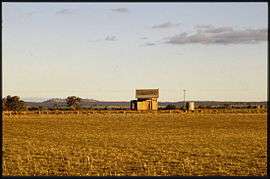 Burrandana railway station, 1985 | |
|
Burrandana Location in New South Wales | |
| Coordinates | 35°24′50″S 147°20′49″E / 35.41389°S 147.34694°ECoordinates: 35°24′50″S 147°20′49″E / 35.41389°S 147.34694°E |
| Postcode(s) | 2650 |
| Location |
|
| LGA(s) | City of Wagga Wagga |
| County | Mitchell |
| State electorate(s) | Wagga Wagga |
Burrandana is a rural locality in the south eastern part of the Riverina. It is situated by road, about 5 kilometres east south-east from Pulletop[2] and 9 kilometres north from Mangoplah.[3]
References
- ↑ Travelmate Archived March 25, 2007, at the Wayback Machine.
- ↑ "Burrandana". Geographical Names Register (GNR) of NSW. Geographical Names Board of New South Wales.
- ↑ Geographical Names Register (GNR) of NSW. Geographical Names Board of New South Wales http://www.gnb.nsw.gov.au/place_naming/placename_search/extract?id=. Missing or empty
|title=(help) KWjLBKsEuj Geographical Names Board of NSW]
External links
![]() Media related to Burrandana at Wikimedia Commons
Media related to Burrandana at Wikimedia Commons
This article is issued from Wikipedia - version of the 11/18/2016. The text is available under the Creative Commons Attribution/Share Alike but additional terms may apply for the media files.