Bridgeton, Missouri
| Bridgeton, Missouri | |
|---|---|
| City | |
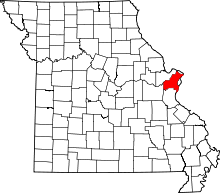
 Location of Bridgeton, Missouri | |
| Coordinates: 38°45′26″N 90°25′4″W / 38.75722°N 90.41778°WCoordinates: 38°45′26″N 90°25′4″W / 38.75722°N 90.41778°W | |
| Country | United States |
| State | Missouri |
| County | St. Louis |
| Government | |
| • Mayor | Terry W. Briggs |
| Area[1] | |
| • Total | 15.24 sq mi (39.47 km2) |
| • Land | 14.60 sq mi (37.81 km2) |
| • Water | 0.64 sq mi (1.66 km2) |
| Elevation | 584 ft (178 m) |
| Population (2010)[2] | |
| • Total | 11,550 |
| • Estimate (2015[3]) | 11,786 |
| • Density | 791.1/sq mi (305.4/km2) |
| Time zone | Central (CST) (UTC-6) |
| • Summer (DST) | CDT (UTC-5) |
| FIPS code | 29-08398[4] |
| GNIS feature ID | 0755816 [5] |
| Website |
www |
Bridgeton is a second-ring suburb of Greater St. Louis in northwestern St. Louis County, Missouri, United States. Bridgeton serves as the primary transport hub within Greater St. Louis. The population at the 2010 census was 11,550.[6] Portions of Lambert-St. Louis International Airport are within Bridgeton.[7]
Location
The populated areas of the city are located between Lambert-St. Louis International Airport and St. Charles. The Missouri River serves as the city's northwestern boundary. Bridgeton is centered at 38°45'26" North, 90°25'4" West (38.7573, -90.4179).[8]
The area has long been influenced by its proximity to important local transportation routes, dating back to Native American trails established by the Osage Nation. Many of those trails became the basis of the first roads in the area, such as Natural Bridge and the historic St. Charles Rock Road, which date back to the days of Spanish, French, and early American settlement. The intersection of I-70 and I-270 in this area add to air and rail access to make the area a good base for transportation-dependent industries. The recreational American Discovery Trail passes through the area,
According to the United States Census Bureau, the city has a total area of 15.24 square miles (39.47 km2), of which 14.60 square miles (37.81 km2) is land and 0.64 square miles (1.66 km2) is water.[1]
History
Early history
Bridgeton has a long and uneven history. The first Europeans to interact with Native American peoples and settle there were associated with the area's days as part of the French Illinois Territory. The French explorer, Étienne de Veniard de Bourgmont traveled the area in 1724, on a trail that developed as the main route between St. Louis and St. Charles.
The Spanish gained colonial control in 1768 after France was defeated by Great Britain in the Seven Years' War and ceded its territory west of the Mississippi to Spain; they remained in control until 1804, when the area was transferred to the Americans in the Louisiana Purchase. In a 1799 census, the population of "Marais des Liards" was given as 337 whites and 42 slaves.[9]
Bridgeton was first platted in 1794, and named Marais des Liards (Cottonwood Swamp). It was also known as Village à Robert, named after Robert Owen, its founder, who had received a land grant from the Spanish government. In a Spanish census two years later it had a population (including slaves) of 77 males and 47 females. As the area received more and more English-speaking settlers, the village's name became Owen's Station.
Because of its location, including its proximity to a ferry across the Missouri River, Bridgeton became a stop along the way from St. Louis to St. Charles. Meriwether Lewis passed through on his way to meet members who were gathering as part of the Lewis and Clark Expedition. The city was granted a state charter in 1843; throughout the next few years it was a stop along the way for emigrants seeking the major trailheads to the Oregon and Santa Fe trails.
The Jesuits, a Catholic religious order of priests and brothers, came to Bridgeton from St. Stanislaus Seminary and St. Ferdinand Parish of Florissant, Missouri. The order established St. Mary's Church in 1851 as a mission to serve area Catholics; it became a full parish within its first year. The parish closed in 2001 due to the expansion of Lambert-St. Louis International Airport, which caused a decline in residential population.
Modern history
By 1950, Bridgeton's population was 276, lower than it had been in the late 1790s and early 19th century. The city expanded in size during the decade, growing through annexation, to 16 square miles (41 km2). The decade included the founding of the Northwest Chamber of Commerce,[10] the chamber of commerce for the Northwest St. Louis area, which includes Bridgeton.[11]
This led into its period of greatest residential growth, the 1960s, during which nearly 8000 single-family homes were built. Denser development was strong during that decade as well, at nearly 2000 units. Unlike with single-family development, the multi-family development continued at about the same average pace during the 1970s and 1980s.
While residential construction nearly ended in the 1990s, that decade has seen significant growth in commercial development. Levee-protected floodplains of the river, together with good access to interstate highways, rail, and the airport have translated into continued growth for Bridgeton and nearby communities, and a diversification of the city's tax base. Proximity to Lambert-Saint Louis International Airport proved to be a mixed blessing. Starting in 1995, an expansion plan for the airport,[12] centered on a new runway plan called W-1W, was fought (unsuccessfully) by the city. The new runway led to the elimination of 2000 homes in the city, most notably in the Carrollton subdivision, undoubtedly playing a significant role in the city's recent population decline.[13]
Demographics
| Historical population | |||
|---|---|---|---|
| Census | Pop. | %± | |
| 1880 | 197 | — | |
| 1890 | 237 | 20.3% | |
| 1900 | 178 | −24.9% | |
| 1910 | 129 | −27.5% | |
| 1920 | 121 | −6.2% | |
| 1930 | 152 | 25.6% | |
| 1940 | 169 | 11.2% | |
| 1950 | 202 | 19.5% | |
| 1960 | 7,820 | 3,771.3% | |
| 1970 | 19,992 | 155.7% | |
| 1980 | 18,445 | −7.7% | |
| 1990 | 17,779 | −3.6% | |
| 2000 | 15,550 | −12.5% | |
| 2010 | 11,550 | −25.7% | |
| Est. 2015 | 11,786 | [14] | 2.0% |
2010 census
As of the census[2] of 2010, there were 11,550 people, 4,760 households, and 2,957 families residing in the city. The population density was 791.1 inhabitants per square mile (305.4/km2). There were 5,088 housing units at an average density of 348.5 per square mile (134.6/km2). The racial makeup of the city was 72.4% White, 18.7% African American, 0.2% Native American, 2.5% Asian, 4.1% from other races, and 2.1% from two or more races. Hispanic or Latino of any race were 6.4% of the population.
There were 4,760 households of which 28.0% had children under the age of 18 living with them, 43.8% were married couples living together, 13.3% had a female householder with no husband present, 5.0% had a male householder with no wife present, and 37.9% were non-families. 32.3% of all households were made up of individuals and 15.6% had someone living alone who was 65 years of age or older. The average household size was 2.33 and the average family size was 2.94.
The median age in the city was 44.6 years. 19.9% of residents were under the age of 18; 8.1% were between the ages of 18 and 24; 22.5% were from 25 to 44; 29.2% were from 45 to 64; and 20.2% were 65 years of age or older. The gender makeup of the city was 47.0% male and 53.0% female.
2000 census
In 2000, the city included 6,251 households and 4,206 families. The population density was 1,067.1 people per square mile (412.1/km²). There were 6,729 housing units at an average density of 461.8 per square mile (178.3/km²). The racial makeup of the city was 86.47% White, 9.05% African American, 2.27% Asian, 0.01% Pacific Islander, 0.21% Native American, 0.69% from other races, and 1.30% from two or more races. 2.22% of the population were Hispanic or Latino of any race.
There were 6,251 households in the city, with an average of 2.43 members. Of these households:
- 27.9% had children under the age of 18,
- 52.3% were married couples co-habitating,
- 11.3% had a female householder with no husband present, and
- 32.7% were not family-based.
26.8% of all households were made up of individuals, and 9.8% had someone living alone who was 65 years of age or older. The average household size was 2.43, and the average family size was 2.95.
The median age of the city's residents was 40 years, distributed as follows:
- 22.1% under the age of 18,
- 8.0% from 18 to 24,
- 27.9% from 25 to 44,
- 26.4% from 45 to 64, and
- 15.7% who were 65 years of age or older.
For every 100 females there were 93.6 males. For every 100 females age 18 and over, there were 89.7 males.
The median income for a household in the city was $49,216; it was greater for families, at $57,797. Males had a median income of $41,250 versus $28,175 for females. The per-capita income for the city was $23,955. 4.9% of the population and 3.2% of families lived below the poverty line. Out of the total population, 4.7% were under 18 and 6.4% of those 65 and older were living below the poverty line.
Economy
Regional airline Trans States Airlines is headquartered in Bridgeton.[7][16] Trans States subsidiary GoJet Airlines is also headquartered in Bridgeton.[17]
The only Level II Trauma Center in North St. Louis County, SSM DePaul Health Center, is located in Bridgeton. It is a 476-bed, full-service Catholic hospital and a member of SSM Health Care-St. Louis, sponsored by the Franciscan Sisters of Mary. Opened in 1828, SSM DePaul was the first hospital west of the Mississippi River and remains the oldest continuously existing business in St. Louis.
Education
St. Louis County Library operates the Bridgeton Trails Branch in Bridgeton.[18][19] The city is served by the Pattonville School District.
References
- 1 2 "US Gazetteer files 2010". United States Census Bureau. Archived from the original on 2012-01-24. Retrieved 2012-07-08.
- 1 2 "American FactFinder". United States Census Bureau. Retrieved 2012-07-08.
- ↑ "Population Estimates". United States Census Bureau. Retrieved 2016-05-29.
- ↑ "American FactFinder". United States Census Bureau. Archived from the original on 2013-09-11. Retrieved 2008-01-31.
- ↑ "Bridgeton". Geographic Names Information System. United States Geological Survey.
- ↑ "Race, Hispanic or Latino, Age, and Housing Occupancy: 2010 Census Redistricting Data (Public Law 94-171) Summary File (QT-PL), Bridgeton city, Missouri". U.S. Census Bureau, American FactFinder 2. Archived from the original on September 11, 2013. Retrieved October 19, 2011.
- 1 2 "Bridgeton city, Missouri." U.S. Census Bureau. Retrieved on June 9, 2009.
- ↑ "US Gazetteer files: 2010, 2000, and 1990". United States Census Bureau. 2011-02-12. Retrieved 2011-04-23.
- ↑ Digest of the Laws of Louisiana, Appendix 4 from the American Memory archives of the Library of Congress
- ↑ About Us from the Northwest Chamber of Commerce website
- ↑ Community Home from the Northwest Chamber of Commerce website
- ↑
- ↑ Bandle, Scott (November 30, 2010). "Bridgeton prepares to move city offices". STLtoday.com. Retrieved 2013-03-12.
- ↑ "Annual Estimates of the Resident Population for Incorporated Places: April 1, 2010 to July 1, 2015". Retrieved July 2, 2016.
- ↑ "Census of Population and Housing". Census.gov. Archived from the original on May 11, 2015. Retrieved June 4, 2015.
- ↑ "Contact Us." Trans States Airlines. Retrieved on May 26, 2009.
- ↑ "Contact Us." GoJet Airlines. Retrieved on August 19, 2009.
- ↑ "Bridgeton Trails Branch." St. Louis County Library. Retrieved on August 18, 2009.
- ↑ "Bridgeton city, Missouri." U.S. Census Bureau. Retrieved on August 18, 2009.
External links
| Topics |  | |
|---|---|---|
| Central city | ||
| Largest cities (over 50,000 in 2010) | ||
| Medium-sized cities (over 20,000 in 2010) | ||
| Largest towns and villages (over 10,000 in 2010) |
| |
| Missouri Counties | ||
| Illinois Counties | ||
| Subregions | ||