Berkeley, Missouri
| Berkeley, Missouri | ||
|---|---|---|
| City | ||
| ||
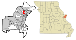 Location of Berkeley, Missouri | ||
| Coordinates: 38°44′32″N 90°20′0″W / 38.74222°N 90.33333°WCoordinates: 38°44′32″N 90°20′0″W / 38.74222°N 90.33333°W | ||
| Country | United States | |
| State | Missouri | |
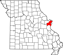
| County | St. Louis | |
| Government | ||
| • Mayor | Theodore Hoskins | |
| Area[1] | ||
| • Total | 4.97 sq mi (12.87 km2) | |
| • Land | 4.97 sq mi (12.87 km2) | |
| • Water | 0 sq mi (0 km2) | |
| Elevation | 538 ft (164 m) | |
| Population (2010)[2] | ||
| • Total | 8,978 | |
| • Estimate (2012[3]) | 8,953 | |
| • Density | 1,806.4/sq mi (697.5/km2) | |
| Time zone | Central (CST) (UTC-6) | |
| • Summer (DST) | CDT (UTC-5) | |
| FIPS code | 29-04906[4] | |
| GNIS feature ID | 0755756[5] | |
| Website | cityofberkeley.us | |
| [6] | ||

Berkeley is an inner-ring suburb of St. Louis, located in St. Louis County, Missouri, United States. The population was 8,978 at the 2010 census.[7] Portions of Lambert–St. Louis International Airport are within the city limits.[8]
History
Berkeley incorporated in 1937.[9]
Geography
According to the United States Census Bureau, the city has a total area of 4.97 square miles (12.87 km2), all of it land.[1]
Demographics
| Historical population | |||
|---|---|---|---|
| Census | Pop. | %± | |
| 1940 | 2,577 | — | |
| 1950 | 5,268 | 104.4% | |
| 1960 | 14,123 | 168.1% | |
| 1970 | 19,743 | 39.8% | |
| 1980 | 15,922 | −19.4% | |
| 1990 | 12,450 | −21.8% | |
| 2000 | 10,063 | −19.2% | |
| 2010 | 8,978 | −10.8% | |
| Est. 2015 | 9,073 | [10] | 1.1% |
2010 census
As of the census[2] of 2010, there were 8,978 people, 3,275 households, and 2,310 families residing in the city. The population density was 1,806.4 inhabitants per square mile (697.5/km2). There were 3,776 housing units at an average density of 759.8 per square mile (293.4/km2). The racial makeup of the city was 81.8% African American, 14.3% White, 3.5% Hispanic or Latino, 0.4% Asian, 0.2% Native American, 0.1% Pacific Islander, 1.6% from other races, and 1.7% from two or more races made up its population.
There were 3,275 households of which 42.3% had children under the age of 18 living with them, 25.6% were married couples living together, 37.7% had a female householder with no husband present, 7.2% had a male householder with no wife present, and 29.5% were non-families. 24.9% of all households were made up of individuals and 8.3% had someone living alone who was 65 years of age or older. The average household size was 2.74 and the average family size was 3.26.
The median age in the city was 32.3 years. 30.5% of residents were under the age of 18; 9.6% were between the ages of 18 and 24; 25.7% were from 25 to 44; 23.4% were from 45 to 64; and 10.8% were 65 years of age or older. The gender makeup of the city was 44.9% male and 55.1% female.
2000 census
As of the census[4] of 2000, there were 10,063 people, 3,600 households, and 2,588 families residing in the city. The population density was 2,040.6 people per square mile (788.1/km²). There were 3,953 housing units at an average density of 801.6 per square mile (309.6/km²). The racial makeup of the city was 76.69% African American, 20.64% White, and 1.60% from two or more races. Hispanic or Latino of any race were 1.08% of the population. And 0.37% Asian, 0.26% Native American, 0.02% Pacific Islander, and 0.43% from other races made the city's population.
There were 3,600 households out of which 37.3% had children under the age of 18 living with them, 32.2% were married couples living together, 33.8% had a female householder with no husband present, and 28.1% were non-families. 23.9% of all households were made up of individuals and 7.8% had someone living alone who was 65 years of age or older. The average household size was 2.76 and the average family size was 3.25.
In the city the population dispersal was 32.2% under the age of 18, 9.3% from 18 to 24, 27.8% from 25 to 44, 19.8% from 45 to 64, and 11.0% who were 65 years of age or older. The median age was 31 years. For every 100 females there were 81.7 males. For every 100 females age 18 and over, there were 74.9 males.
The median income for a household in the city was $32,219, and the median income for a family was $34,148. Males had a median income of $29,511 versus $24,338 for females. The per capita income for the city was $13,788. About 17.0% of families and 19.3% of the population were below the poverty line, including 29.0% of those under age 18 and 10.8% of those age 65 or over.
Economy
Boeing Integrated Defense Systems is headquartered in Berkeley. Prior to its dissolution, McDonnell Douglas was headquartered in the same complex in Berkeley.[8][12] Boeing chose to locate the defense systems offices in the St. Louis area because of the metropolitan area's central location in the United States, the role of the space and aircraft programs of the former McDonnell Douglas location, and bipartisan support from area politicians.[13] At the site, Boeing maintains the James S. McDonnell Prologue Room, containing a museum exhibition of Boeing memorabilia.[14][15]
Police department
The Berkeley Police Department (BKPD) is responsible for law enforcement within the city of Berkeley. According to Berkeley's website there are currently 47 commissioned police officers on the force, along with 13 civilian employees. Another website lists 42 officers and 13 civilian employees. The BKPD has its own dispatch center, and also has its own corrections/detention center. Most BKPD vehicles are white Ford Crown Victorias; several black Crown Victorias are used for traffic enforcement. Berkeley is located at the junction of I-170 and I-70, and is in close proximity to Lambert St. Louis International Airport.
Education

Berkeley is within the Ferguson-Florissant School District. Airport Elementary School and Holman Elementary School serve separate sections of Berkeley and are within the city.[16][17] Elementary schools outside of Berkeley serving sections of the city include Johnson-Wabash in Ferguson and Walnut Grove in Calverton Park.[18][19][20][21][22]
Berkeley Middle School is located in Berkeley.[23] McCluer South-Berkeley High School is in Ferguson.[22][24]
The Berkeley School District opened in 1937 after a dispute over where a school for black people should be located, with the black residents of southern Kinloch and the white residents of northern Kinloch opposing each other. The newly formed school district, mostly white, took over Kinloch High School, which had opened during that year; previously a part of the Kinloch School District, the high school was renamed Berkeley High School. The high school, located in what is now Berkeley, was exclusively for white students. At a later point a new Berkeley High School campus opened in a new location, and the former Berkeley High School became Berkeley Middle School. On June 7, 1975, a U.S. district court ordered the Ferguson-Florissant School District to annex the Berkeley School District and the Kinloch School District; therefore the Ferguson-Florissant district began to serve Berkeley. In December 2003 the former Berkeley High School closed due to expansion of Lambert-St. Louis Airport. In January 2004 McCluer South-Berkeley High School opened.[25]
References
- 1 2 "US Gazetteer files 2010". United States Census Bureau. Archived from the original on 2012-07-14. Retrieved 2012-07-08.
- 1 2 "American FactFinder". United States Census Bureau. Retrieved 2012-07-08.
- ↑ "Population Estimates". United States Census Bureau. Archived from the original on 2013-06-17. Retrieved 2013-05-30.
- 1 2 "American FactFinder". United States Census Bureau. Archived from the original on 2013-09-11. Retrieved 2008-01-31.
- ↑ "US Board on Geographic Names". United States Geological Survey. 2007-10-25. Retrieved 2008-01-31.
- ↑ "US Gazetteer files: 2010, 2000, and 1990". United States Census Bureau. 2011-02-12. Retrieved 2011-04-23.
- ↑ "Race, Hispanic or Latino, Age, and Housing Occupancy: 2010 Census Redistricting Data (Public Law 94-171) Summary File (QT-PL), Berkeley city, Missouri". U.S. Census Bureau, American FactFinder 2. Archived from the original on September 11, 2013. Retrieved October 18, 2011.
- 1 2 "Berkeley city, Missouri." U.S. Census Bureau. Retrieved on June 9, 2009.
- ↑ "Frequently Asked Questions." City of Berkeley. Retrieved on June 13, 2009.
- ↑ "Annual Estimates of the Resident Population for Incorporated Places: April 1, 2010 to July 1, 2015". Retrieved July 2, 2016.
- ↑ "Census of Population and Housing". Census.gov. Archived from the original on April 22, 2013. Retrieved June 4, 2015.
- ↑ "Mcdonnell Douglas Corporation." Manta. Retrieved on June 8, 2009.
- ↑ "St. Louis Lands $23 Billion Boeing Integrated Defense Systems Headquarters Archived August 7, 2008, at the Wayback Machine.." St. Louis Commerce Magazine. Retrieved on June 13, 2009.
- ↑ "The Boeing Company Air and Space Exhibit Opens to the Public." Boeing. May 31, 2005. Retrieved on June 13, 2009.
- ↑ "James S. McDonnell Prologue Room." Boeing. May 31, 2005. Retrieved on June 13, 2009.
- ↑ "Airport Elementary School." Ferguson-Florissant School District. Retrieved on June 13, 2009.
- ↑ "Holman Elementary School." Ferguson-Florissant School District. Retrieved on June 13, 2009.
- ↑ "FFSD Attendance Map." Ferguson-Florissant School District. Retrieved on June 13, 2009.
- ↑ "Johnson-Wabash Elementary School." Ferguson-Florissant School District. Retrieved on June 13, 2009.
- ↑ "Walnut Grove Elementary School." Ferguson-Florissant School District. Retrieved on June 13, 2009.
- ↑ "Calverton Park village, Missouri." U.S. Census Bureau. Retrieved on June 13, 2009.
- 1 2 "Ferguson city, Missouri." U.S. Census Bureau. Retrieved on June 13, 2009.
- ↑ "Berkeley Middle School." Ferguson-Florissant School District. Retrieved on June 13, 2009.
- ↑ "McCluer South-Berkeley High School." Ferguson-Florissant School District. Retrieved on June 13, 2009.
- ↑ Bosenbecker, Ray. So Where'd You Go to High School? Virginia Publishing Corporation. 2008. "94. Retrieved on June 13, 2009.
External links
| Topics |  | |
|---|---|---|
| Central city | ||
| Largest cities (over 50,000 in 2010) | ||
| Medium-sized cities (over 20,000 in 2010) | ||
| Largest towns and villages (over 10,000 in 2010) |
| |
| Missouri Counties | ||
| Illinois Counties | ||
| Subregions | ||