Blanding, Utah
| Blanding, Utah | |
|---|---|
| City | |
|
City office | |
 Location in San Juan County and the state of Utah. | |
| Coordinates: 37°37′24″N 109°28′44″W / 37.62333°N 109.47889°WCoordinates: 37°37′24″N 109°28′44″W / 37.62333°N 109.47889°W | |
| Country | United States |
| State | Utah |
| County | San Juan |
| Founded | 1905 |
| Founded by | Walter C. Lyman |
| Named for | Amelia Blanding Bicknell |
| Area | |
| • Total | 2.4 sq mi (6.1 km2) |
| • Land | 2.4 sq mi (6.1 km2) |
| • Water | 0.0 sq mi (0.0 km2) |
| Elevation | 6,106 ft (1,861 m) |
| Population (2012) | |
| • Total | 3,504 |
| • Density | 1,500/sq mi (570/km2) |
| Time zone | MST (UTC-7) |
| • Summer (DST) | MDT (UTC-6) |
| ZIP code | 84511 |
| Area code | 435 |
| FIPS code | 49-06370 [1] |
| GNIS feature ID | 1438903 [2] |
| Website | blandingutah.org |

Blanding is a city in San Juan County, Utah, United States. The population was 3,375 at the 2010 census, making it the most populated city in San Juan County. It was settled in the late 19th century by Mormon settlers, predominantly from the famed Hole-In-The-Rock expedition. Economic contributors include mineral processing, mining, agriculture, local commerce, tourism, and transportation.
Blanding is located near both the Navajo and White Mesa Ute Native American reservations, and a significant percentage of Blanding's population has family ties to these nearby cultures. Blanding is a gateway to an abundance of nearby natural and archaeological resources, including The Dinosaur Museum, Natural Bridges National Monument, Monument Valley and the Four Corners area, Glen Canyon National Recreation Area (Lake Powell), Cedar Mesa archaeological and wilderness area, the San Juan River including Goosenecks State Park, and the Needles district of Canyonlands National Park. It is located approximately 1 hour south of the popular recreation hub of Moab and Arches National Park.
History
First known as Grayson (after Nellie Grayson Lyman, wife of settler Joseph Lyman), the town changed its name in 1914 when a wealthy easterner, Thomas W. Bicknell, offered a thousand-volume library to any town that would adopt his name. Grayson competed with Thurber, Utah (renamed Bicknell) for the prize. Grayson was renamed Blanding after the maiden name of Bicknell's wife, and each of the towns received 500 books.[3]
Geography
Blanding is located at 37°37′24″N 109°28′44″W / 37.623199°N 109.478943°W (37.623199, -109.478943)[4] in the Four Corners area of the Colorado Plateau.
According to the United States Census Bureau, the city has a total area of 2.4 square miles (6.1 km2), all land.
Demographics
| Historical population | |||
|---|---|---|---|
| Census | Pop. | %± | |
| 1910 | 385 | — | |
| 1920 | 1,072 | 178.4% | |
| 1930 | 1,001 | −6.6% | |
| 1940 | 1,438 | 43.7% | |
| 1950 | 1,177 | −18.2% | |
| 1960 | 1,805 | 53.4% | |
| 1970 | 2,250 | 24.7% | |
| 1980 | 3,118 | 38.6% | |
| 1990 | 3,162 | 1.4% | |
| 2000 | 3,162 | 0.0% | |
| 2010 | 3,375 | 6.7% | |
| Est. 2015 | 3,785 | [5] | 12.1% |
As of the census[1] of 2010, there were 3,375 people, 1,013 households, and 785 families residing in the city. The population density was 1,332.7 people per square mile (515.1/km2). There were 1,110 housing units at an average density of 417.7 per square mile (161.4/km2). The racial makeup of the city was 66.1% White, 0.3% African American, 29.4% Native American, 0.09% Asian, 0.01% Pacific Islander, .5% from other races, and 3.3% from two or more races. Hispanic or Latino of any race were 3.8% of the population.
There were 1,013 households out of which 43.2% had children under the age of 18 living with them, 59% were married couples living together, 14.3% had a female householder with no husband present, and 22.5% were non-families. 20.4% of all households were made up of individuals and 8.8% had someone living alone who was 65 years of age or older. The average household size was 3.19 and the average family size was 3.71.
In the city the population was spread out with 39.2% under the age of 19, 9.87% from 20 to 24, 22% from 25 to 44, 18.8% from 45 to 64, and 11.2% who were 65 years of age or older. The median age was 26.6 years. For every 100 females there were 95.3 males. For every 100 females age 18 and over, there were 88.3 males.
The median income for a household in the city was $43,946, and the median income for a family was $50,833. Males had a median income of $42,667 versus $21,615 for females. About 14.1% of families and 11.1% of the population were below the poverty line, including 34.0% of those under age 18 and 10.9% of those age 65 or over.
Anasazi artifacts
The community of Blanding and its surrounding area is rich in Anasazi artifacts, many examples of which are now on display at the Edge of the Cedars Museum. Largely these examples have come from the collections of local residents and were put together early in the history of the community. In more recent decades the majority of local residents have abandoned artifact hunting, partially because they became more difficult to find, but also because of more aggressive enforcement of the antiquities acts by Federal authorities. Federal authorities still retain out-of-area custody of local artifacts seized in raids conducted in 2009. There have been local efforts to have these artifacts also deposited in the Edge of the Cedars Museum in an effort to use them educationally to inform the public of the Anasazi heritage and to teach conservation of these resources.
Climate
| Climate data for Blanding, Utah. (data from 1904-2013) | |||||||||||||
|---|---|---|---|---|---|---|---|---|---|---|---|---|---|
| Month | Jan | Feb | Mar | Apr | May | Jun | Jul | Aug | Sep | Oct | Nov | Dec | Year |
| Record high °F (°C) | 63 (17) |
71 (22) |
86 (30) |
88 (31) |
98 (37) |
110 (43) |
109 (43) |
106 (41) |
100 (38) |
99 (37) |
74 (23) |
65 (18) |
110 (43) |
| Average high °F (°C) | 39.2 (4) |
44.9 (7.2) |
53.0 (11.7) |
62.4 (16.9) |
72.5 (22.5) |
83.6 (28.7) |
88.8 (31.6) |
86.3 (30.2) |
78.4 (25.8) |
66.0 (18.9) |
51.6 (10.9) |
41.2 (5.1) |
64.0 (17.8) |
| Average low °F (°C) | 17.3 (−8.2) |
22.4 (−5.3) |
28.0 (−2.2) |
34.5 (1.4) |
42.4 (5.8) |
51.1 (10.6) |
58.2 (14.6) |
56.4 (13.6) |
48.6 (9.2) |
38.2 (3.4) |
27.0 (−2.8) |
19.3 (−7.1) |
37.0 (2.8) |
| Record low °F (°C) | −20 (−29) |
−23 (−31) |
−3 (−19) |
10 (−12) |
15 (−9) |
28 (−2) |
32 (0) |
38 (3) |
20 (−7) |
10 (−12) |
−7 (−22) |
−13 (−25) |
−30 (−34) |
| Average precipitation inches (mm) | 1.40 (35.6) |
1.22 (31) |
1.02 (25.9) |
0.86 (21.8) |
0.71 (18) |
0.44 (11.2) |
1.15 (29.2) |
1.36 (34.5) |
1.28 (32.5) |
1.44 (36.6) |
1.03 (26.2) |
1.39 (35.3) |
13.29 (337.6) |
| Average snowfall inches (cm) | 10.9 (27.7) |
7.4 (18.8) |
4.3 (10.9) |
1.9 (4.8) |
0.2 (0.5) |
0 (0) |
0 (0) |
0 (0) |
0 (0) |
0.4 (1) |
3.2 (8.1) |
10.1 (25.7) |
38.3 (97.3) |
| Source: The Western Regional Climate Center[7] | |||||||||||||
See also
- Abajo Mountains
- Arizona breccia pipe uranium mineralization
- Blanding Municipal Airport
- Colorado Plateau
- Four Corners
- Hovenweep National Monument
- KBDX
- Swallow's Nest (Blanding, Utah)
- U.S. Route 191 in Utah
- Utah State Route 95
- Utah State Route 262
References
- 1 2 "American FactFinder". United States Census Bureau. Archived from the original on 2013-09-11. Retrieved 2008-01-31.
- ↑ "US Board on Geographic Names". United States Geological Survey. 2007-10-25. Retrieved 2008-01-31.
- ↑ Van Cott, John W. (1990). Utah Place Names. Salt Lake City, Utah: University of Utah Press. p. 39. ISBN 0-87480-345-4.
- ↑ "US Gazetteer files: 2010, 2000, and 1990". United States Census Bureau. 2011-02-12. Retrieved 2011-04-23.
- ↑ "Annual Estimates of the Resident Population for Incorporated Places: April 1, 2010 to July 1, 2015". Retrieved July 2, 2016.
- ↑ "Census of Population and Housing". Census.gov. Archived from the original on May 11, 2015. Retrieved June 4, 2015.
- ↑ "Seasonal Temperature and Precipitation Information". Western Regional Climate Center. Retrieved August 6, 2013.
External links
![]() Media related to Blanding, Utah at Wikimedia Commons
Media related to Blanding, Utah at Wikimedia Commons
 |
Torrey, Hanksville / Colorado River | Monticello | |
|
| Boulder Escalante / Colorado River |
|
| ||
| ||||
| | ||||
| Big Water / Colorado River |
Canyon de Chelly National Monument |
|
Municipalities and communities of San Juan County, Utah, United States | ||
|---|---|---|
| Cities | 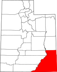 | |
| CDPs | ||
| Unincorporated community | ||
| Indian reservations | ||
| Ghost towns | ||
| Footnotes | ‡This populated place also has portions in an adjacent county or counties | |