La Sal, Utah
| La Sal, Utah | |
|---|---|
| CDP | |
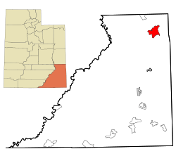 Location in San Juan County and the state of Utah. | |
| Coordinates: 38°18′8″N 109°16′7″W / 38.30222°N 109.26861°WCoordinates: 38°18′8″N 109°16′7″W / 38.30222°N 109.26861°W | |
| Country | United States |
| State | Utah |
| County | San Juan |
| Founded | 1930 |
| Named for | La Sal Mountains |
| Area | |
| • Total | 46.0 sq mi (119.2 km2) |
| • Land | 45.8 sq mi (118.7 km2) |
| • Water | 0.2 sq mi (0.4 km2) |
| Elevation | 6,978 ft (2,127 m) |
| Population (2000) | |
| • Total | 339 |
| • Density | 7.4/sq mi (2.9/km2) |
| Time zone | Mountain (MST) (UTC-7) |
| • Summer (DST) | MDT (UTC-6) |
| ZIP code | 84530 |
| Area code(s) | 435 |
| FIPS code | 49-43110[1] |
| GNIS feature ID | 1442376[2] |
La Sal is a census-designated place (CDP) in San Juan County, Utah, United States. The population was 339 at the 2000 census. The name comes from the La Sal Mountains which means in Spanish "The Salt".
Geography
La Sal is located at 38°18′8″N 109°16′7″W / 38.30222°N 109.26861°W (38.302188, -109.268688).[3]
According to the United States Census Bureau, the CDP has a total area of 46.0 square miles (119.1 km²), of which, 45.8 square miles (118.7 km²) of it is land and 0.2 square miles (0.4 km²) of it (0.35%) is water.
Climate
According to the Köppen Climate Classification system, La Sal has a semi-arid climate, abbreviated "BSk" on climate maps.[4]
Demographics
As of the census[1] of 2000, there were 339 people, 96 households, and 72 families residing in the CDP. The population density was 7.4 people per square mile (2.9/km²). There were 121 housing units at an average density of 2.6/sq mi (1.0/km²). The racial makeup of the CDP was 66.67% White, 22.12% Native American, 0.29% Asian, 4.42% from other races, and 6.49% from two or more races. Hispanic or Latino of any race were 11.21% of the population.
There were 96 households out of which 35.4% had children under the age of 18 living with them, 61.5% were married couples living together, 10.4% had a female householder with no husband present, and 25.0% were non-families. 20.8% of all households were made up of individuals and 3.1% had someone living alone who was 65 years of age or older. The average household size was 2.73 and the average family size was 3.19.
In the CDP the population was spread out with 24.2% under the age of 18, 28.6% from 18 to 24, 20.4% from 25 to 44, 20.4% from 45 to 64, and 6.5% who were 65 years of age or older. The median age was 23 years. For every 100 females there were 87.3 males. For every 100 females age 18 and over, there were 91.8 males.
The median income for a household in the CDP was $25,926, and the median income for a family was $26,071. Males had a median income of $26,295 versus $25,893 for females. The per capita income for the CDP was $7,567. About 16.3% of families and 22.1% of the population were below the poverty line, including 27.9% of those under age 18 and 100.0% of those age 65 or over.
References
- 1 2 "American FactFinder". United States Census Bureau. Retrieved 2008-01-31.
- ↑ "US Board on Geographic Names". United States Geological Survey. 2007-10-25. Retrieved 2008-01-31.
- ↑ "US Gazetteer files: 2010, 2000, and 1990". United States Census Bureau. 2011-02-12. Retrieved 2011-04-23.
- ↑ Climate Summary for La Sal, Utah
Municipalities and communities of San Juan County, Utah, United States | ||
|---|---|---|
| Cities | 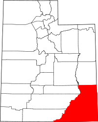 | |
| CDPs | ||
| Unincorporated community | ||
| Indian reservations | ||
| Ghost towns | ||
| Footnotes | ‡This populated place also has portions in an adjacent county or counties | |