Dolores, Colorado
| Town of Dolores, Colorado | |
|---|---|
| Statutory Town | |
 Location in Montezuma County and the State of Colorado | |
| Coordinates: 37°28′26″N 108°29′59″W / 37.473990°N 108.499824°WCoordinates: 37°28′26″N 108°29′59″W / 37.473990°N 108.499824°W[1] | |
| Country |
|
| State |
|
| County | Montezuma County[2] |
| Incorporated | July 19, 1900[3] |
| Government | |
| • Type | Statutory Town[2] |
| Area | |
| • Total | 0.7 sq mi (1.8 km2) |
| • Land | 0.7 sq mi (1.8 km2) |
| • Water | 0 sq mi (0 km2) |
| Elevation[4] | 6,936 ft (2,114 m) |
| Population (2010) | |
| • Total | 936 |
| • Density | 1,337.1/sq mi (520.0/km2) |
| Time zone | MST (UTC-7) |
| • Summer (DST) | MDT (UTC-6) |
| ZIP code[5] | 81323 |
| Area code(s) | 970 |
| INCITS place code | 0820770 |
| GNIS feature ID | 0202607 |
The Town of Dolores is a Statutory Town in Montezuma County, Colorado, United States. The population was 936 at the 2010 census. It is one of three incorporated municipalities in the county.
Dolores (Spanish for "sorrows" and named for the river on which it is located) is located at the mouth of the Dolores Valley and the upper reaches of McPhee Reservoir, approximately 40 miles from the Four Corners Monument. Established as a station on the Rio Grande Southern Railroad, it replaced the earlier town, Big Bend, now covered by McPhee Reservoir. McPhee Reservoir is named for a company town founded by New Mexico Lumber Company, that is now covered by the reservoir.
Geography
Dolores is located at 37°28′28″N 108°29′54″W / 37.47444°N 108.49833°W (37.474540, -108.498294).[6]
According to the United States Census Bureau, the town has a total area of 0.7 square miles (1.8 km2), all land.
The town is confined to a narrow valley bottom along the Dolores River near the point where the river turns from flowing southward out of the San Juan Mountains to the north. Built-up areas outside the town limits include extensive residential, commercial, and minor-industrial areas upstream in the valley floor, on Summit Ridge to the south-southwest, and on high ground to the west, at the intersections of Colorado Highways 145 and 184.
Demographics
| Historical population | |||
|---|---|---|---|
| Census | Pop. | %± | |
| 1900 | 108 | — | |
| 1910 | 320 | 196.3% | |
| 1920 | 465 | 45.3% | |
| 1930 | 557 | 19.8% | |
| 1940 | 804 | 44.3% | |
| 1950 | 729 | −9.3% | |
| 1960 | 805 | 10.4% | |
| 1970 | 820 | 1.9% | |
| 1980 | 802 | −2.2% | |
| 1990 | 866 | 8.0% | |
| 2000 | 857 | −1.0% | |
| 2010 | 936 | 9.2% | |
| Est. 2015 | 963 | [7] | 2.9% |
As of the census[9] of 2010, there were 936 people, 431 households, and 236 families residing in the town. The population density was 1,337.1 people per square mile (520.0/km²). There were 501 housing units at an average density of 715.7 per square mile (278.3/km²). The racial makeup of the town was 90.38% White, 2.14% Native American, 0.11% Asian, 0.21% Pacific Islander, 3.42% from other races, and 3.74% from two or more races. Hispanic or Latino of any race were 10.90% of the population.
There were 431 households out of which 25.3% had children under the age of 18 living with them, 38.5% were married couples living together, 12.1% had a female householder with no husband present, and 45.2% were non-families. 39.7% of all households were made up of individuals and 13.9% had someone living alone who was 65 years of age or older. The average household size was 2.15 and the average family size was 2.92.
In the town the population was spread out with 22.5% under the age of 18, 7.5% from 18 to 24, 26.0% from 25 to 44, 28.6% from 45 to 64, and 16.3% who were 65 years of age or older. The median age was 44.7 years. For every 100 females there were 99.6 males. For every 100 females age 18 and over, there were 99.7 males.
The median income for a household in the town was $30,417, and the median income for a family was $32,188. Males had a median income of $27,404 versus $19,286 for females. The per capita income for the town was $14,912. About 16.6% of families and 17.3% of the population were below the poverty line, including 24.1% of those under age 18 and 11.6% of those age 65 or over.
History
The following are Dolores area historic sites of the Ancient Pueblo People:
- The BLM-Anasazi Heritage Center, and the on-site Domniguez and Escalante Pueblos are listed on the Colorado State Register of Historic Properties and the National Register of Historic Places listings in Montezuma County, Colorado.[10][11]
- Canyons of the Ancients National Monument
- O'Brien Site, an Ancient Pueblo settlement of 11 pueblos occupied between AD 1075 - 1150.[10]
Other historic sites added to the Colorado State Register of Historic Properties and National Register of Historic Places include:[10][11]
- Lebannon School, also known as the Lebannon Schoolhouse
- Southern Hotel, also known as Benny's Hogan and the Rio Grande Southern Hotel
See also
- Outline of Colorado
- State of Colorado
- Dolores River
- Four Corners region
- Mesa Verde National Park and UNESCO World Heritage Site
- McPhee Reservoir
- San Juan Skyway National Scenic Byway
References
- ↑ "2014 U.S. Gazetteer Files: Places". United States Census Bureau. July 1, 2014. Retrieved January 5, 2015.
- 1 2 "Active Colorado Municipalities". State of Colorado, Department of Local Affairs. Retrieved 2007-09-01.
- ↑ "Colorado Municipal Incorporations". State of Colorado, Department of Personnel & Administration, Colorado State Archives. 2004-12-01. Retrieved 2007-09-02.
- ↑ "US Board on Geographic Names". United States Geological Survey. 2007-10-25. Retrieved 2008-01-31.
- ↑ "ZIP Code Lookup" (JavaScript/HTML). United States Postal Service. Retrieved September 8, 2007.
- ↑ "US Gazetteer files: 2010, 2000, and 1990". United States Census Bureau. 2011-02-12. Retrieved 2011-04-23.
- ↑ "Annual Estimates of the Resident Population for Incorporated Places: April 1, 2010 to July 1, 2015". Retrieved July 2, 2016.
- ↑ "Census of Population and Housing". Census.gov. Retrieved June 4, 2015.
- ↑ "American FactFinder". United States Census Bureau. Retrieved 2008-01-31.
- 1 2 3 Colorado State Register of Historic Properties - Montezuma County. Colorado Historical Society Office of Archaeology and Historic Preservation. Retrieved 10-8-2011.
- 1 2 National Register of Historic Places in Montezuma County American Dreams, Inc. Retrieved 2011-10-7.
External links
Municipalities and communities of Montezuma County, Colorado, United States | ||
|---|---|---|
| City | 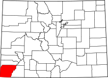 | |
| Towns | ||
| CDP | ||
| Unincorporated communities | ||
| Indian reservation | ||
