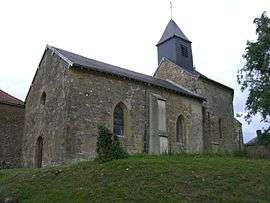
Beffu-et-le-Morthomme
| Beffu-et-le-Morthomme | |
|---|---|
 | |
 Beffu-et-le-Morthomme | |
|
Location within Grand Est region  Beffu-et-le-Morthomme | |
| Coordinates: 49°22′11″N 4°54′01″E / 49.3697°N 4.9003°ECoordinates: 49°22′11″N 4°54′01″E / 49.3697°N 4.9003°E | |
| Country | France |
| Region | Grand Est |
| Department | Ardennes |
| Arrondissement | Vouziers |
| Canton | Grandpré |
| Intercommunality | Argonne Ardennaise |
| Government | |
| • Mayor (2008–2014) | Régis Barre |
| Area1 | 5.49 km2 (2.12 sq mi) |
| Population (2008)2 | 72 |
| • Density | 13/km2 (34/sq mi) |
| Time zone | CET (UTC+1) |
| • Summer (DST) | CEST (UTC+2) |
| INSEE/Postal code | 08056 / 08250 |
| Elevation |
147–247 m (482–810 ft) (avg. 170 m or 560 ft) |
|
1 French Land Register data, which excludes lakes, ponds, glaciers > 1 km² (0.386 sq mi or 247 acres) and river estuaries. 2 Population without double counting: residents of multiple communes (e.g., students and military personnel) only counted once. | |
Beffu-et-le-Morthomme is a commune in the Ardennes department in northern France.
Population
| Historical population | ||
|---|---|---|
| Year | Pop. | ±% |
| 1962 | 72 | — |
| 1968 | 80 | +11.1% |
| 1975 | 57 | −28.7% |
| 1982 | 51 | −10.5% |
| 1990 | 60 | +17.6% |
| 1999 | 53 | −11.7% |
| 2008 | 72 | +35.8% |
See also
References
| Wikimedia Commons has media related to Beffu-et-le-Morthomme. |
This article is issued from Wikipedia - version of the 3/15/2016. The text is available under the Creative Commons Attribution/Share Alike but additional terms may apply for the media files.