Amesti, California
| Amesti | |
|---|---|
| census-designated place | |
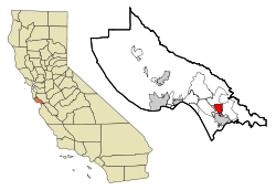 Location in Santa Cruz County and the state of California | |
 Amesti Location in the United States | |
| Coordinates: 36°57′33″N 121°46′56″W / 36.95917°N 121.78222°WCoordinates: 36°57′33″N 121°46′56″W / 36.95917°N 121.78222°W | |
| Country |
|
| State |
|
| County | Santa Cruz |
| Area[1] | |
| • Total | 3.056 sq mi (7.914 km2) |
| • Land | 2.992 sq mi (7.748 km2) |
| • Water | 0.064 sq mi (0.166 km2) 2.10% |
| Elevation | 148 ft (45 m) |
| Population (2010) | |
| • Total | 3,478 |
| • Density | 1,100/sq mi (440/km2) |
| Time zone | PST (UTC-8) |
| • Summer (DST) | PDT (UTC-7) |
| ZIP code | 95076 |
| Area code(s) | 831 |
| FIPS code | 06-01651 |
| GNIS feature ID | 1853375 |
Amesti is a census-designated place (CDP) in Santa Cruz County, California, United States. The population was 3,478 at the 2010 census.
Amesti is named for José Amesti, a Basque who came to California in 1822, and who was the grantee of Rancho Los Corralitos.[2]
Geography
Amesti is located at 36°57′33″N 121°46′56″W / 36.95917°N 121.78222°W (36.959210, -121.782131).[3]
According to the United States Census Bureau, the CDP has a total area of 3.1 square miles (8.0 km2), of which, 3.0 square miles (7.8 km2) of it is land and 0.1 square miles (0.26 km2) of it (2.10%) is water.
Demographics
2010
The 2010 United States Census[4] reported that Amesti had a population of 3,478. The population density was 1,138.2 people per square mile (439.5/km²). The racial makeup of Amesti was 1,889 (54.3%) White, 12 (0.3%) African American, 41 (1.2%) Native American, 89 (2.6%) Asian, 1,309 (37.6%) from other races, and 137 (3.9%) from two or more races. Hispanic or Latino of any race were 2,273 persons (65.4%).
The Census reported that 99.6% of the population lived in households and 0.4% lived in non-institutionalized group quarters.
There were 982 households, out of which 509 (51.8%) had children under the age of 18 living in them, 576 (58.7%) were opposite-sex married couples living together, 158 (16.1%) had a female householder with no husband present, 56 (5.7%) had a male householder with no wife present. There were 68 (6.9%) unmarried opposite-sex partnerships, and 12 (1.2%) same-sex married couples or partnerships. 143 households (14.6%) were made up of individuals and 71 (7.2%) had someone living alone who was 65 years of age or older. The average household size was 3.53. There were 790 families (80.4% of all households); the average family size was 3.83.
The population was spread out with 1,100 people (31.6%) under the age of 18, 343 people (9.9%) aged 18 to 24, 895 people (25.7%) aged 25 to 44, 805 people (23.1%) aged 45 to 64, and 335 people (9.6%) who were 65 years of age or older. The median age was 31.3 years. For every 100 females there were 95.3 males. For every 100 females age 18 and over, there were 89.3 males.
There were 1,015 housing units at an average density of 332.2 per square mile (128.2/km²), of which 61.5% were owner-occupied and 38.5% were occupied by renters. The homeowner vacancy rate was 0.3%; the rental vacancy rate was 1.3%. 56.6% of the population lived in owner-occupied housing units and 42.9% lived in rental housing units.
2000
As of the census[5] of 2000, there were 2,436 people, 760 households, and 589 families residing in the CDP. The population density was 833.0 people per square mile (322.1/km²). There were 781 housing units at an average density of 267.1 per square mile (103.3/km²). The racial makeup of the CDP in 2010 was 30.6% non-Hispanic White, 0.3% non-Hispanic African American, 0.5% Native American, 2.2% Asian, and 1.1% from two or more races. Hispanic or Latino of any race were 65.4% of the population.
There were 760 households out of which 38.6% had children under the age of 18 living with them, 61.2% were married couples living together, 11.1% had a female householder with no husband present, and 22.5% were non-families. 17.5% of all households were made up of individuals and 8.8% had someone living alone who was 65 years of age or older. The average household size was 3.21 and the average family size was 3.56.
In the CDP the population was spread out with 30.2% under the age of 18, 7.4% from 18 to 24, 26.8% from 25 to 44, 21.6% from 45 to 64, and 14.0% who were 65 years of age or older. The median age was 36 years. For every 100 females there were 97.6 males. For every 100 females age 18 and over, there were 92.5 males.
The median income for a household in the CDP was $45,558, and the median income for a family was $48,036. Males had a median income of $43,800 versus $30,223 for females. The per capita income for the CDP was $18,422. About 14.0% of families and 14.4% of the population were below the poverty line, including 18.9% of those under age 18 and none of those age 65 or over.
Government
In the California State Legislature, Amesti is in the 17th Senate District, represented by Democrat Bill Monning, and in the 30th Assembly District, represented by Democrat Anna Caballero.[6]
In the United States House of Representatives, Amesti is in California's 20th congressional district, represented by Democrat Sam Farr.[7]
References
- ↑ "2010 Census U.S. Gazetteer Files – Places – California". United States Census Bureau.
- ↑ Gudde, Erwin; William Bright (2004). California Place Names (Fourth ed.). University of California Press. p. 12. ISBN 0-520-24217-3.
- ↑ "US Gazetteer files: 2010, 2000, and 1990". United States Census Bureau. 2011-02-12. Retrieved 2011-04-23.
- ↑ "2010 Census Interactive Population Search: CA - Amesti CDP". U.S. Census Bureau. Retrieved July 12, 2014.
- ↑ "American FactFinder". United States Census Bureau. Archived from the original on 2013-09-11. Retrieved 2008-01-31.
- ↑ "Statewide Database". UC Regents. Retrieved December 10, 2014.
- ↑ "California's 20th Congressional District - Representatives & District Map". Civic Impulse, LLC.
External links
Municipalities and communities of Santa Cruz County, California, United States | ||
|---|---|---|
| Cities | 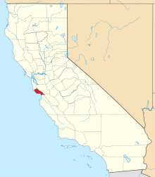 | |
| CDPs | ||
| Unincorporated communities | ||
| Ghost town | ||