Chittenden, California
| Chittenden, California | |
|---|---|
| Unincorporated community | |
 Chittenden, California | |
| Coordinates: 36°54′05″N 121°36′19″W / 36.90139°N 121.60528°WCoordinates: 36°54′05″N 121°36′19″W / 36.90139°N 121.60528°W | |
| Country | United States |
| State | California |
| County | Santa Cruz |
| Elevation | 125 ft (38 m) |
| Time zone | Pacific (PST) (UTC-8) |
| • Summer (DST) | PDT (UTC-7) |
| Area code(s) | 831 |
| GNIS feature ID | 251973[1] |
Chittenden is an unincorporated community in Santa Cruz County, California, United States. Chittenden is located along California State Route 129 and the north bank of the Pajaro River, across the river from River Oaks and 8.4 miles (13.5 km) west of Watsonville.
References
Municipalities and communities of Santa Cruz County, California, United States | ||
|---|---|---|
| Cities | 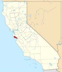 | |
| CDPs | ||
| Unincorporated communities | ||
| Ghost town | ||
This article is issued from Wikipedia - version of the 1/29/2014. The text is available under the Creative Commons Attribution/Share Alike but additional terms may apply for the media files.