Yarine
| Yarine يارين | |
|---|---|
| Village | |
 Yarine | |
| Coordinates: 33°06′23″N 35°14′01″E / 33.10639°N 35.23361°E | |
| Grid position | 172/279 PAL |
| Country |
|
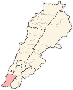
| Governorate | South Governorate |
| District | Tyre |
| Area | |
| • Water | 0 sq mi (0 km2) |
| Time zone | GMT +3 |
Yarine (Arabic: يارين ) is a village in the Tyre District in South Lebanon.
Name
According to E. H. Palmer in 1881, the name Kh. Yarin comes from "the ruin of Yârîn, p.n."[1]
History
In 1875, Victor Guérin found here 'On the east extends a sort of avenue, formerly bordered by important buildings. One remarks especially the remains of a great edifice measuring forty-five paces in length from west to east by twenty-two in breadth from north to south. It was built of finely cut stones lying one upon the other with cement, and terminated at the east in three apses, the largest of which, that in the centre, is still partly upright. It was once an ancient church divided into three naves by monolithic columns, some undulated fragments of which are lying on the ground . ….. Small cubes of mosaic in red, white, and black still adhere to the soil in several places.' [2]
In 1881, the Palestine Exploration Fund's Survey of Western Palestine (SWP) found here: “Large ruin; some small-sized drafted stones with bosses left rough, two stones bearing Latin crosses; remains of modern walls and heaps of stones; two rock-cut tombs with square-headed kokim; loculi. In the more eastern one a figure of a human head is roughly cut out of the rock in the first chamber of the tomb, out of which two square loculi open.”[3]
References
Bibliography
- Conder, Claude Reignier; Kitchener, H. H. (1881). The Survey of Western Palestine: Memoirs of the Topography, Orography, Hydrography, and Archaeology. 1. London: Committee of the Palestine Exploration Fund.
- Guérin, Victor (1880). Description Géographique Historique et Archéologique de la Palestine (in French). 3: Galilee, pt. 2. Paris: L'Imprimerie Nationale.
- Palmer, E. H. (1881). The Survey of Western Palestine: Arabic and English Name Lists Collected During the Survey by Lieutenants Conder and Kitchener, R. E. Transliterated and Explained by E.H. Palmer. Committee of the Palestine Exploration Fund.
External links
- Yarine, Localiban
- Survey of Western Palestine, Map 3: IAA, Wikimedia commons
Capital: Tyre | ||
| Towns and villages |
|  |