Bayyad
| Bayyad بياض Biyad | |
|---|---|
| Village | |
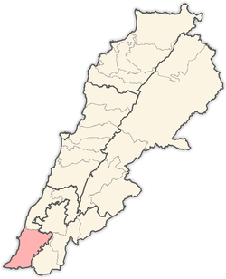
 Bayyad Location within Lebanon | |
| Coordinates: 33°12′15″N 35°19′42″E / 33.20417°N 35.32833°ECoordinates: 33°12′15″N 35°19′42″E / 33.20417°N 35.32833°E | |
| Grid position | 180/290 PAL |
| Country |
|
| Governorate | South Lebanon Governorate |
| District | Tyre District |
| Time zone | EET (UTC+2) |
| • Summer (DST) | EEST (UTC+3) |
| Dialing code | +9617 |
Bayyad (Arabic: بياض ) is a village in Southern Lebanon, located in Tyre District, Governorate of South Lebanon.
Origin of name
E. H. Palmer wrote that the name means "the white spot".[1]
History
In 1881, during the late Ottoman era, the Palestine Exploration Fund's Survey of Western Palestine (SWP) described it: "A village, built of stone, with many ruined houses [..], containing about 100 Metawileh, situated on hill-top, surrounded by fig-trees, olives, and arable land ; water supplied from cisterns."[2]
They further noted: "There are many ruined houses at this village, and a lintel with three crosses upon it, the centre being the largest. Foundations of rough-hewn stones of some building."[3]
References
Bibliography
- Conder, Claude Reignier; Kitchener, H. H. (1881). The Survey of Western Palestine: Memoirs of the Topography, Orography, Hydrography, and Archaeology. 1. London: Committee of the Palestine Exploration Fund.
- Palmer, E. H. (1881). The Survey of Western Palestine: Arabic and English Name Lists Collected During the Survey by Lieutenants Conder and Kitchener, R. E. Transliterated and Explained by E.H. Palmer. Committee of the Palestine Exploration Fund.
External links
- Biyad, Localiban
- Survey of Western Palestine, Map 2: IAA, Wikimedia commons
Capital: Tyre | ||
| Towns and villages |
|  |
This article is issued from Wikipedia - version of the 9/15/2016. The text is available under the Creative Commons Attribution/Share Alike but additional terms may apply for the media files.