Rechknanay
| Rechknanay رشكنانيه | |
|---|---|
| Village | |
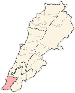
 Rechknanay Location within Lebanon | |
| Coordinates: 33°11′23″N 35°19′22″E / 33.18972°N 35.32278°ECoordinates: 33°11′23″N 35°19′22″E / 33.18972°N 35.32278°E | |
| Grid position | 180/288 PAL |
| Country |
|
| Governorate | South Lebanon Governorate |
| District | Tyre District |
| Time zone | EET (UTC+2) |
| • Summer (DST) | EEST (UTC+3) |
| Dialing code | +9617 |
Rechknanay (Arabic: رشكنانيه) is a village in Southern Lebanon, located in Tyre District, Governorate of South Lebanon.
Origin of name
E. H. Palmer wrote that the name comes from a personal name.[1]
History
In 1875, during the late Ottoman era, Victor Guérin noted it as a small village of Metualis.[2]
In 1881, the Palestine Exploration Fund's Survey of Western Palestine (SWP) described it: "A small village built of stone, containing about 100 Metawileh, on side of valley, surrounded by figs, olives, and arable land. Water is obtained from cisterns and the spring of 'Ain el Tozeh."[3] They further noted: "The rocks to the west of the village are cut into wine-presses, cisterns, etc.; probably an ancient place."[4]
References
Bibliography
- Conder, Claude Reignier; Kitchener, H. H. (1881). The Survey of Western Palestine: Memoirs of the Topography, Orography, Hydrography, and Archaeology. 1. London: Committee of the Palestine Exploration Fund.
- Guérin, Victor (1880). Description Géographique Historique et Archéologique de la Palestine (in French). 3: Galilee, pt. 2. Paris: L'Imprimerie Nationale.
- Palmer, E. H. (1881). The Survey of Western Palestine: Arabic and English Name Lists Collected During the Survey by Lieutenants Conder and Kitchener, R. E. Transliterated and Explained by E.H. Palmer. Committee of the Palestine Exploration Fund.
External links
- Recheknanay, Localiban
- Survey of Western Palestine, Map 2: IAA, Wikimedia commons
Capital: Tyre | ||
| Towns and villages |
|  |
This article is issued from Wikipedia - version of the 9/17/2016. The text is available under the Creative Commons Attribution/Share Alike but additional terms may apply for the media files.