Aitit
| Aitit عيتيت | |
|---|---|
| Village | |
 Aitit | |
| Coordinates: 33°13′32″N 35°19′56″E / 33.22556°N 35.33222°E | |
| Grid position | 178/292 PAL |
| Country |
|
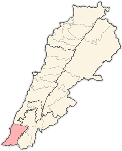
| Governorate | South Governorate |
| District | Tyre District |
| Population (2011) | |
| • Total | 12,000 |
| Time zone | GMT +3 |
Aitit[1] is a village located in South Lebanon north of Qana. All of Aitit's residents are primarily Shiite Muslim.
History
In the early 1860s Ernest Renan noted: "Its antiquities are a stone with three circles, two with rays, in which are crosses (not of great age), a grotto, and beside it a good sarcophagus lid serving to support a press. Near Aitit is a rectangular cemetery, well preserved".[2]
In 1881, the Palestine Exploration Fund's Survey of Western Palestine (SWP) described it as "A village, built of stone, containing about 450 Metawileh, situated on hill-top, surrounded by olives and arable cultivation; water supplied from cisterns and a spring near."[3]
They further noted: "There are traces at this village of ancient remains. It is said by the natives that there was once a church here. There are broken pillars scattered about, stone lintels, three caves, and three olive-presses, with cisterns."[4]
Attacks on Aitit
Due to it being close to Israel many attacks have been made against Aitit. Throughout Aitit many houses have bullet holes ingraved in the bricks and some buildings have still not been revived. Most of these incidents were due to the 2006 Lebanon War. Within that war 3 people died.
References
Bibliography
- Conder, Claude Reignier; Kitchener, H. H. (1881). The Survey of Western Palestine: Memoirs of the Topography, Orography, Hydrography, and Archaeology. 1. London: Committee of the Palestine Exploration Fund.
- Palmer, E. H. (1881). The Survey of Western Palestine: Arabic and English Name Lists Collected During the Survey by Lieutenants Conder and Kitchener, R. E. Transliterated and Explained by E.H. Palmer. Committee of the Palestine Exploration Fund.
- Renan, Ernest (1864). Mission de Phénicie (in French). Paris: Imprimerie impériale.
External links
- Survey of Western Palestine, Map 2: IAA, Wikimedia commons
- Aaytit, Localiban
Capital: Tyre | ||
| Towns and villages |
|  |