Bazouriyeh
| Bazourieh البازوريه Bazouriyeh | |
|---|---|
| Municipality | |
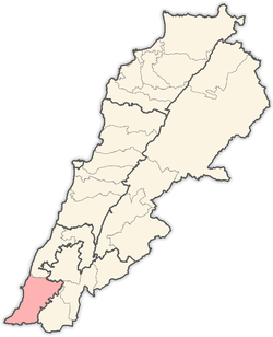
 Bazourieh Location within Lebanon | |
| Coordinates: 33°15′14″N 35°16′18″E / 33.25389°N 35.27167°ECoordinates: 33°15′14″N 35°16′18″E / 33.25389°N 35.27167°E | |
| Grid position | 175/295 PAL |
| Country |
|
| Governorate | South Lebanon Governorate |
| District | Tyre District |
| Time zone | EET (UTC+2) |
| • Summer (DST) | EEST (UTC+3) |
| Dialing code | +9617 |
Bazourieh (Arabic: البازوريه) is a municipality in Southern Lebanon, located in Tyre District, Governorate of South Lebanon.
Name
According to E. H. Palmer, the name means "producing pot-herbs".[1]
History
In 1596, it was named as a village, al-Bazuri, in the Ottoman nahiya (subdistrict) of Tibnin under the liwa' (district) of Safad, with a population of 22 households, all Muslim. The villagers paid a fixed tax rate of 25% on agricultural products, such as wheat, barley, summer crops, fruit trees, goats and beehives, in addition to occasional revenues; a total of 4,243 akçe.[2][3]
In 1881, the Palestine Exploration Fund's Survey of Western Palestine (SWP) described it: "A village built of stone, containing 300 Metawileh, situated on a ridge. One oil-press and one rock-cut cistern are the only antiquities. Water is obtained from a spring half a mile to the west."[4]
Other
Bazouriyeh is the ancestral home of Hassan Nasrallah.
References
Bibliography
- Conder, Claude Reignier; Kitchener, H. H. (1881). The Survey of Western Palestine: Memoirs of the Topography, Orography, Hydrography, and Archaeology. 1. London: Committee of the Palestine Exploration Fund.
- Hütteroth, Wolf-Dieter; Abdulfattah, Kamal (1977). Historical Geography of Palestine, Transjordan and Southern Syria in the Late 16th Century. Erlanger Geographische Arbeiten, Sonderband 5. Erlangen, Germany: Vorstand der Fränkischen Geographischen Gesellschaft. ISBN 3-920405-41-2.
- Palmer, E. H. (1881). The Survey of Western Palestine: Arabic and English Name Lists Collected During the Survey by Lieutenants Conder and Kitchener, R. E. Transliterated and Explained by E.H. Palmer. Committee of the Palestine Exploration Fund.
- Rhode, Harold (1979). Administration and Population of the Sancak of Safed in the Sixteenth Century. Columbia University.
External links
- Bazouriyeh, Localiban
- Survey of Western Palestine, Map 1: IAA, Wikimedia commons
Capital: Tyre | ||
| Towns and villages |
|  |