Weichang Manchu and Mongol Autonomous County
| Weichang County 围场县 • ᠸᡝᡳᠴᠠᠩ ᠰᡳᠶᠠᠨ • ᠸᠧᠢᠴᠠᠩ ᠰᡳᠶᠠᠨ (Chinese) • (Manchu) • (Mongolian) | |
|---|---|
| Autonomous county | |
围场满族蒙古族自治县 ᠸᡝᡳᠴᠠᠩ ᠮᠠᠨᠵᡠ ᠮᠣᠩᡤᠣ ᠪᡝᠶᡝ ᡩᠠᠰᠠᠩᡤᠠ ᠰᡳᠶᠠᠨᠸᠧᠢᠴᠠᠩ ᠮᠠᠨᠵᠤ ᠮᠣᠩᠭ᠋ᠣᠯ ᠥᠪᠡᠷᠲᠡᠭᠡᠨ ᠵᠠᠰᠠᠬᠤ ᠰᠢᠶᠠᠨ Weichang Manchu and Mongol Autonomous County | |
|
Saihanba National Park within the county | |
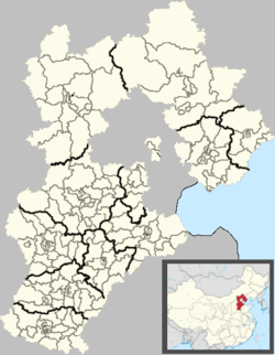 Weichang Location of the seat in Hebei | |
| Coordinates: 41°56′N 117°46′E / 41.933°N 117.767°ECoordinates: 41°56′N 117°46′E / 41.933°N 117.767°E | |
| Country | People's Republic of China |
| Province | Hebei |
| Prefecture-level city | Chengde |
| County seat | Weichang Town (围场镇) |
| Area | |
| • Total | 9,058 km2 (3,497 sq mi) |
| Elevation | 847 m (2,779 ft) |
| Population (2004) | |
| • Total | 520,000 |
| • Density | 57/km2 (150/sq mi) |
| Time zone | China Standard (UTC+8) |
| Postal code | 068400 |
| Area code(s) | 0314 |

Weichang Manchu and Mongol Autonomous County (simplified Chinese: 围场满族蒙古族自治县; traditional Chinese: 圍場滿族蒙古族自治縣; pinyin: Wéichǎng Mǎnzú Ménggǔzú Zìzhìxiàn) is a Manchu and Mongol autonomous county located in far northeastern Hebei province, China. It lies under the administration of Chengde City, and is the northernmost county of the province, bordering Inner Mongolia to the north. In terms of area, it is the largest county of Hebei, occupying an area of 9,058 km2 (3,497 sq mi), though, as it is located in mountainous terrain, it is rather sparsely populated, as of 2004, housing 520,000 people.
The area has been historically home to Manchu soldiers, and the local dialect of Mandarin is similar to that of Beijing, though there is some Northeastern influence
Geography and climate
Weichang is located in the northernmost part of Hebei, with a latitude range of 41° 35' to 42° 40' N and longitude range of 116° 32' to 118° 14' E. It borders Inner Mongolia's Chifeng to the east, Hexigten Banner to the north, as well as Duolun County to the northwest, and within the province, borders Fengning County and Longhua County to the southwest and south.
Weichang has a rather dry, monsoon-influenced humid continental climate (Köppen Dwb), with long, very cold and dry winters, and very warm, humid summers, and the elevation depresses temperatures. The 24-hour average in January is −12.5 °C (9.5 °F) and the same figure for July is 21.1 °C (70.0 °F), while the annual mean is 5.33 °C (41.6 °F). More than half of the annual precipitation occurs in July and August alone. The coldest temperature recorded in the province was −42.9 °C (−45 °F) on 12 January 1957 at Yudaokou Township (御道口乡).
| Climate data for Weichang (1971−2000) | |||||||||||||
|---|---|---|---|---|---|---|---|---|---|---|---|---|---|
| Month | Jan | Feb | Mar | Apr | May | Jun | Jul | Aug | Sep | Oct | Nov | Dec | Year |
| Record high °C (°F) | 6.8 (44.2) |
16.4 (61.5) |
21.1 (70) |
30.0 (86) |
33.4 (92.1) |
35.2 (95.4) |
39.4 (102.9) |
33.5 (92.3) |
30.2 (86.4) |
26.1 (79) |
17.7 (63.9) |
10.2 (50.4) |
39.4 (102.9) |
| Average high °C (°F) | −5.8 (21.6) |
−1.8 (28.8) |
5.0 (41) |
14.6 (58.3) |
21.3 (70.3) |
25.2 (77.4) |
26.9 (80.4) |
25.5 (77.9) |
20.5 (68.9) |
13.6 (56.5) |
3.5 (38.3) |
−3.7 (25.3) |
12.1 (53.8) |
| Daily mean °C (°F) | −12.5 (9.5) |
−8.9 (16) |
−1.8 (28.8) |
7.3 (45.1) |
14.2 (57.6) |
18.7 (65.7) |
21.1 (70) |
19.3 (66.7) |
13.4 (56.1) |
6.3 (43.3) |
−3.0 (26.6) |
−10.1 (13.8) |
5.3 (41.5) |
| Average low °C (°F) | −17.7 (0.1) |
−14.7 (5.5) |
−7.9 (17.8) |
0.6 (33.1) |
7.1 (44.8) |
12.4 (54.3) |
16.0 (60.8) |
14.1 (57.4) |
7.5 (45.5) |
0.6 (33.1) |
−8 (18) |
−15 (5) |
−0.4 (31.3) |
| Record low °C (°F) | −27.7 (−17.9) |
−26.7 (−16.1) |
−26.6 (−15.9) |
−11.2 (11.8) |
−2.4 (27.7) |
4.4 (39.9) |
8.8 (47.8) |
0.6 (33.1) |
−2.9 (26.8) |
−13.0 (8.6) |
−22.0 (−7.6) |
−26.1 (−15) |
−27.7 (−17.9) |
| Average precipitation mm (inches) | 1.9 (0.075) |
3.0 (0.118) |
7.6 (0.299) |
16.2 (0.638) |
39.2 (1.543) |
68.3 (2.689) |
135.4 (5.331) |
100.3 (3.949) |
44.8 (1.764) |
20.6 (0.811) |
5.3 (0.209) |
2.0 (0.079) |
444.6 (17.505) |
| Average precipitation days (≥ 0.1 mm) | 2.0 | 2.8 | 4.2 | 5.4 | 8.3 | 12.9 | 15.7 | 13.0 | 9.6 | 5.4 | 3.2 | 1.8 | 84.3 |
| Source: Weather China | |||||||||||||
Administrative divisions
There are 7 towns and 30 townships in the county.[1]
Towns:
- Weichang (围场镇)
- Siheyong (四合永镇)
- Kelegou (克勒沟镇)
- Qipanshan (棋盘山镇)
- Banjieta (半截塔镇)
- Chaoyangdi (朝阳地镇)
- Chaoyangwan (朝阳湾镇)
Townships:
|
|
|
References
- ↑ 2011年统计用区划代码和城乡划分代码:围场满族蒙古族自治县 (in Chinese). National Bureau of Statistics of the People's Republic of China. Retrieved 2012-07-19.
External links
| Counties |
|    | ||||||||||
|---|---|---|---|---|---|---|---|---|---|---|---|---|
Ethnic minority autonomous areas: Dong · Hui · Korean · Manchu · Miao · Mongol · Tibetan · Tujia · Uyghur · Yao · Yi · Zhuang · Other | ||||||||||||
| Regions |  | ||||||||||||||
|---|---|---|---|---|---|---|---|---|---|---|---|---|---|---|---|
| Prefectures and counties |
| ||||||||||||||
Ethnic minority autonomous areas: Dong · Hui · Korean · Manchu · Miao · Mongol · Tibetan · Tujia · Uyghur · Yao · Yi · Zhuang · Other | |||||||||||||||