Funing District
| Funing 抚宁区 | |
|---|---|
| District | |
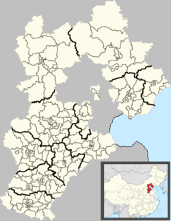 Funing Location in Hebei | |
| Coordinates: 39°53′N 119°15′E / 39.883°N 119.250°ECoordinates: 39°53′N 119°15′E / 39.883°N 119.250°E | |
| Country | People's Republic of China |
| Province | Hebei |
| Prefecture-level city | Qinhuangdao |
| County seat | Licheng Subdistrict (骊城街道) |
| Area | |
| • Total | 1,618 km2 (625 sq mi) |
| Elevation | 21 m (69 ft) |
| Population (2001) | |
| • Total | 510,000 |
| • Density | 320/km2 (820/sq mi) |
| Time zone | China Standard (UTC+8) |
| Postal code | 066300 |
| Area code(s) | 0335 |
| Website |
chinafuning |
Funing County (simplified Chinese: 抚宁区; traditional Chinese: 撫寧區; pinyin: Fǔníng Qū) is a district of northeastern Hebei Province, China, located about 30 km (19 mi) to the west of Qinhuangdao, which administers it. As of 2001, it had a population of 510,000 residing in an area of 1,646 km2 (636 sq mi).
Administrative divisions
The district administers 2 subdistricts, 5 towns and 2 townships.[1]
Subdistricts:
- Licheng Subdistrict (骊城街道), Nandaihe Subdistrict (南戴河街道)
Towns:
- Funing (抚宁镇), Liushouying (留守营镇), Yuguan (榆关镇), Taiying (台营镇), Daxinzhai (大新寨镇)
Townships:
- Chapeng Township (茶棚乡), Shenhe Township (深河乡)
Transport
- China National Highway 102
- China National Highway 205
- Beijing–Harbin Railway
- Beijing–Qinhuangdao Railway
- Datong–Qinhuangdao Railway
- G1 Beijing–Harbin Expressway
References
- ↑ 2011年统计用区划代码和城乡划分代码:抚宁县 (in Chinese). National Bureau of Statistics of the People's Republic of China. Retrieved 2012-07-20.
External links
This article is issued from Wikipedia - version of the 8/28/2015. The text is available under the Creative Commons Attribution/Share Alike but additional terms may apply for the media files.