Wardsboro, Vermont
| Wardsboro, Vermont | |
|---|---|
| Town | |
|
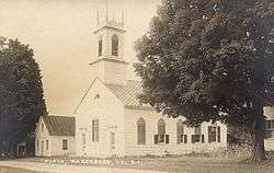
Old Methodist Church, built 1832 | |
 Wardsboro, Vermont | |
 Wardsboro, Vermont Location in the United States | |
| Coordinates: 43°2′7″N 72°48′46″W / 43.03528°N 72.81278°WCoordinates: 43°2′7″N 72°48′46″W / 43.03528°N 72.81278°W | |
| Country | United States |
| State | Vermont |
| County | Windham |
| Chartered | 1780 |
| Area | |
| • Total | 29.3 sq mi (75.8 km2) |
| • Land | 29.3 sq mi (75.8 km2) |
| • Water | 0.0 sq mi (0.0 km2) |
| Elevation | 1,391 ft (424 m) |
| Population (2010) | |
| • Total | 900 |
| • Density | 30.7/sq mi (11.9/km2) |
| Time zone | Eastern (EST) (UTC-5) |
| • Summer (DST) | EDT (UTC-4) |
| ZIP code | 05355 |
| Area code(s) | 802 |
| FIPS code | 50-76225[1] |
| GNIS feature ID | 1462241[2] |
Wardsboro is a town in Windham County, Vermont, United States. The population was 900 at the 2010 census. The town includes the villages of Wardsboro Center, West Wardsboro and South Wardsboro.
History

The town was settled circa 1779 by Samuel Davis and his wife from Milford, Massachusetts.[3] It was granted and chartered on November 7, 1780 to William Ward of Newfane, for whom the town was named Wardsborough, together with 62 others. In 1788, it was divided into north and south districts, the latter set off and incorporated in 1810 as Dover. Although the terrain is very uneven and in parts rocky, farmers worked the soil into productivity.[4]
Mills were built along the brook, a tributary of the West River. In 1859, industries included three gristmills, six sawmills, one tannery, and a rawhide whip factory.[5] During the Civil War, Wardsborough Center was called Unionville because of its strong Federal sentiment. In the 1880s, Jebediah Estabrook's tub, bucket and pail factory at Wardsborough Center was the area's principal employer.[6] In 1894, the U.S. Post Office dropped the "ugh" from town names ending in "borough," so Wardsborough was thereafter known as Wardsboro.
Wardsboro was one of thirteen Vermont towns isolated by flooding caused by Hurricane Irene in 2011, and it was the last of those towns to be released from its isolation.[7]
In April 2016, the Vermont State Legislature voted to make the Gilfeather Turnip the Official Vermont State Vegetable. This unusual hybrid, dating back to the early 1900s, is credited to Farmer John Gilfeather of the Gilfeather Farm in Wardsboro.
Community Events
The two largest community events annually are the 4th of July Street Fair and Parade, always held on the 4th of July regardless of what day of the week the holiday falls on, and the Gilfeather Turnip Festival at the end of October.
Geography
According to the United States Census Bureau, the town has a total area of 29.3 square miles (75.8 km2), all of it land. It is drained by Wardsboro Brook, a tributary of the West River.
Set in the Green Mountains, much of Wardsboro is included in the Green Mountain National Forest. The town is approximately six miles north of Mount Snow ski area and less than 10 miles south of Stratton ski area. There are numerous planned communities such as Snow Mountain Farms. Somerset Reservoir and Grout Pond are only a few minutes away, and the Vermont Association of Snow Travelers Snowmobile trails run through the town.
Wardsboro is crossed by Vermont Route 100.
Demographics
| Historical population | |||
|---|---|---|---|
| Census | Pop. | %± | |
| 1790 | 753 | — | |
| 1800 | 1,484 | 97.1% | |
| 1810 | 1,159 | −21.9% | |
| 1820 | 1,016 | −12.3% | |
| 1830 | 1,148 | 13.0% | |
| 1840 | 1,102 | −4.0% | |
| 1850 | 1,125 | 2.1% | |
| 1860 | 1,004 | −10.8% | |
| 1870 | 866 | −13.7% | |
| 1880 | 766 | −11.5% | |
| 1890 | 704 | −8.1% | |
| 1900 | 637 | −9.5% | |
| 1910 | 559 | −12.2% | |
| 1920 | 380 | −32.0% | |
| 1930 | 355 | −6.6% | |
| 1940 | 401 | 13.0% | |
| 1950 | 377 | −6.0% | |
| 1960 | 322 | −14.6% | |
| 1970 | 391 | 21.4% | |
| 1980 | 505 | 29.2% | |
| 1990 | 654 | 29.5% | |
| 2000 | 854 | 30.6% | |
| 2010 | 900 | 5.4% | |
| Est. 2014 | 886 | [8] | −1.6% |
| U.S. Decennial Census[9] | |||
As of the census of 2010,[10] there were 900 people, 374 households, and 242 families residing in the town. The population density was 30.7 people per square mile (11.8/km2). The racial makeup of the town was 97.5% White (97% Non-Hispanic White), 1.2% African American, .1% Hawaiian and 1.1% from two or more races. Hispanic or Latino of any race were .5% of the population.
As of the census[1] of 2000, there were 854 people, 358 households, and 234 families residing in the town. The population density was 29.2 people per square mile (11.3/km2). There were 766 housing units at an average density of 26.2 per square mile (10.1/km2). The racial makeup of the town was 98.48% White, 0.35% African American, 0.47% Native American, 0.12% Asian, and 0.59% from two or more races. Hispanic or Latino of any race were 0.59% of the population.
There were 358 households out of which 28.8% had children under the age of 18 living with them, 54.5% were married couples living together, 6.4% had a female householder with no husband present, and 34.4% were non-families. 27.1% of all households were made up of individuals and 9.2% had someone living alone who was 65 years of age or older. The average household size was 2.39 and the average family size was 2.91.
In the town the population was spread out with 23.7% under the age of 18, 6.6% from 18 to 24, 28.5% from 25 to 44, 30.1% from 45 to 64, and 11.2% who were 65 years of age or older. The median age was 41 years. For every 100 females there were 109.3 males. For every 100 females age 18 and over, there were 107.0 males.
The median income for a household in the town was $35,000, and the median income for a family was $43,333. Males had a median income of $28,083 versus $22,656 for females. The per capita income for the town was $17,165. About 4.1% of families and 7.6% of the population were below the poverty line, including 6.2% of those under age 18 and 16.2% of those age 65 or over.
Notable people
- Augustus F. Allen, US congressman from New York
- Herbert G. Barber, Vermont Attorney General[11]
- George Burton Drake, minister
- Clarke C. Fitts, Vermont Attorney General
- Abner Hazeltine, US congressman
- Marshall Otis Howe, Vermont state legislator
- Miles Justice Knowlton, clergyman and missionary
Climate
This climatic region is typified by large seasonal temperature differences, with warm to hot (and often humid) summers and cold (sometimes severely cold) winters. According to the Köppen Climate Classification system, Wardsboro has a humid continental climate, abbreviated "Dfb" on climate maps.[12]
References
- 1 2 "American FactFinder". United States Census Bureau. Retrieved 2008-01-31.
- ↑ "US Board on Geographic Names". United States Geological Survey. 2007-10-25. Retrieved 2008-01-31.
- ↑ John P. Warren, MD, Vermont Historical Gazetteer -- Wardsboro; Brandon, Vermont 1891
- ↑ Hayward's New England Gazetteer of 1839
- ↑ Austin J. Coolidge & John B. Mansfield, A History and Description of New England; Boston, Massachusetts 1859
- ↑ Virtual Vermont -- Wardsboro, Vermont
- ↑ Floodwaters From Storm Isolate 13 Vermont Towns, The New York Times
- ↑ "Annual Estimates of the Resident Population for Incorporated Places: April 1, 2010 to July 1, 2014". Retrieved June 4, 2015.
- ↑ "U.S. Decennial Census". United States Census Bureau. Retrieved May 16, 2015.
- ↑ "American Fact Finder".
- ↑ Fifield, James Clark (1918). The American Bar: Contemporary Lawyers of the United States and Canada. Minneapolis, MN: James C. Fifield Company. p. 670.
- ↑ Climate Summary for Wardsboro, Vermont
External links
- unofficial town website
- Wardsboro Public Library
- Friends of the Wardsboro Public Library
- Wardsboro Street Fair & Fourth of July Parade
- Wardsboro Elementary School
- Pathfinders Snowmobile Club
Municipalities and communities of Windham County, Vermont, United States | ||
|---|---|---|
| Towns | 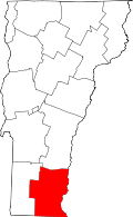 | |
| Villages | ||
| CDPs | ||
| Other communities | ||
| Footnotes | ‡ Disincorporated | |