Windham, Vermont
| Windham, Vermont | |
|---|---|
| Town | |
|
Church in Windham | |
 Windham, Vermont | |
 Windham, Vermont Location in the United States | |
| Coordinates: 43°10′25″N 72°43′26″W / 43.17361°N 72.72389°WCoordinates: 43°10′25″N 72°43′26″W / 43.17361°N 72.72389°W | |
| Country | United States |
| State | Vermont |
| County | Windham |
| Area | |
| • Total | 26.1 sq mi (67.6 km2) |
| • Land | 26.1 sq mi (67.5 km2) |
| • Water | 0.0 sq mi (0.1 km2) |
| Elevation | 1,759 ft (536 m) |
| Population (2000) | |
| • Total | 328 |
| • Density | 12.6/sq mi (4.9/km2) |
| Time zone | Eastern (EST) (UTC-5) |
| • Summer (DST) | EDT (UTC-4) |
| ZIP code | 05359 |
| Area code(s) | 802 |
| FIPS code | 50-84850[1] |
| GNIS feature ID | 1462265[2] |

Windham is a town in Windham County, Vermont, United States. The population was 328 at the 2000 census. The town center village is designated as the Windham Village Historic District.
History
Windham was part of Londonderry until after 1792 and was "duly organized" in 1796. The first settler of what was to become the village was Benjamin Pierce circa 1783. Pierce was from Westmoreland, New Hampshire.[3]
Being such a small and dispersed mountain village, relatively few men from Windham served with the Union Army during the Civil War. Windham County itself contributed heavily to manning the 4th Vermont Infantry and most of the village's sons joined either Company C or K of that regiment. The 4th regiment saw heavy combat throughout the war.[4] One of Windham's soldiers, Captain Charles G. Gould of Company H, 5th Vermont Infantry, won the Medal of Honor for bravery under fire.
Geography
According to the United States Census Bureau, the town has a total area of 26.1 square miles (67.7 km2), of which 26.1 square miles (67.5 km2) is land and 0.04 square mile (0.1 km2) (0.15%) is water.
Demographics
| Historical population | |||
|---|---|---|---|
| Census | Pop. | %± | |
| 1800 | 429 | — | |
| 1810 | 782 | 82.3% | |
| 1820 | 931 | 19.1% | |
| 1830 | 847 | −9.0% | |
| 1840 | 757 | −10.6% | |
| 1850 | 763 | 0.8% | |
| 1860 | 680 | −10.9% | |
| 1870 | 544 | −20.0% | |
| 1880 | 536 | −1.5% | |
| 1890 | 379 | −29.3% | |
| 1900 | 356 | −6.1% | |
| 1910 | 345 | −3.1% | |
| 1920 | 261 | −24.3% | |
| 1930 | 254 | −2.7% | |
| 1940 | 183 | −28.0% | |
| 1950 | 146 | −20.2% | |
| 1960 | 135 | −7.5% | |
| 1970 | 174 | 28.9% | |
| 1980 | 223 | 28.2% | |
| 1990 | 251 | 12.6% | |
| 2000 | 328 | 30.7% | |
| 2010 | 419 | 27.7% | |
| Est. 2014 | 416 | [5] | −0.7% |
| U.S. Decennial Census[6] | |||
As of the census[1] of 2000, there were 328 people, 150 households, and 91 families residing in the town. The population density was 12.6 people per square mile (4.9/km2). There were 354 housing units at an average density of 13.6 per square mile (5.2/km2). The racial makeup of the town was 96.04% White, 0.30% African American, 0.30% Asian, 0.91% from other races, and 2.44% from two or more races. Hispanic or Latino of any race were 1.22% of the population.
There were 150 households out of which 21.3% had children under the age of 18 living with them, 52.0% were married couples living together, 3.3% had a female householder with no husband present, and 39.3% were non-families. 33.3% of all households were made up of individuals and 12.0% had someone living alone who was 65 years of age or older. The average household size was 2.19 and the average family size was 2.76.
In the town the population was spread out with 19.2% under the age of 18, 8.5% from 18 to 24, 25.3% from 25 to 44, 24.7% from 45 to 64, and 22.3% who were 65 years of age or older. The median age was 43 years. For every 100 females there were 115.8 males. For every 100 females age 18 and over, there were 117.2 males.
The median income for a household in the town was $39,659, and the median income for a family was $41,786. Males had a median income of $27,500 versus $23,125 for females. The per capita income for the town was $20,704. About 2.2% of families and 6.3% of the population were below the poverty line, including 8.7% of those under age 18 and 4.9% of those age 65 or over.
References
- 1 2 "American FactFinder". United States Census Bureau. Retrieved 2008-01-31.
- ↑ "US Board on Geographic Names". United States Geological Survey. 2007-10-25. Retrieved 2008-01-31.
- ↑ Child, Hamilton, Gazetteer and Business Directory of Windham county, Vt., 1724-1884, Syracuse: The Journal Office, 1884, 304.
- ↑ Vermont in the Civil War
- ↑ "Annual Estimates of the Resident Population for Incorporated Places: April 1, 2010 to July 1, 2014". Retrieved June 4, 2015.
- ↑ "U.S. Decennial Census". United States Census Bureau. Retrieved May 16, 2015.
External links
Municipalities and communities of Windham County, Vermont, United States | ||
|---|---|---|
| Towns | 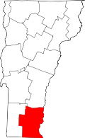 | |
| Villages | ||
| CDPs | ||
| Other communities | ||
| Footnotes | ‡ Disincorporated | |