Brookline, Vermont
| Brookline, Vermont | |
|---|---|
| Town | |
|
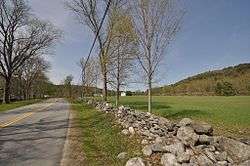
View of the Grassy Brook valley in Brookline | |
 Brookline, Vermont | |
 Brookline, Vermont Location in the United States | |
| Coordinates: 43°1′26″N 72°36′19″W / 43.02389°N 72.60528°WCoordinates: 43°1′26″N 72°36′19″W / 43.02389°N 72.60528°W | |
| Country | United States |
| State | Vermont |
| County | Windham |
| Settled | 1777 |
| Incorporated | 1794 |
| Area | |
| • Total | 12.9 sq mi (33.4 km2) |
| • Land | 12.9 sq mi (33.4 km2) |
| • Water | 0.0 sq mi (0.0 km2) |
| Elevation | 525 ft (160 m) |
| Population (2000) | |
| • Total | 467 |
| • Density | 36.2/sq mi (14.0/km2) |
| Time zone | Eastern (EST) (UTC-5) |
| • Summer (DST) | EDT (UTC-4) |
| ZIP code | 05345 |
| Area code(s) | 802 Exchange: 365 |
| FIPS code | 50-09475[1] |
| GNIS feature ID | 1462055[2] |
| Website | brooklinevt.com |
Brookline is a town in Windham County, Vermont, United States. The population was 467 at the 2000 census.
Geography
According to the United States Census Bureau, the town has a total area of 12.9 square miles (33.4 km2), all land. The West River flows along the southwestern boundary of the town.[3]
Demographics
| Historical population | |||
|---|---|---|---|
| Census | Pop. | %± | |
| 1800 | 472 | — | |
| 1810 | 431 | −8.7% | |
| 1820 | 391 | −9.3% | |
| 1830 | 376 | −3.8% | |
| 1840 | 328 | −12.8% | |
| 1850 | 285 | −13.1% | |
| 1860 | 243 | −14.7% | |
| 1870 | 203 | −16.5% | |
| 1880 | 205 | 1.0% | |
| 1890 | 162 | −21.0% | |
| 1900 | 171 | 5.6% | |
| 1910 | 137 | −19.9% | |
| 1920 | 105 | −23.4% | |
| 1930 | 101 | −3.8% | |
| 1940 | 104 | 3.0% | |
| 1950 | 132 | 26.9% | |
| 1960 | 127 | −3.8% | |
| 1970 | 180 | 41.7% | |
| 1980 | 310 | 72.2% | |
| 1990 | 403 | 30.0% | |
| 2000 | 467 | 15.9% | |
| 2010 | 530 | 13.5% | |
| Est. 2014 | 524 | [4] | −1.1% |
| U.S. Decennial Census[5] | |||
As of the census[1] of 2000, there were 467 people and 124 families residing in the town. The population density was 36.2 people per square mile (14.0/km2). There were 274 housing units at an average density of 21.2 per square mile (8.2/km2). The racial makeup of the town was 99.36% White, 0.21% Native American, 0.43% from other races. Hispanic or Latino of any race were 0.64% of the population.
There were 186 households out of which 34.4% had children under the age of 18 living with them, 59.1% were married couples living together, 4.8% had a female householder with no husband present, and 32.8% were non-families. 23.1% of all households were made up of individuals and 9.1% had someone living alone who was 65 years of age or older. The average household size was 2.51 and the average family size was 3.00.
27.2% of the population were under the age of 18, 4.5% were 18 to 24, 29.8% were 25 to 44, 27.8% were 45 to 64, and 10.7% were 65 years of age or older. The median age was 39 years. For every 100 females there were 97.9 males. For every 100 females age 18 and over, there were 93.2 males.
The median income for a household in the town was $39,125, and the median income for a family was $44,375. Males had a median income of $31,094 versus $20,893 for females. The per capita income for the town was $18,082. About 5.0% of families and 8.5% of the population were below the poverty line, including 10.6% of those under age 18 and 11.7% of those age 65 or over.
References
- 1 2 "American FactFinder". United States Census Bureau. Archived from the original on 2013-09-11. Retrieved 2008-01-31.
- ↑ "US Board on Geographic Names". United States Geological Survey. 2007-10-25. Retrieved 2008-01-31.
- ↑ DeLorme (1996). Vermont Atlas & Gazetteer. Yarmouth, Maine: DeLorme. ISBN 0-89933-016-9
- ↑ "Annual Estimates of the Resident Population for Incorporated Places: April 1, 2010 to July 1, 2014". Retrieved June 4, 2015.
- ↑ "U.S. Decennial Census". United States Census Bureau. Archived from the original on May 11, 2015. Retrieved May 16, 2015.
Municipalities and communities of Windham County, Vermont, United States | ||
|---|---|---|
| Towns | 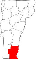 | |
| Villages | ||
| CDPs | ||
| Other communities | ||
| Footnotes | ‡ Disincorporated | |