Wallpack Center, New Jersey
| Wallpack Center, New Jersey | |
|---|---|
| Unincorporated community | |
|
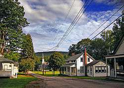
Downtown Wallpack Center | |
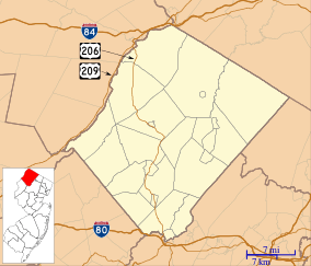 Wallpack Center, New Jersey  Wallpack Center, New Jersey  Wallpack Center, New Jersey Wallpack Center's location in Sussex County (Inset: Sussex County in New Jersey) | |
| Coordinates: 41°09′32″N 74°52′49″W / 41.15889°N 74.88028°WCoordinates: 41°09′32″N 74°52′49″W / 41.15889°N 74.88028°W | |
| Country |
|
| State |
|
| County | Sussex |
| Township | Walpack |
| Elevation | 138 m (453 ft) |
| Time zone | Eastern (EST) (UTC-5) |
| • Summer (DST) | EDT (UTC-4) |
| ZIP code | 07881 |
| Area code(s) | 908 |
| GNIS feature ID | 881503[1] |
| Designated | July 17, 1980 |
| Reference no. | 80000354[2] |
Wallpack Center (also known as Walpack Center) is an unincorporated community located within Walpack Township, Sussex County, New Jersey, United States.[3] Wallpack Center is located in the Flat Brook Valley 6.7 miles (10.8 km) west of Branchville. Wallpack Center has a post office with ZIP code 07881.[4][5]
Wallpack Center was established as a farming community in the mid-1800s. The community, which is located in a rural area, functioned as a service center for the surrounding farms. Due to its isolated location, the community only served farmers within its valley, which could not easily go to other communities for services. In the 1900s, the community declined as larger settlements were able to serve the farms in the region.[6]
The community presently includes the post office, a church, a former school used for storage, and six houses. These buildings were added to the National Register of Historic Places as the Wallpack Center Historic District.[6]
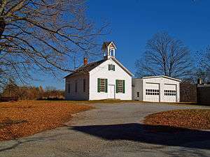 One room schoolhouse
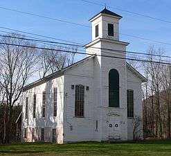 Methodist Church
References
| Wikimedia Commons has media related to Wallpack Center Historic District. |
- ↑ "Wallpack Center". Geographic Names Information System. United States Geological Survey.
- ↑ National Park Service (2010-07-09). "National Register Information System". National Register of Historic Places. National Park Service.
- ↑ Locality Search, State of New Jersey. Accessed June 9, 2016.
- ↑ United States Postal Service (2012). "USPS - Look Up a ZIP Code". Retrieved 2012-02-15.
- ↑ "Postmaster Finder - Post Offices by ZIP Code". United States Postal Service. Retrieved July 25, 2013.
- 1 2 Bodle, Wayne K. (April 22, 1977). "National Register of Historic Places Inventory - Nomination Form: Wallpack Center Historic District" (PDF). National Park Service. Retrieved July 25, 2013. Accompanied by photos.
Municipalities and communities of Sussex County, New Jersey, United States | ||
|---|---|---|
| Boroughs | 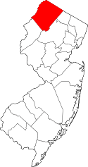 | |
| Town | ||
| Townships | ||
| CDPs | ||
| Other unincorporated communities | ||