Augusta, New Jersey
| Augusta, New Jersey | |
|---|---|
| Unincorporated community | |
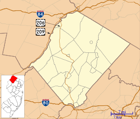 Augusta, New Jersey  Augusta, New Jersey  Augusta, New Jersey Location within Sussex County. Inset: Location of Sussex County within New Jersey | |
| Coordinates: 41°07′44″N 74°43′42″W / 41.12889°N 74.72833°WCoordinates: 41°07′44″N 74°43′42″W / 41.12889°N 74.72833°W | |
| Country |
|
| State |
|
| County | Sussex |
| Township | Frankford |
| Elevation | 495 ft (151 m) |
| Population (2010 Census)[1] | |
| • Total | 887 |
| ZIP code | 07822[2][3] |
| GNIS feature ID | 0874424[4] |
Augusta is an unincorporated community located within Frankford Township, in Sussex County, New Jersey, United States.[5] As of the 2010 United States Census, the population for the ZIP Code Tabulation Area 07822 was 887.[1]
Augusta is the home of the New Jersey State Fair and the Sussex County Farm and Horse Show.
Skylands Park, a 4,300-seat ballpark, was home to the New Jersey Cardinals of the New York–Penn League from 1993 to 2005, and the Sussex Skyhawks of the Can-Am League from 2006 to 2010. The stadium will be the home of the Sussex County Miners of the Can-Am League, which will debut in the 2015 season.[6]
Geography
Augusta is located at 41°8'42" North, 74°41'5" West (41.145086, -74.684753).[7]
Augusta lies in the Kittatinny Valley which is part of the Great Appalachian Valley. The Kittatinny Mountains are to the west and the New Jersey Highlands are to the east.
Geology
Augusta lies on top of the Ordovician Martinsburg Formation, created around 450 million B. C. when a volcanic chain of islands collided with the proto North American plate. The islands rode over top of the North American plate creating the valley. The valley was under a shallow sea until geologic pressure forced the shale upwards.
The Wisconsin Glacier covered the valley from 21,000 B.C. to 13,000 B.C. Augusta was covered in three hundred meters of ice. When the ice slowly melted this created the Paulinskill River as well as Papakatkin Creek.
The Paulinskill River, which starts in Newton and flows westerly through Augusta from Lafayette, drains into the Delaware River to the southwest. The Paulinskill is one of the premier fishing streams in the state of New Jersey. Each year, thousands of trout are stocked in the Paulinskill River from the New Jersey Division of Fish and Wildlife.
Papakatkin Creek drains into the Wallkill River to the north. The drainage divide is just north of Route 206 in Augusta. A chain of hills leads Papakatkin Creek to travel east and then north into the Wallkill River.
References
- 1 2 DP-1 – Profile of General Population and Housing Characteristics: 2010 from 2010 Demographic Profile Data for ZCTA5 07822, United States Census Bureau. Accessed August 27, 2013.
- ↑ Look Up a ZIP Code for Augusta, NJ, United States Postal Service. Accessed August 27, 2013.
- ↑ Zip Codes, State of New Jersey. Accessed August 27, 2013.
- ↑ "Augusta". Geographic Names Information System. United States Geological Survey. Retrieved 2012-09-21.
- ↑ Locality Search, State of New Jersey. Accessed June 9, 2016.
- ↑ Westhoven, William. "Miners to fill major baseball void in Sussex", Daily Record (Morristown), December 10, 2014. Accessed December 24, 2014. "The new owners of Skylands Stadium in Augusta announced Wednesday that they have established a new minor-league team — appropriately dubbed the Sussex County Miners — that will begin play in the independent Can-Am Association of Professional Baseball."
- ↑ US Gazetteer files: 2010, 2000, and 1990, United States Census Bureau. Accessed September 4, 2014.
External links
Municipalities and communities of Sussex County, New Jersey, United States | ||
|---|---|---|
| Boroughs | 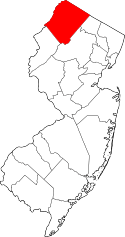 | |
| Town | ||
| Townships | ||
| CDPs | ||
| Other unincorporated communities | ||