Van Buren, Maine
| Van Buren, Maine | ||
|---|---|---|
| Town | ||
|
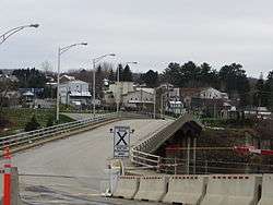
Van Buren's view from the Canada–US border | ||
| ||
| Nickname(s): Gateway to the St. John Valley | ||
|
Motto: In Hoc Signo Vinces (Latin) "With this as your standard you shall have victory" | ||
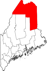
 Van Buren, Maine Location within the state of Maine | ||
| Coordinates: 47°09′53″N 67°56′27″W / 47.16472°N 67.94083°W | ||
| Country | United States | |
| State | Maine | |
| County | Aroostook | |
| Incorporated (town) | March 1881 | |
| Area[1] | ||
| • Total | 34.86 sq mi (90.29 km2) | |
| • Land | 33.78 sq mi (87.49 km2) | |
| • Water | 1.08 sq mi (2.80 km2) | |
| Population (2010)[2] | ||
| • Total | 2,171 | |
| • Estimate (2012[3]) | 2,135 | |
| • Density | 64.3/sq mi (24.8/km2) | |
| Time zone | Eastern (EST) (UTC-5) | |
| • Summer (DST) | EDT (UTC-4) | |
| ZIP code | 04785 | |
| Area code(s) | 207 | |

Van Buren is a town on the Saint John River in Aroostook County, Maine, United States; located across from Saint-Leonard, New Brunswick, Canada. The population was 2,171 at the 2010 census. It is named after U.S. President Martin Van Buren.[4]
Geography
According to the United States Census Bureau, the town has a total area of 34.86 square miles (90.29 km2), of which 33.78 square miles (87.49 km2) is land and 1.08 square miles (2.80 km2) is water.[1]
Van Buren is connected to Saint Leonard, New Brunswick via the Saint Leonard-Van Buren Bridge.
Climate
This climatic region is typified by large seasonal temperature differences, with warm to hot (and often humid) summers and cold (sometimes severely cold) winters. According to the Köppen Climate Classification system, Van Buren has a humid continental climate, abbreviated "Dfb" on climate maps.[5]
| Climate data for Van Buren (1981-2010 normals, extremes 1963-present) | |||||||||||||
|---|---|---|---|---|---|---|---|---|---|---|---|---|---|
| Month | Jan | Feb | Mar | Apr | May | Jun | Jul | Aug | Sep | Oct | Nov | Dec | Year |
| Record high °F (°C) | 52 (11) |
61 (16) |
67 (19) |
85 (29) |
94 (34) |
94 (34) |
95 (35) |
94 (34) |
92 (33) |
81 (27) |
71 (22) |
59 (15) |
95 (35) |
| Average high °F (°C) | 18.8 (−7.3) |
23.4 (−4.8) |
33.5 (0.8) |
47.4 (8.6) |
62.3 (16.8) |
71.5 (21.9) |
76.0 (24.4) |
74.5 (23.6) |
65.7 (18.7) |
52.3 (11.3) |
38.8 (3.8) |
26.0 (−3.3) |
49.18 (9.54) |
| Daily mean °F (°C) | 5.8 (−14.6) |
9 (−13) |
20.8 (−6.2) |
36.8 (2.7) |
50.0 (10) |
59.4 (15.2) |
64.8 (18.2) |
62.7 (17.1) |
53.9 (12.2) |
41.8 (5.4) |
30.5 (−0.8) |
15.7 (−9.1) |
37.6 (3.09) |
| Average low °F (°C) | −7.2 (−21.8) |
−5.5 (−20.8) |
8.1 (−13.3) |
26.3 (−3.2) |
37.8 (3.2) |
47.4 (8.6) |
53.6 (12) |
50.9 (10.5) |
42.1 (5.6) |
31.4 (−0.3) |
22.3 (−5.4) |
5.3 (−14.8) |
26.04 (−3.31) |
| Record low °F (°C) | −47 (−44) |
−44 (−42) |
−37 (−38) |
−19 (−28) |
18 (−8) |
22 (−6) |
30 (−1) |
26 (−3) |
19 (−7) |
2 (−17) |
−16 (−27) |
−35 (−37) |
−47 (−44) |
| Average precipitation inches (mm) | 2.45 (62.2) |
2.00 (50.8) |
2.18 (55.4) |
2.74 (69.6) |
3.34 (84.8) |
3.71 (94.2) |
4.95 (125.7) |
3.77 (95.8) |
3.69 (93.7) |
3.83 (97.3) |
3.60 (91.4) |
2.99 (75.9) |
39.25 (996.8) |
| Average snowfall inches (cm) | 23.1 (58.7) |
18.3 (46.5) |
15.0 (38.1) |
4.6 (11.7) |
0 (0) |
0 (0) |
0 (0) |
0 (0) |
0 (0) |
0.6 (1.5) |
6.0 (15.2) |
18.9 (48) |
86.5 (219.7) |
| Source: NOAA [6] | |||||||||||||
Schools
Van Buren is part of the Maine School Administrative District No. 24 school system,[7] which contains Van Buren District Elementary School[8] and Van Buren District Secondary School.[9]
Demographics
| Historical population | |||
|---|---|---|---|
| Census | Pop. | %± | |
| 1850 | 1,050 | — | |
| 1860 | 616 | −41.3% | |
| 1870 | 922 | 49.7% | |
| 1880 | 1,110 | 20.4% | |
| 1890 | 1,168 | 5.2% | |
| 1900 | 1,878 | 60.8% | |
| 1910 | 3,065 | 63.2% | |
| 1920 | 4,594 | 49.9% | |
| 1930 | 4,721 | 2.8% | |
| 1940 | 5,380 | 14.0% | |
| 1950 | 5,094 | −5.3% | |
| 1960 | 4,679 | −8.1% | |
| 1970 | 3,971 | −15.1% | |
| 1980 | 3,557 | −10.4% | |
| 1990 | 3,045 | −14.4% | |
| 2000 | 2,631 | −13.6% | |
| 2010 | 2,171 | −17.5% | |
| Est. 2014 | 2,085 | [10] | −4.0% |
Van Buren is part of Francophone North America: 76.6 per cent of residents are habitual speakers of French. Links with Québec and New Brunswick are consequently strong.
2010 census
As of the census[2] of 2010, there were 2,171 people, 1,027 households, and 601 families residing in the town. The population density was 64.3 inhabitants per square mile (24.8/km2). There were 1,184 housing units at an average density of 35.1 per square mile (13.6/km2). The racial makeup of the town was 96.9% White, 0.3% African American, 0.4% Native American, 0.1% Asian, 0.3% from other races, and 2.1% from two or more races. Hispanic or Latino of any race were 0.6% of the population.
There were 1,027 households of which 20.5% had children under the age of 18 living with them, 43.1% were married couples living together, 11.2% had a female householder with no husband present, 4.2% had a male householder with no wife present, and 41.5% were non-families. 36.7% of all households were made up of individuals and 17.2% had someone living alone who was 65 years of age or older. The average household size was 2.06 and the average family size was 2.55.
The median age in the town was 51.5 years. 15.9% of residents were under the age of 18; 6% were between the ages of 18 and 24; 18.2% were from 25 to 44; 35.1% were from 45 to 64; and 24.7% were 65 years of age or older. The gender makeup of the town was 48.5% male and 51.5% female.
2000 census
As of the census[12] of 2000, there were 2,631 people, 1,095 households, and 704 families residing in the town. The population density was 77.5 people per square mile (29.9/km²). There were 1,232 housing units at an average density of 36.3 per square mile (14.0/km²). The racial makeup of the town was 98.59% White, 0.11% Black or African American, 0.30% Native American, 0.15% Asian, 0.04% from other races, and 0.80% from two or more races. Hispanic or Latino of any race were 0.72% of the population.
There were 1,095 households out of which 25.9% had children under the age of 18 living with them, 50.6% were married couples living together, 9.0% had a female householder with no husband present, and 35.7% were non-families. 31.5% of all households were made up of individuals and 14.9% had someone living alone who was 65 years of age or older. The average household size was 2.22 and the average family size was 2.73.
In the town the population was spread out with 19.8% under the age of 18, 5.3% from 18 to 24, 24.5% from 25 to 44, 28.3% from 45 to 64, and 22.1% who were 65 years of age or older. The median age was 45 years. For every 100 females there were 87.9 males. For every 100 females age 18 and over, there were 85.7 males.
The median income for a household in the town was $20,038, and the median income for a family was $29,458. Males had a median income of $27,411 versus $19,583 for females. The per capita income for the town was $12,651. About 15.2% of families and 22.1% of the population were below the poverty line, including 25.9% of those under age 18 and 14.5% of those age 65 or over.
References
- 1 2 "US Gazetteer files 2010". United States Census Bureau. Retrieved 2012-12-16.
- 1 2 "American FactFinder". United States Census Bureau. Retrieved 2012-12-16.
- ↑ "Population Estimates". United States Census Bureau. Retrieved 2013-07-06.
- ↑ Maine League of Historical Societies and Museums (1970). Doris A. Isaacson, ed. Maine: A Guide 'Down East'. Rockland, Me: Courier-Gazette, Inc. p. 296.
- ↑ Climate Summary for Van Buren, Maine
- ↑ "Van Buren, Maine 1981-2010 normals". Retrieved September 21, 2016.
- ↑ "Maine School Administrative District #24 – Van Buren, Maine". Maine School Administrative District #24. Retrieved 6 June 2012.
- ↑ "Van Buren District Elementary School". Maine School Administrative District #24. Retrieved August 30, 2013.
- ↑ "Van Buren District Secondary School". Maine School Administrative District #24. Retrieved August 30, 2013.
- ↑ "Annual Estimates of the Resident Population for Incorporated Places: April 1, 2010 to July 1, 2014". Retrieved June 4, 2015.
- ↑ "Census of Population and Housing". Census.gov. Retrieved June 4, 2015.
- ↑ "American FactFinder". United States Census Bureau. Retrieved 2008-01-31.
External links
Coordinates: 47°09′53″N 67°56′27″W / 47.16472°N 67.94083°W