Amity, Maine
| Amity, Maine | |
|---|---|
| Town | |
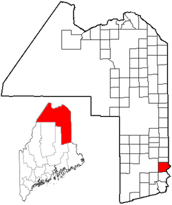 Location of Amity, Maine | |
| Coordinates: 45°55′50″N 67°50′57″W / 45.93056°N 67.84917°WCoordinates: 45°55′50″N 67°50′57″W / 45.93056°N 67.84917°W | |
| Country |
|
| State |
|
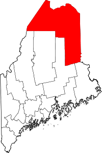
| County | Aroostook |
| Area[1] | |
| • Total | 41.72 sq mi (108.05 km2) |
| • Land | 41.72 sq mi (108.05 km2) |
| • Water | 0 sq mi (0 km2) |
| Elevation | 663 ft (202 m) |
| Population (2010)[2] | |
| • Total | 238 |
| • Estimate (2012[3]) | 235 |
| • Density | 5.7/sq mi (2.2/km2) |
| Time zone | Eastern (EST) (UTC-5) |
| • Summer (DST) | EDT (UTC-4) |
| ZIP code | 04471 |
| Area code(s) | 207 |
| FIPS code | 23-01220 |
| GNIS feature ID | 0582324 |
Amity is a town in Aroostook County, eastern Maine, United States, near the Canada–US border. The population was 238 at the 2010 census.
Geography
According to the United States Census Bureau, the town has a total area of 41.72 square miles (108.05 km2), all land.[1]
Demographics
| Historical population | |||
|---|---|---|---|
| Census | Pop. | %± | |
| 1840 | 169 | — | |
| 1850 | 256 | 51.5% | |
| 1860 | 302 | 18.0% | |
| 1870 | 311 | 3.0% | |
| 1880 | 432 | 38.9% | |
| 1890 | 420 | −2.8% | |
| 1900 | 404 | −3.8% | |
| 1910 | 375 | −7.2% | |
| 1920 | 393 | 4.8% | |
| 1930 | 324 | −17.6% | |
| 1940 | 345 | 6.5% | |
| 1950 | 300 | −13.0% | |
| 1960 | 206 | −31.3% | |
| 1970 | 156 | −24.3% | |
| 1980 | 168 | 7.7% | |
| 1990 | 186 | 10.7% | |
| 2000 | 199 | 7.0% | |
| 2010 | 238 | 19.6% | |
| Est. 2014 | 230 | [4] | −3.4% |
2010 census
As of the census[2] of 2010, there were 238 people, 102 households, and 65 families residing in the town. The population density was 5.7 inhabitants per square mile (2.2/km2). There were 162 housing units at an average density of 3.9 per square mile (1.5/km2). The racial makeup of the town was 99.2% White, 0.4% Native American, and 0.4% from two or more races.
There were 102 households of which 25.5% had children under the age of 18 living with them, 49.0% were married couples living together, 7.8% had a female householder with no husband present, 6.9% had a male householder with no wife present, and 36.3% were non-families. 27.5% of all households were made up of individuals and 7.9% had someone living alone who was 65 years of age or older. The average household size was 2.33 and the average family size was 2.71.
The median age in the town was 45.9 years. 19.3% of residents were under the age of 18; 7.7% were between the ages of 18 and 24; 20.1% were from 25 to 44; 39.6% were from 45 to 64; and 13.4% were 65 years of age or older. The gender makeup of the town was 52.5% male and 47.5% female.
2000 census
As of the census[6] of 2000, there were 199 people, 77 households, and 62 families residing in the town. The population density was 4.7 people per square mile (1.8/km²). There were 122 housing units at an average density of 2.9 per square mile (1.1/km²). The racial makeup of the town was 98.99% White, 0.50% African American, and 0.50% from two or more races.
There were 77 households out of which 32.5% had children under the age of 18 living with them, 72.7% were married couples living together, 7.8% had a female householder with no husband present, and 18.2% were non-families. 14.3% of all households were made up of individuals and 1.3% had someone living alone who was 65 years of age or older. The average household size was 2.58 and the average family size was 2.81.
In the town the population was spread out with 26.1% under the age of 18, 5.0% from 18 to 24, 27.6% from 25 to 44, 32.2% from 45 to 64, and 9.0% who were 65 years of age or older. The median age was 38 years. For every 100 females there were 99.0 males. For every 100 females age 18 and over, there were 101.4 males.
The median income for a household in the town was $26,667, and the median income for a family was $26,667. Males had a median income of $26,458 versus $16,250 for females. The per capita income for the town was $13,484. About 13.3% of families and 15.0% of the population were below the poverty line, including 27.5% of those under the age of eighteen and none of those sixty five or over.
References
- 1 2 "US Gazetteer files 2010". United States Census Bureau. Retrieved 2012-12-16.
- 1 2 "American FactFinder". United States Census Bureau. Retrieved 2012-12-16.
- ↑ "Population Estimates". United States Census Bureau. Archived from the original on 2013-06-17. Retrieved 2013-07-06.
- ↑ "Annual Estimates of the Resident Population for Incorporated Places: April 1, 2010 to July 1, 2014". Retrieved June 4, 2015.
- ↑ "Census of Population and Housing". Census.gov. Archived from the original on May 11, 2015. Retrieved June 4, 2015.
- ↑ "American FactFinder". United States Census Bureau. Archived from the original on 2013-09-11. Retrieved 2008-01-31.