Ashland, Maine
| Ashland, Maine | |
|---|---|
| Town | |
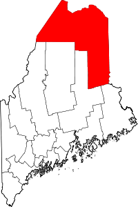
 Location of Ashland, Maine | |
| Coordinates: 46°37′40″N 68°23′23″W / 46.62778°N 68.38972°W | |
| Country |
|
| State |
|
| County | Aroostook |
| Area[1] | |
| • Total | 81.54 sq mi (211.19 km2) |
| • Land | 80.41 sq mi (208.26 km2) |
| • Water | 1.13 sq mi (2.93 km2) |
| Elevation | 722 ft (220 m) |
| Population (2010)[2] | |
| • Total | 1,302 |
| • Estimate (2012[3]) | 1,282 |
| • Density | 16.2/sq mi (6.3/km2) |
| Time zone | Eastern (EST) (UTC-5) |
| • Summer (DST) | EDT (UTC-4) |
| ZIP codes | 04732, 04737, 04759 |
| Area code(s) | 207 |
| FIPS code | 23-01710 |
| GNIS feature ID | 0582331 |
Ashland is a town in Aroostook County, Maine, United States. The population was 1309 at the 2010 census. It is the location of Maine's Great North Woods.
Geography
According to the United States Census Bureau, the town has a total area of 81.54 square miles (211.19 km2), of which 80.41 square miles (208.26 km2) is land and 1.13 square miles (2.93 km2) is water.[1] Around Ashland are the smaller towns and townships of Masardis, Oxbow Plantation, Portage, Sheridan, Nashville Plantation, and Garfield Plantation.
History
For thousands of years, Native American tribes inhabited this region.
In the 1830s William Dalton became the first Euro-American to establish residency at the site of the future town.[4][5] The community was organized as a plantation in 1840,[5] at which time there were 40 heads of household listed.[6] It was incorporated as a town in 1862, under the name of Ashland. From 1869 to 1876 the town was renamed "Dalton," but then reverted to its historic and current name.[5]
The town of Ashland was located on the nineteenth-century stage route from Patten to Fort Kent. In the nineteenth-century logging was the main industry. The lumber industry was at a peak about 1915,[5] although some continues to the present.

Demographics
| Historical population | |||
|---|---|---|---|
| Census | Pop. | %± | |
| 1860 | 606 | — | |
| 1870 | 445 | −26.6% | |
| 1880 | 505 | 13.5% | |
| 1890 | 568 | 12.5% | |
| 1900 | 1,080 | 90.1% | |
| 1910 | 2,173 | 101.2% | |
| 1920 | 2,391 | 10.0% | |
| 1930 | 2,198 | −8.1% | |
| 1940 | 2,457 | 11.8% | |
| 1950 | 2,370 | −3.5% | |
| 1960 | 1,980 | −16.5% | |
| 1970 | 1,761 | −11.1% | |
| 1980 | 1,865 | 5.9% | |
| 1990 | 1,542 | −17.3% | |
| 2000 | 1,474 | −4.4% | |
| 2010 | 1,302 | −11.7% | |
| Est. 2014 | 1,252 | [7] | −3.8% |
2010 census
As of the census[2] of 2010, there were 1,302 people, 603 households, and 355 families residing in the town. The population density was 16.2 inhabitants per square mile (6.3/km2). There were 733 housing units at an average density of 9.1 per square mile (3.5/km2). The racial makeup of the town was 98.6% White, 0.7% African American, 0.2% Native American, 0.3% Asian, and 0.2% from two or more races. Hispanic or Latino of any race were 0.6% of the population.
There were 603 households of which 23.9% had children under the age of 18 living with them, 46.4% were married couples living together, 6.6% had a female householder with no husband present, 5.8% had a male householder with no wife present, and 41.1% were non-families. 34.5% of all households were made up of individuals and 17.5% had someone living alone who was 65 years of age or older. The average household size was 2.16 and the average family size was 2.74.
The median age in the town was 45.2 years. 19.7% of residents were under the age of 18; 7% were between the ages of 18 and 24; 23.2% were from 25 to 44; 29.3% were from 45 to 64; and 20.9% were 65 years of age or older. The gender makeup of the town was 50.8% male and 49.2% female.
2000 census
As of the census[9] of 2000, there were 1,474 people, 629 households, and 398 families residing in the town. The population density was 18.3 people per square mile (7.1/km²). There were 760 housing units at an average density of 9.4 per square mile (3.6/km²). The racial makeup of the town was 98.78% White, 0.88% Native American, 0.20% Asian, and 0.14% from two or more races. Hispanic or Latino of any race were 0.07% of the population.
There were 629 households out of which 27.5% had children under the age of 18 living with them, 54.2% were married couples living together, 5.4% had a female householder with no husband present, and 36.6% were non-families. 30.0% of all households were made up of individuals and 13.2% had someone living alone who was 65 years of age or older. The average household size was 2.34 and the average family size was 2.90.
In the town the population was spread out with 23.7% under the age of 18, 6.0% from 18 to 24, 29.1% from 25 to 44, 25.6% from 45 to 64, and 15.6% who were 65 years of age or older. The median age was 40 years. For every 100 females there were 104.4 males. For every 100 females age 18 and over, there were 101.3 males.
The median income for a household in the town was $33,472, and the median income for a family was $40,185. Males had a median income of $32,768 versus $21,027 for females. The per capita income for the town was $15,328. About 6.1% of families and 9.7% of the population were below the poverty line, including 7.4% of those under age 18 and 15.2% of those age 65 or over.
Education
The town was served by Ashland Community High School for grades 7-12 and the Ashland Central School for grades K-6. In 2010 construction was completed and the new consolidated Ashland District School, next to the former high school, was opened for grades K-12. The building that housed Ashland Community High School for nearly 50 years was demolished that year to make way for new athletic fields.
References
- 1 2 "US Gazetteer files 2010". United States Census Bureau. Retrieved 2012-12-16.
- 1 2 "American FactFinder". United States Census Bureau. Retrieved 2012-12-16.
- ↑ "Population Estimates". United States Census Bureau. Archived from the original on 2013-06-17. Retrieved 2013-07-06.
- ↑ Wiggin, Edward (1922). History of Aroostook.pdf History of Aroostook, Vol. I, Comprising Facts, Names, and Dates Relating to the Early Settlement of all the Different Towns and Plantations of the County Check
|url=value (help) (PDF). Presque Isle, Maine: Star Herald Press. p. 305. - 1 2 3 4 Hellmann, Paul T. (2006). Historical Gazetteer of the United States. Routledge. pp. 445–446. ISBN 1135948593.
- ↑ "Range 5 Township 11, Aroostook, Maine". Sixth Census of the United States, 1840. Ancestry.com. Retrieved 14 May 2014.
- ↑ "Annual Estimates of the Resident Population for Incorporated Places: April 1, 2010 to July 1, 2014". Retrieved June 4, 2015.
- ↑ "Census of Population and Housing". Census.gov. Archived from the original on May 11, 2015. Retrieved June 4, 2015.
- ↑ "American FactFinder". United States Census Bureau. Archived from the original on 2013-09-11. Retrieved 2008-01-31.
External links
Coordinates: 46°37′52″N 68°24′22″W / 46.63111°N 68.40611°W