Unity, Maine
| Unity, Maine | |
|---|---|
| Town | |
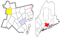
 Unity, Maine Location within the state of Maine | |
| Coordinates: 44°36′40″N 69°20′5″W / 44.61111°N 69.33472°WCoordinates: 44°36′40″N 69°20′5″W / 44.61111°N 69.33472°W | |
| Country | United States |
| State | Maine |
| County | Waldo |
| Area[1] | |
| • Total | 41.36 sq mi (107.12 km2) |
| • Land | 39.40 sq mi (102.05 km2) |
| • Water | 1.96 sq mi (5.08 km2) |
| Elevation | 220 ft (70 m) |
| Population (2010)[2] | |
| • Total | 2,099 |
| • Estimate (2012[3]) | 2,090 |
| • Density | 53.3/sq mi (20.6/km2) |
| Time zone | Eastern (EST) (UTC-5) |
| • Summer (DST) | EDT (UTC-4) |
| ZIP code | 04988 |
| Area code(s) | 207 Exchange: 948 |
| GNIS feature ID | 577560[4] |
Unity is a town in Waldo County, Maine, United States. The population was 2,099 at the 2010 census. The town is the service center for the northern portion of Waldo County. Outside of Waldo county, it is best known as the home of the Maine Organic Farmers and Gardeners Association, its Common Ground Country Fair and Unity College. Unity College was founded in 1965 to offset the economic effects of the declining chicken farming industry. As of 2007, the college is the town's largest employer.
History
When originally settled by Quakers, the town was known as Twenty-Five Mile Pond Plantation. The name came from its being located on a pond twenty-five miles from Fort Halifax in Winslow. The name was changed to Unity upon incorporation as a town in 1804. In 1898, the Village School was opened. It remained in operation until 1953 when it closed and a new elementary school was built.
In 1996, the Maine Organic Farmers and Gardeners Association (MOFGA) purchased 200 acres of land in Unity, where it is now based. The MOFGA-run Common Ground Country Fair moved with the organization and annually brings more than 50,000 visitors to the town.
During 2008–2009, eight Amish families moved into the community.[5] They belong to the "Michigan Churches", an Amish affiliation, that is more open to outsiders, than most other Amish affiliation.[6]
Geography
According to the United States Census Bureau, the town has a total area of 41.36 square miles (107.12 km2), of which, 39.40 square miles (102.05 km2) of it is land and 1.96 square miles (5.08 km2) is water.[1]
Demographics
| Historical population | |||
|---|---|---|---|
| Census | Pop. | %± | |
| 1810 | 793 | — | |
| 1820 | 978 | 23.3% | |
| 1830 | 1,299 | 32.8% | |
| 1840 | 1,457 | 12.2% | |
| 1850 | 1,557 | 6.9% | |
| 1860 | 1,320 | −15.2% | |
| 1870 | 1,201 | −9.0% | |
| 1880 | 1,095 | −8.8% | |
| 1890 | 922 | −15.8% | |
| 1900 | 877 | −4.9% | |
| 1910 | 899 | 2.5% | |
| 1920 | 916 | 1.9% | |
| 1930 | 892 | −2.6% | |
| 1940 | 935 | 4.8% | |
| 1950 | 1,014 | 8.4% | |
| 1960 | 983 | −3.1% | |
| 1970 | 1,280 | 30.2% | |
| 1980 | 1,431 | 11.8% | |
| 1990 | 1,817 | 27.0% | |
| 2000 | 1,889 | 4.0% | |
| 2010 | 2,099 | 11.1% | |
| Est. 2014 | 2,087 | [7] | −0.6% |
2010 census
As of the census[2] of 2010, there were 2,099 people, 750 households, and 429 families residing in the town. The population density was 53.3 inhabitants per square mile (20.6/km2). There were 939 housing units at an average density of 23.8 per square mile (9.2/km2). The racial makeup of the town was 96.9% White, 0.4% African American, 0.3% Native American, 0.2% Asian, 0.2% from other races, and 1.9% from two or more races. Hispanic or Latino of any race were 1.3% of the population.
There were 750 households of which 26.3% had children under the age of 18 living with them, 40.7% were married couples living together, 12.4% had a female householder with no husband present, 4.1% had a male householder with no wife present, and 42.8% were non-families. 29.3% of all households were made up of individuals and 11.4% had someone living alone who was 65 years of age or older. The average household size was 2.34 and the average family size was 2.88.
The median age in the town was 31.2 years. 17.8% of residents were under the age of 18; 26.4% were between the ages of 18 and 24; 19.1% were from 25 to 44; 24% were from 45 to 64; and 12.9% were 65 years of age or older. The gender makeup of the town was 48.8% male and 51.2% female.
2000 census
As of the census[9] of 2000, there were 1,889 people, 713 households, and 419 families residing in the town. The population density was 47.8 people per square mile (18.4/km²). There were 926 housing units at an average density of 23.4 per square mile (9.0/km²). The racial makeup of the town was 97.72% White, 0.32% Black or African American, 0.42% Native American, 0.26% Asian, 0.11% from other races, and 1.16% from two or more races. Hispanic or Latino of any race were 0.74% of the population.
There were 713 households out of which 27.5% had children under the age of 18 living with them, 44.6% were married couples living together, 10.7% had a female householder with no husband present, and 41.2% were non-families. 32.8% of all households were made up of individuals and 12.9% had someone living alone who was 65 years of age or older. The average household size was 2.27 and the average family size was 2.89.
In the town the population was spread out with 20.1% under the age of 18, 22.8% from 18 to 24, 22.6% from 25 to 44, 21.4% from 45 to 64, and 13.2% who are 65 years of age or older. The median age is 32 years. For every 100 females there were 100.7 males. For every 100 females age 18 and over, there were 103.2 males.
The median income for a household in the town was $26,927, and the median income for a family was $36,696. Males had a median income of $29,398 versus $22,708 for females. The per capita income for the town is $15,086. About 18.6% of families and 21.8% of the population were below the poverty line, including 26.3% of those under age 18 and 16.1% of those age 65 or over.
Notable people
- George Colby Chase, English scholar; second president of Bates College
References
- 1 2 "US Gazetteer files 2010". United States Census Bureau. Retrieved 2012-12-16.
- 1 2 "American FactFinder". United States Census Bureau. Retrieved 2012-12-16.
- ↑ "Population Estimates". United States Census Bureau. Archived from the original on June 17, 2013. Retrieved 2013-07-06.
- ↑ "Unity". Geographic Names Information System. United States Geological Survey. Retrieved 2009-02-09.
- ↑ Sarah Schweitzer (November 29, 2009). "Living in Unity". Boston Globe.
- ↑ "The Atypical Amish Community at Unity, Maine" at amishamerica.com
- ↑ "Annual Estimates of the Resident Population for Incorporated Places: April 1, 2010 to July 1, 2014". Retrieved June 4, 2015.
- ↑ "Census of Population and Housing". Census.gov. Archived from the original on May 11, 2015. Retrieved June 4, 2015.
- ↑ "American FactFinder". United States Census Bureau. Archived from the original on September 11, 2013. Retrieved 2008-01-31.
Further reading
- Wright, Virginia M. (May 2007). "A place called Unity". Down East: The Magazine of Maine (May 2007): 54–57, 85–87.
External links
Municipalities and communities of Waldo County, Maine, United States | ||
|---|---|---|
| City | 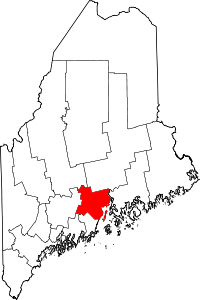 | |
| Towns | ||
| CDPs | ||
| Other villages | ||