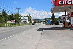
Jackman, Maine
| Jackman, Maine | |
|---|---|
| Town | |
 | |
 Jackman, Maine Location within the state of Maine | |
| Coordinates: 45°37′38″N 70°12′39″W / 45.62722°N 70.21083°W | |
| Country | United States |
| State | Maine |
| County | Somerset |
| Area[1] | |
| • Total | 42.42 sq mi (109.87 km2) |
| • Land | 41.26 sq mi (106.86 km2) |
| • Water | 1.16 sq mi (3.00 km2) |
| Elevation | 1,375 ft (419 m) |
| Population (2010)[2] | |
| • Total | 862 |
| • Estimate (2012[3]) | 859 |
| • Density | 20.9/sq mi (8.1/km2) |
| Time zone | Eastern (EST) (UTC-5) |
| • Summer (DST) | EDT (UTC-4) |
| ZIP code | 04945 |
| Area code(s) | 207 |
| FIPS code | 23-35345 |
| GNIS feature ID | 0582532 |
| Website | jackmanmaine.org |
Jackman is a town in Somerset County, Maine, United States. The population was 862 at the 2010 census.
Geography
According to the United States Census Bureau, the town has a total area of 42.42 square miles (109.87 km2), of which 41.26 square miles (106.86 km2) is land and 1.16 square miles (3.00 km2) is water.[1]
Climate
This climatic region is typified by large seasonal temperature differences, with warm to hot (and often humid) summers and cold (sometimes severely cold) winters. According to the Köppen Climate Classification system, Jackman has a humid continental climate, abbreviated "Dfb" on climate maps.[4] The town also has only a few stores that only stay open for a few hours a day. The town council is perfectly contempt with letting Jackman be far behind the rest of the United States in economic growth.
Demographics
| Historical population | |||
|---|---|---|---|
| Census | Pop. | %± | |
| 1840 | 10 | — | |
| 1850 | 12 | 20.0% | |
| 1870 | 65 | — | |
| 1880 | 95 | 46.2% | |
| 1890 | 217 | 128.4% | |
| 1900 | 352 | 62.2% | |
| 1910 | 667 | 89.5% | |
| 1920 | 902 | 35.2% | |
| 1930 | 1,099 | 21.8% | |
| 1940 | 1,069 | −2.7% | |
| 1950 | 964 | −9.8% | |
| 1960 | 984 | 2.1% | |
| 1970 | 848 | −13.8% | |
| 1980 | 1,003 | 18.3% | |
| 1990 | 920 | −8.3% | |
| 2000 | 718 | −22.0% | |
| 2010 | 862 | 20.1% | |
| Est. 2014 | 851 | [5] | −1.3% |
2010 census
As of the census[2] of 2010, there were 862 people, 383 households, and 228 families residing in the town. The population density was 20.9 inhabitants per square mile (8.1/km2). There were 726 housing units at an average density of 17.6 per square mile (6.8/km2). The racial makeup of the town was 96.4% White, 0.1% African American, 1.0% Native American, 0.6% Asian, 0.1% from other races, and 1.7% from two or more races. Hispanic or Latino of any race were 1.7% of the population.
There were 383 households of which 23.0% had children under the age of 18 living with them, 51.2% were married couples living together, 6.3% had a female householder with no husband present, 2.1% had a male householder with no wife present, and 40.5% were non-families. 32.1% of all households were made up of individuals and 12% had someone living alone who was 65 years of age or older. The average household size was 2.19 and the average family size was 2.78.
The median age in the town was 44.8 years. 19.5% of residents were under the age of 18; 5.8% were between the ages of 18 and 24; 25.1% were from 25 to 44; 32.1% were from 45 to 64; and 17.5% were 65 years of age or older. The gender makeup of the town was 49.3% male and 50.7% female.
2000 census
As of the census[7] of 2000, there were 718 people, 310 households, and 190 families residing in the town. The population density was 17.5 people per square mile (6.8/km²). There were 585 housing units at an average density of 14.3 per square mile (5.5/km²). The racial makeup of the town was 98.75% White, 0.14% African American, 0.56% Native American, 0.56% from other races. Hispanic or Latino of any race were 1.81% of the population.
There were 310 households out of which 33.5% had children under the age of 18 living with them, 46.8% were married couples living together, 9.4% had a female householder with no husband present, and 38.4% were non-families. 31.9% of all households were made up of individuals and 15.5% had someone living alone who was 65 years of age or older. The average household size was 2.25 and the average family size was 2.84.
In the town the population was spread out with 25.8% under the age of 18, 5.3% from 18 to 24, 29.2% from 25 to 44, 25.1% from 45 to 64, and 14.6% who were 65 years of age or older. The median age was 40 years. For every 100 females there were 96.2 males. For every 100 females age 18 and over, there were 92.4 males.
The median income for a household in the town was $29,615, and the median income for a family was $33,182. Males had a median income of $29,135 versus $21,310 for females. The per capita income for the town was $15,763. About 3.7% of families and 9.5% of the population were below the poverty line, including 16.0% of those under age 18 and 13.2% of those age 65 or over.
Education
Jackman is part of Forest Hills Consolidated School, which teaches grades kindergarten to grade 12.
Jackman belongs to Maine Area School District 12.[8]
Railroad history
Jackman became connected to the international North American rail network upon completion the International of Maine Division of the transcontinental Canadian Pacific Railway in 1889.[9] Jackman Lumber Company built the Bald Mountain Railroad in 1915 north from Jackman up Heald Stream and across the South Branch Penobscot River into Moose River Plantation. This logging railroad brought logs to the Jackman sawmill until 1926.[10]
Jackman Lumber Company locomotives
| Number | Builder | Type | Date | Works number | Notes[11] |
|---|---|---|---|---|---|
| Lima Locomotive Works | Shay locomotive | 24 March 1894 | 464 | originally Keystone Railroad #2 of Pennsylvania; purchased from Lye Brook Railroad of Manchester, Vermont | |
| Lima Locomotive Works | Shay locomotive | 26 June 1908 | 1970 | originally Beebe River Railroad #2 of Campton, New Hampshire | |
| Lima Locomotive Works | Shay locomotive | 11 November 1907 | 2036 | originally Johnson Lumber Company #3 of North Woodstock, New Hampshire |
See also
References
- 1 2 "US Gazetteer files 2010". United States Census Bureau. Retrieved 2012-12-16.
- 1 2 "American FactFinder". United States Census Bureau. Retrieved 2012-12-16.
- ↑ "Population Estimates". United States Census Bureau. Archived from the original on June 17, 2013. Retrieved 2013-07-06.
- ↑ Climate Summary for Jackman, Maine
- ↑ "Annual Estimates of the Resident Population for Incorporated Places: April 1, 2010 to July 1, 2014". Retrieved June 4, 2015.
- ↑ "Census of Population and Housing". Census.gov. Archived from the original on May 11, 2015. Retrieved June 4, 2015.
- ↑ "American FactFinder". United States Census Bureau. Archived from the original on September 11, 2013. Retrieved 2008-01-31.
- ↑ "Main Area School District 12". GreatSchools, Inc. Retrieved 2012-10-06.
- ↑ Johnson, Ron (1985). The Best of Maine Railroads. Portland Litho. p. 62.
- ↑ Rice, Douglas M. (1982). Log and Lumber Railroads of New England. The 470 Railroad Club. p. 1.
- ↑ Koch, Michael (1971). The Shay Locomotive Titan of the Timber. The World Press. pp. 397&426–427.
External links
| Wikivoyage has a travel guide for Jackman. |
Municipalities and communities of Somerset County, Maine, United States | ||
|---|---|---|
| Towns |  | |
| Plantations | ||
| Unorganized territories | ||
| CDPs | ||
| Other villages | ||
Coordinates: 45°37′26″N 70°15′16″W / 45.62389°N 70.25444°W