Albion, Maine
| Albion, Maine | ||
|---|---|---|
| Town | ||
| ||
 Location in Kennebec County and the state of Maine. | ||
| Coordinates: 44°30′49″N 69°26′6″W / 44.51361°N 69.43500°W | ||
| Country | United States | |
| State | Maine | |
| County | Kennebec | |
| Area[1] | ||
| • Total | 39.46 sq mi (102.20 km2) | |
| • Land | 38.83 sq mi (100.57 km2) | |
| • Water | 0.63 sq mi (1.63 km2) | |
| Elevation | 404 ft (123 m) | |
| Population (2010)[2] | ||
| • Total | 2,041 | |
| • Estimate (2012[3]) | 2,054 | |
| • Density | 52.6/sq mi (20.3/km2) | |
| Time zone | Eastern (EST) (UTC-5) | |
| • Summer (DST) | EDT (UTC-4) | |
| ZIP code | 04910 | |
| Area code(s) | 207 Exchange: 437 | |
| FIPS code | 23-00590 | |
| GNIS feature ID | 0582317 | |
| Website | www.albionme.com | |

Albion is a town in Kennebec County, Maine, United States. The population was 2,041 at the 2010 census.
Geography
According to the United States Census Bureau, the town has a total area of 39.46 square miles (102.20 km2), of which, 38.83 square miles (100.57 km2) of it is land and 0.63 square miles (1.63 km2) is water.[1]
Demographics
| Historical population | |||
|---|---|---|---|
| Census | Pop. | %± | |
| 1810 | 924 | — | |
| 1820 | 1,204 | 30.3% | |
| 1830 | 1,393 | 15.7% | |
| 1840 | 1,624 | 16.6% | |
| 1850 | 1,604 | −1.2% | |
| 1860 | 1,554 | −3.1% | |
| 1870 | 1,356 | −12.7% | |
| 1880 | 1,191 | −12.2% | |
| 1890 | 1,042 | −12.5% | |
| 1900 | 878 | −15.7% | |
| 1910 | 922 | 5.0% | |
| 1920 | 900 | −2.4% | |
| 1930 | 923 | 2.6% | |
| 1940 | 974 | 5.5% | |
| 1950 | 992 | 1.8% | |
| 1960 | 974 | −1.8% | |
| 1970 | 1,056 | 8.4% | |
| 1980 | 1,551 | 46.9% | |
| 1990 | 1,736 | 11.9% | |
| 2000 | 1,946 | 12.1% | |
| 2010 | 2,041 | 4.9% | |
| Est. 2014 | 2,049 | [4] | 0.4% |
2010 census
As of the census[2] of 2010, there were 2,041 people, 819 households, and 568 families residing in the town. The population density was 52.6 inhabitants per square mile (20.3/km2). There were 923 housing units at an average density of 23.8 per square mile (9.2/km2). The racial makeup of the town was 97.8% White, 0.4% African American, 0.3% Native American, 0.4% Asian, 0.1% Pacific Islander, 0.2% from other races, and 0.7% from two or more races. Hispanic or Latino of any race were 0.3% of the population.
There were 819 households of which 30.9% had children under the age of 18 living with them, 54.0% were married couples living together, 8.5% had a female householder with no husband present, 6.8% had a male householder with no wife present, and 30.6% were non-families. 23.7% of all households were made up of individuals and 11.1% had someone living alone who was 65 years of age or older. The average household size was 2.49 and the average family size was 2.91.
The median age in the town was 42.6 years. 23.5% of residents were under the age of 18; 6.8% were between the ages of 18 and 24; 24% were from 25 to 44; 31.3% were from 45 to 64; and 14.6% were 65 years of age or older. The gender makeup of the town was 49.5% male and 50.5% female.
2000 census
As of the census[6] of 2000, there were 1,946 people, 719 households, and 545 families residing in the town. The population density was 50.1 people per square mile (19.3/km²). There were 805 housing units at an average density of 20.7 per square mile (8.0/km²). The racial makeup of the town was 98.56% White, 0.05% African American, 0.15% Native American, 0.57% Asian, 0.05% from other races, and 0.62% from two or more races. Hispanic or Latino of any race were 0.41% of the population.
There were 719 households out of which 34.9% had children under the age of 18 living with them, 65.0% were married couples living together, 6.1% had a female householder with no husband present, and 24.2% were non-families. 18.1% of all households were made up of individuals and 8.8% had someone living alone who was 65 years of age or older. The average household size was 2.68 and the average family size was 3.01.
In the town the population was spread out with 26.6% under the age of 18, 7.0% from 18 to 24, 30.2% from 25 to 44, 22.9% from 45 to 64, and 13.3% who were 65 years of age or older. The median age was 37 years. For every 100 females there were 96.2 males. For every 100 females age 18 and over, there were 95.1 males.
The median income for a household in the town was $35,357, and the median income for a family was $37,574. Males had a median income of $30,868 versus $20,385 for females. The per capita income for the town was $15,285. About 8.9% of families and 12.0% of the population were below the poverty line, including 16.1% of those under age 18 and 3.4% of those age 65 or over.
Notable people
- Edward Sturgis Ingraham, educator and mountaineer, helped establish Mount Rainier National Park
- Elijah P. Lovejoy (1802–1837), abolitionist and editor of the Alton Observer
- Owen Lovejoy (1811–1864), brother of Elijah, Congregational clergyman, abolitionist, and congressman from Illinois
Transportation
Albion was the northern terminus of the Wiscasset and Quebec Railroad; a two-foot gauge railroad running north from the seaport of Wiscasset, Maine. The railroad reached Albion in November 1895, with a goal of eventually extending as far north as Quebec City. After going through bankruptcy, several new owners and a couple of name changes to the Wiscasset, Waterville and Farmington Railway, the company finally succumbed to over the road transportation and the depression in 1933.[7]
References
- 1 2 "US Gazetteer files 2010". United States Census Bureau. Retrieved 2012-12-16.
- 1 2 "American FactFinder". United States Census Bureau. Retrieved 2012-12-16.
- ↑ "Population Estimates". United States Census Bureau. Archived from the original on 2013-06-17. Retrieved 2013-07-06.
- ↑ "Annual Estimates of the Resident Population for Incorporated Places: April 1, 2010 to July 1, 2014". Retrieved June 4, 2015.
- ↑ "Census of Population and Housing". Census.gov. Archived from the original on May 11, 2015. Retrieved June 4, 2015.
- ↑ "American FactFinder". United States Census Bureau. Archived from the original on 2013-09-11. Retrieved 2008-01-31.
- ↑ Jones, Robert C.; Register, David L. (1987). Two Feet to Tidewater The Wiscasset, Waterville & Farmington Railway. Pruett Publishing Company. ISBN 0-87108-729-4.
External links
Municipalities and communities of Kennebec County, Maine, United States | ||
|---|---|---|
| Cities | 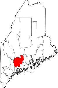 | |
| Towns | ||
| Unorganized territory | ||
| CDPs | ||
| Other villages | ||
Coordinates: 44°31′56″N 69°26′33″W / 44.53222°N 69.44250°W