Truro Highlands Historic District
|
Truro Highlands Historic District | |
|
| |
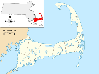   | |
| Location | Truro, Massachusetts |
|---|---|
| Coordinates | 42°02′22″N 70°3′44″W / 42.03944°N 70.06222°WCoordinates: 42°02′22″N 70°3′44″W / 42.03944°N 70.06222°W |
| Area | 85.9 acres (34.8 ha) |
| Architect | Unknown |
| NRHP Reference # | 11000823[1] |
| Added to NRHP | November 22, 2011 |
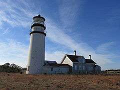
The Truro Highlands Historic District encompasses an area of North Truro, Massachusetts, within the Cape Cod National Seashore, that has served as a recreational destination for more than 175 years. The major features of the district, which is centered on Highland Road east of US Route 6, are the Highland Light Station, the Highland House (now a museum), and the Highland Golf Links, one of the oldest golf courses on Cape Cod.[2]
The district was added to the National Register of Historic Places in 2011.[1]
See also
- National Register of Historic Places listings in Cape Cod National Seashore
- National Register of Historic Places listings in Barnstable County, Massachusetts
References
- 1 2 National Park Service (2008-04-15). "National Register Information System". National Register of Historic Places. National Park Service.
- ↑ "Truro Highlands Historic District: Existing Conditions" (PDF). National Park Service. Retrieved 2014-02-22.
| Topics |  | ||||||||||||||||||||||||||||||
|---|---|---|---|---|---|---|---|---|---|---|---|---|---|---|---|---|---|---|---|---|---|---|---|---|---|---|---|---|---|---|---|
| Lists by county | |||||||||||||||||||||||||||||||
| Lists by city |
| ||||||||||||||||||||||||||||||
| Other lists | |||||||||||||||||||||||||||||||
| |||||||||||||||||||||||||||||||
This article is issued from Wikipedia - version of the 11/30/2016. The text is available under the Creative Commons Attribution/Share Alike but additional terms may apply for the media files.