Fort Hill Rural Historic District
|
Fort Hill Rural Historic District | |
|
View from Fort Hill | |
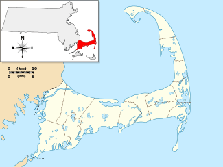   | |
| Location | Eastham, Massachusetts |
|---|---|
| Coordinates | 41°49′10″N 69°57′56″W / 41.81944°N 69.96556°WCoordinates: 41°49′10″N 69°57′56″W / 41.81944°N 69.96556°W |
| Area | 100 acres (40 ha) |
| Built | 1868 |
| Architectural style | Second Empire, Greek Revival |
| NRHP Reference # | [1] |
| Added to NRHP | April 5, 2001 |
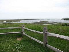
The Fort Hill Rural Historic District is a historic district encompassing two farmsteads with more than 200 years of history in Eastham, Massachusetts. The district is a 100-acre (40 ha) area of forest, fields, and salt marshes that was owned by the Knowles and Penninman families from 1742 to 1941. It has been part of the Cape Cod National Seashore since 1961. The area is dominated by the rise called "Fort Hill", which provides extensive views of the area and has its own rich history. The district includes the Edward Penniman House and Barn, previously listed on the National Register of Historic Places, and the Nauset Archeological District, a National Historic Landmark.[2]
The district was listed on the National Register of Historic Places in 2001.[1]
See also
- National Register of Historic Places listings in Cape Cod National Seashore
- National Register of Historic Places listings in Barnstable County, Massachusetts
References
- 1 2 National Park Service (2008-04-15). "National Register Information System". National Register of Historic Places. National Park Service.
- ↑ "NRHP nomination for Fort Hill Rural Historic District". Commonwealth of Massachusetts. Retrieved 2014-05-10.
| Topics |  | ||||||||||||||||||||||||||||||
|---|---|---|---|---|---|---|---|---|---|---|---|---|---|---|---|---|---|---|---|---|---|---|---|---|---|---|---|---|---|---|---|
| Lists by county | |||||||||||||||||||||||||||||||
| Lists by city |
| ||||||||||||||||||||||||||||||
| Other lists | |||||||||||||||||||||||||||||||
| |||||||||||||||||||||||||||||||