Trout Creek, Utah
| Trout Creek | |
|---|---|
| Unincorporated community | |
 Trout Creek  Trout Creek Location of Trout Creek in Utah | |
| Coordinates: 39°48′7.8″N 113°49′38.24″W / 39.802167°N 113.8272889°WCoordinates: 39°48′7.8″N 113°49′38.24″W / 39.802167°N 113.8272889°W | |
| Country | United States |
| State | Utah |
| County | Juab |
| Named for | Trout Creek |
| Elevation[1] | 6,675 ft (2,035 m) |
| Time zone | Mountain (MST) (UTC-7) |
| • Summer (DST) | MDT (UTC-6) |
| ZIP code | 84083 |
| Area code(s) | 435 |
Trout Creek is a small farming unincorporated community, located along the Pony Express/Overland route in northern Snake Valley, north of Partoun, Utah and south of Callao, Utah. It is named after the creek that flows from the west off of the Deep Creek Mountains.[2] It has one of the most remote Mormon chapels in Utah, with a short section of paved road, the only paved road for over 50 miles.[3]
It is located at 39.68550N 113.82729W, at an elevation of 6,675 feet (2,035 meters). The Zip Code is 84083.
| Historical population | |||
|---|---|---|---|
| Census | Pop. | %± | |
| 1930 | 63 | — | |
| 1940 | 23 | −63.5% | |
| Source: U.S. Census Bureau[4] | |||
References
- ↑ U.S. Geological Survey Geographic Names Information System: Callao
- ↑ Van Cott, J. W., 1990, Utah Place Names, ISBN 0-87480-345-4
- ↑ Baird, Joe (September 25, 2005). "In Utah's west desert, you treasure what you have". The Salt Lake Tribune. Retrieved 2016-08-09.
- ↑ "Census of Population and Housing". U.S. Census Bureau. Retrieved November 7, 2011.
Municipalities and communities of Juab County, Utah, United States | ||
|---|---|---|
| Cities | 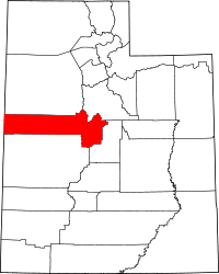 | |
| Towns | ||
| Unincorporated communities | ||
| Ghost towns | ||
| Footnotes | ‡This populated place also has portions in an adjacent county or counties | |
This article is issued from Wikipedia - version of the 8/9/2016. The text is available under the Creative Commons Attribution/Share Alike but additional terms may apply for the media files.