Nephi, Utah
| Nephi, Utah | |
|---|---|
| City | |
|
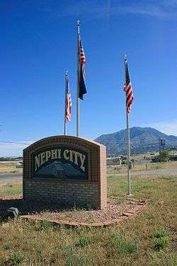
City sign | |
 Location in Juab County and state of Utah. | |
| Coordinates: 39°42′33″N 111°49′53″W / 39.70917°N 111.83139°WCoordinates: 39°42′33″N 111°49′53″W / 39.70917°N 111.83139°W | |
| Country | United States |
| State | Utah |
| County | Juab |
| Settled | 1851 |
| Named for | Nephi |
| Area | |
| • Total | 4.2 sq mi (10.8 km2) |
| • Land | 4.2 sq mi (10.8 km2) |
| • Water | 0.0 sq mi (0.0 km2) |
| Elevation | 5,128 ft (1,563 m) |
| Population (2012) | |
| • Total | 5,438 |
| • Density | 1,300/sq mi (500/km2) |
| Time zone | Mountain (MST) (UTC-7) |
| • Summer (DST) | MDT (UTC-6) |
| ZIP code | 84648 |
| Area code(s) | 435 |
| FIPS code | 49-54220[1] |
| GNIS feature ID | 1443793[2] |
Nephi is a city in Juab County, Utah, United States. It is part of the Provo–Orem, Utah Metropolitan Statistical Area. The population was 4,733 at the 2000 census. It is the county seat of Juab County.[3] It was settled by Mormon pioneers in 1851, as Salt Creek until 1882 when it acquired its current name. It is the principal city in the Juab Valley, an agricultural area. Nephi was named after Nephi, son of Lehi from the Book of Mormon.
History
Before the area was settled, the site along Salt Creek was first a camping place along the Old Mormon Road to Southern California. When Mormon settlers established their settlement in 1851 it too was called, Salt Creek. It retained that name until 1882 when the town and its post office became Nephi.[4]
Geography and climate
According to the United States Census Bureau, the city has a total area of 4.2 square miles (10.8 km²), all of it land.
| Climate data for Nephi, Utah (1981–2010) | |||||||||||||
|---|---|---|---|---|---|---|---|---|---|---|---|---|---|
| Month | Jan | Feb | Mar | Apr | May | Jun | Jul | Aug | Sep | Oct | Nov | Dec | Year |
| Average high °F (°C) | 39.6 (4.2) |
44.6 (7) |
55.6 (13.1) |
64.0 (17.8) |
73.6 (23.1) |
83.9 (28.8) |
91.8 (33.2) |
89.8 (32.1) |
80.5 (26.9) |
66.8 (19.3) |
51.4 (10.8) |
39.5 (4.2) |
65.1 (18.4) |
| Average low °F (°C) | 18.2 (−7.7) |
21.5 (−5.8) |
28.5 (−1.9) |
34.3 (1.3) |
42.3 (5.7) |
50.1 (10.1) |
58.7 (14.8) |
57.5 (14.2) |
48.1 (8.9) |
36.9 (2.7) |
26.9 (−2.8) |
18.5 (−7.5) |
36.8 (2.7) |
| Average precipitation inches (mm) | 1.31 (33.3) |
1.32 (33.5) |
1.61 (40.9) |
1.66 (42.2) |
1.61 (40.9) |
0.98 (24.9) |
0.75 (19) |
0.90 (22.9) |
1.19 (30.2) |
1.57 (39.9) |
1.24 (31.5) |
1.30 (33) |
15.46 (392.7) |
| Average snowfall inches (cm) | 12.2 (31) |
10.4 (26.4) |
6.6 (16.8) |
2.7 (6.9) |
0.4 (1) |
0.0 (0) |
0.0 (0) |
0.0 (0) |
0.0 (0) |
1.2 (3) |
6.9 (17.5) |
12.9 (32.8) |
53.4 (135.6) |
| Source: NOAA[5] | |||||||||||||
Demographics
| Historical population | |||
|---|---|---|---|
| Census | Pop. | %± | |
| 1860 | 672 | — | |
| 1870 | 1,286 | 91.4% | |
| 1880 | 1,797 | 39.7% | |
| 1890 | 2,034 | 13.2% | |
| 1900 | 2,203 | 8.3% | |
| 1910 | 2,759 | 25.2% | |
| 1920 | 2,603 | −5.7% | |
| 1930 | 2,573 | −1.2% | |
| 1940 | 2,835 | 10.2% | |
| 1950 | 2,990 | 5.5% | |
| 1960 | 2,566 | −14.2% | |
| 1970 | 2,699 | 5.2% | |
| 1980 | 3,285 | 21.7% | |
| 1990 | 3,515 | 7.0% | |
| 2000 | 4,733 | 34.7% | |
| 2010 | 5,389 | 13.9% | |
| Est. 2015 | 5,560 | [6] | 3.2% |
As of the census[1] of 2000, there were 4,733 people, 1,430 households, and 1,149 families residing in the city. The population density was 1,133.8 people per square mile (438.2/km²). There were 1,552 housing units at an average density of 371.8 per square mile (143.7/km²). The racial makeup of the city was 96.98% White, 0.11% African American, 0.63% Native American, 0.46% Asian, 0.02% Pacific Islander, 0.97% from other races, and 0.82% from two or more races. Hispanic or Latino of any race were 2.45% of the population.
There were 1,430 households out of which 50.1% had children under the age of 18 living with them, 71.1% were married couples living together, 6.2% had a female householder with no husband present, and 19.6% were non-families. 18.3% of all households were made up of individuals and 9.6% had someone living alone who was 65 years of age or older. The average household size was 3.24 and the average family size was 3.72.
In the city the population was spread out with 37.8% under the age of 18, 9.0% from 18 to 24, 25.4% from 25 to 44, 16.9% from 45 to 64, and 10.9% who were 65 years of age or older. The median age was 28 years. For every 100 females there were 101.2 males. For every 100 females age 18 and over, there were 96.0 males.
The median income for a household in the city was $38,918, and the median income for a family was $43,327. Males had a median income of $34,792 versus $21,027 for females. The per capita income for the city was $13,154. About 7.5% of families and 10.0% of the population were below the poverty line, including 8.7% of those under age 18 and 18.2% of those age 65 or over.
Famous people
- Brandon Flowers of The Killers lived in Nephi from age 8 until his junior year in Juab High School.
- Roger Boisjoly, engineer who tried to prevent Space Shuttle Challenger from launching, lived his final years in Nephi.
References
- 1 2 "American FactFinder". United States Census Bureau. Retrieved 2008-01-31.
- ↑ "US Board on Geographic Names". United States Geological Survey. 2007-10-25. Retrieved 2008-01-31.
- ↑ "Find a County". National Association of Counties. Retrieved 2011-06-07.
- ↑ Post Offices, Utah, Juab County, Nephi (1882-Date), Salt Creek (1851-1882), from postalhistory.com accessed September 3, 2015]
- ↑ "NOWData - NOAA Online Weather Data". National Oceanic and Atmospheric Administration. Retrieved May 5, 2013.
- ↑ "Annual Estimates of the Resident Population for Incorporated Places: April 1, 2010 to July 1, 2015". Retrieved July 2, 2016.
- ↑ "Census of Population and Housing". Census.gov. Retrieved June 4, 2015.
External links
| Wikimedia Commons has media related to Nephi, Utah. |
 |
Eureka | Mona | Uinta National Forest | |
| Fish Springs National Wildlife Refuge | |
Scofield | ||
| ||||
| | ||||
| Leamington | Levan | Fountain Green Moroni Wales |
Municipalities and communities of Juab County, Utah, United States | ||
|---|---|---|
| Cities | 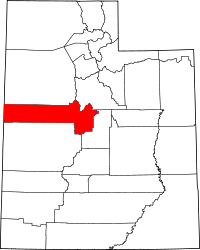 | |
| Towns | ||
| Unincorporated communities | ||
| Ghost towns | ||
| Footnotes | ‡This populated place also has portions in an adjacent county or counties | |