Partoun, Utah
| Partoun | |
|---|---|
| Unincorporated community | |
|
View to the southeast showing Partoun and West Desert High | |
 Partoun  Partoun Location of Partoun in Utah | |
| Coordinates: 39°38′36″N 113°53′16″W / 39.64333°N 113.88778°WCoordinates: 39°38′36″N 113°53′16″W / 39.64333°N 113.88778°W | |
| Country | United States |
| State | Utah |
| County | Juab |
| Founded | 1949 |
| Named for | A Scottish town |
| Elevation[1] | 4,800 ft (1,463 m) |
| GNIS feature ID | 1437285[1] |

Partoun /ˈpɑːrtuːn/ is an unincorporated community in Juab County, Utah, United States. It is located in Snake Valley at latitude 39.64661N and longitude -113.88700W with an elevation of 4,818' (1,469m). It was founded in 1949 by the religious group called the Aaronic Order, and named after a town in Scotland.
Partoun is part of the Provo–Orem, Utah Metropolitan Statistical Area.
Partoun is also home to West Desert High[2] and West Desert Elementary,[3] even though the website mentions the neighboring community of Trout Creek to the north.[4]
Climate
| Climate data for Partoun, Utah (Elevation 4,800ft) | |||||||||||||
|---|---|---|---|---|---|---|---|---|---|---|---|---|---|
| Month | Jan | Feb | Mar | Apr | May | Jun | Jul | Aug | Sep | Oct | Nov | Dec | Year |
| Record high °F (°C) | 69 (21) |
74 (23) |
82 (28) |
92 (33) |
100 (38) |
105 (41) |
107 (42) |
105 (41) |
100 (38) |
93 (34) |
78 (26) |
67 (19) |
107 (42) |
| Average high °F (°C) | 40.4 (4.7) |
46.6 (8.1) |
55.9 (13.3) |
64.4 (18) |
74.4 (23.6) |
85.5 (29.7) |
94.4 (34.7) |
92.0 (33.3) |
82.2 (27.9) |
68.2 (20.1) |
52.4 (11.3) |
41.3 (5.2) |
66.5 (19.2) |
| Average low °F (°C) | 13.7 (−10.2) |
19.4 (−7) |
25.8 (−3.4) |
32.4 (0.2) |
40.5 (4.7) |
48.7 (9.3) |
56.1 (13.4) |
54.3 (12.4) |
44.0 (6.7) |
33.2 (0.7) |
22.8 (−5.1) |
14.7 (−9.6) |
33.8 (1) |
| Record low °F (°C) | −23 (−31) |
−29 (−34) |
−2 (−19) |
10 (−12) |
16 (−9) |
21 (−6) |
36 (2) |
31 (−1) |
21 (−6) |
2 (−17) |
−7 (−22) |
−27 (−33) |
−29 (−34) |
| Average precipitation inches (mm) | 0.42 (10.7) |
0.50 (12.7) |
0.54 (13.7) |
0.72 (18.3) |
0.94 (23.9) |
0.69 (17.5) |
0.56 (14.2) |
0.57 (14.5) |
0.58 (14.7) |
0.61 (15.5) |
0.46 (11.7) |
0.35 (8.9) |
6.93 (176) |
| Average snowfall inches (cm) | 3.3 (8.4) |
3.4 (8.6) |
0.8 (2) |
0.7 (1.8) |
0.1 (0.3) |
0 (0) |
0 (0) |
0 (0) |
0 (0) |
0.3 (0.8) |
0.8 (2) |
1.9 (4.8) |
11.4 (29) |
| Source: The Western Regional Climate Center[5] | |||||||||||||
References
- 1 2 U.S. Geological Survey Geographic Names Information System: Partoun
- ↑ http://www.tintic.k12.ut.us/schools/westdeserths/
- ↑ http://www.tintic.k12.ut.us/schools/westdesertes
- ↑ Fish Springs 1:100,000 topo map
- ↑ "Seasonal Temperature and Precipitation Information". Western Regional Climate Center. Retrieved April 12, 2013.
Municipalities and communities of Juab County, Utah, United States | ||
|---|---|---|
| Cities | 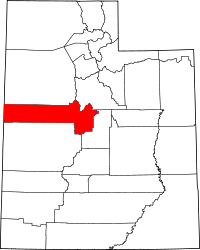 | |
| Towns | ||
| Unincorporated communities | ||
| Ghost towns | ||
| Footnotes | ‡This populated place also has portions in an adjacent county or counties | |
This article is issued from Wikipedia - version of the 8/8/2016. The text is available under the Creative Commons Attribution/Share Alike but additional terms may apply for the media files.