Eureka, Utah
| Eureka, Utah | |
|---|---|
| City | |
|
BPOE Block in Eureka | |
 Location in Juab County and state of Utah. | |
| Coordinates: 39°57′18″N 112°6′59″W / 39.95500°N 112.11639°WCoordinates: 39°57′18″N 112°6′59″W / 39.95500°N 112.11639°W | |
| Country | United States |
| State | Utah |
| County | Juab |
| Founded | 1870 |
| Incorporated | November 8, 1892 |
| Named for | Eureka |
| Area | |
| • Total | 1.5 sq mi (3.8 km2) |
| • Land | 1.5 sq mi (3.8 km2) |
| • Water | 0.0 sq mi (0.0 km2) |
| Elevation | 6,430 ft (1,960 m) |
| Population (2012) | |
| • Total | 667 |
| • Density | 521.4/sq mi (201.3/km2) |
| Time zone | Mountain (MST) (UTC-7) |
| • Summer (DST) | MDT (UTC-6) |
| ZIP code | 84628 |
| Area code(s) | 435 |
| FIPS code | 49-24080[1] |
| GNIS feature ID | 1437974[2] |

Eureka is a city in Juab County, Utah, United States. It is part of the Provo–Orem, Utah Metropolitan Statistical Area. The population was 766 at the 2000 census.
Geography
Eureka is located at 39°57′18″N 112°6′59″W / 39.95500°N 112.11639°W (39.954974, -112.116364).[3]
According to the United States Census Bureau, the city has a total area of 1.5 square miles (3.8 km²), all of it land.
Climate
This climatic region is typified by large seasonal temperature differences, with warm to hot (and often humid) summers and cold (sometimes severely cold) winters. According to the Köppen Climate Classification system, Eureka has a humid continental climate, abbreviated "Dfb" on climate maps.[4]
Demographics
| Historical population | |||
|---|---|---|---|
| Census | Pop. | %± | |
| 1880 | 122 | — | |
| 1890 | 1,733 | 1,320.5% | |
| 1900 | 3,085 | 78.0% | |
| 1910 | 3,416 | 10.7% | |
| 1920 | 3,608 | 5.6% | |
| 1930 | 3,041 | −15.7% | |
| 1940 | 2,292 | −24.6% | |
| 1950 | 1,318 | −42.5% | |
| 1960 | 771 | −41.5% | |
| 1970 | 753 | −2.3% | |
| 1980 | 670 | −11.0% | |
| 1990 | 562 | −16.1% | |
| 2000 | 766 | 36.3% | |
| 2010 | 669 | −12.7% | |
| Est. 2015 | 666 | [5] | −0.4% |
| Source: U.S. Census Bureau[6] | |||
As of the census[1] of 2000, there were 766 people, 271 households, and 197 families residing in the city. The population density was 521.4 people per square mile (201.2/km²). There were 342 housing units at an average density of 232.8 per square mile (89.8/km²). The racial makeup of the city was 97.65% White, 1.04% Native American, 0.13% Asian, 0.13% Pacific Islander, 0.26% from other races, and 0.78% from two or more races. Hispanic or Latino of any race were 2.35% of the population.

There were 271 households out of which 39.1% had children under the age of 18 living with them, 56.8% were married couples living together, 8.9% had a female householder with no husband present, and 27.3% were non-families. 24.0% of all households were made up of individuals and 13.7% had someone living alone who was 65 years of age or older. The average household size was 2.83 and the average family size was 3.37.
In the city the population was spread out with 33.2% under the age of 18, 9.1% from 18 to 24, 27.7% from 25 to 44, 18.8% from 45 to 64, and 11.2% who were 65 years of age or older. The median age was 30 years. For every 100 females there were 103.2 males. For every 100 females age 18 and over, there were 102.4 males.
The median income for a household in the city was $36,875, and the median income for a family was $43,077. Males had a median income of $35,938 versus $26,563 for females. The per capita income for the city was $14,534. About 6.3% of families and 9.9% of the population were below the poverty line, including 10.5% of those under age 18 and 12.2% of those age 65 or over.
Mining history
|
Eureka Historic District | |
|
Tintic District at Eureka in 1911 | |
  | |
| Location | Coterminous with the city |
|---|---|
| Built | 1892 |
| Architect | Multiple |
| Architectural style | Prairie School, Bungalow/Craftsman, Saltbox |
| MPS | Tintic Mining District MRA |
| NRHP Reference # | 79002514[7] |
| Added to NRHP | March 14, 1979 |

Eureka was originally known as Ruby Hollow before it developed into a bustling mining town. Incorporated as a city in 1892, Eureka became the financial center for the Tintic Mining District, a wealthy gold and silver mining area in Utah and Juab counties. The district was organized in 1869 and by 1899 became one of the top mineral producing areas in Utah. The Eureka Micropolitan Statistical Area housed the "Big Four" mines—Bullion Beck and Champion, Centennial Eureka, Eureka Hill, and Gemini-and later the Chief Consolidated Mining Company.

Eureka's role as the central financial point for the district ensured its survival. It housed business establishments, including the second-ever JCPenney store (then called the Golden Rule Store), financial institutions, local and county governmental buildings including Eureka City Hall (1899) and a Juab County Courthouse (1892), various churches, and the meeting places for numerous labor, social, and fraternal organizations. Mining entrepreneurs such as John Q. Packard, John Beck, Jesse Knight, and Walter Fitch Sr. were important figures in Eureka and Tintic history. In 1979, Eureka was placed in the National Register of Historic Places as part of the Tintic Mining District Multiple Resource Area, recognizing the importance of remaining buildings and sites.
See also
References
- 1 2 "American FactFinder". United States Census Bureau. Retrieved 2008-01-31.
- ↑ "US Board on Geographic Names". United States Geological Survey. 2007-10-25. Retrieved 2008-01-31.
- ↑ "US Gazetteer files: 2010, 2000, and 1990". United States Census Bureau. 2011-02-12. Retrieved 2011-04-23.
- ↑ Climate Summary for Eureka, Utah
- ↑ "Annual Estimates of the Resident Population for Incorporated Places: April 1, 2010 to July 1, 2015". Retrieved July 2, 2016.
- ↑ "Census of Population and Housing". U.S. Census Bureau. Retrieved November 18, 2011.
- ↑ National Park Service (2009-03-13). "National Register Information System". National Register of Historic Places. National Park Service.
External links
![]() Media related to Eureka, Utah at Wikimedia Commons
Media related to Eureka, Utah at Wikimedia Commons
 |
Vernon | Fairfield | Saratoga Springs Utah Lake |
|
| Fish Springs National Wildlife Refuge | |
Genola Goshen Rocky Ridge | ||
| ||||
| | ||||
| Lynndyl, Leamington | Scipio | Mona Nephi Levan |
Municipalities and communities of Juab County, Utah, United States | ||
|---|---|---|
| Cities | 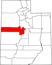 | |
| Towns | ||
| Unincorporated communities | ||
| Ghost towns | ||
| Footnotes | ‡This populated place also has portions in an adjacent county or counties | |