Toronto, Iowa
| Toronto, Iowa | |
|---|---|
| City | |
|
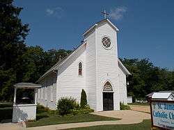
Saint James Catholic Church | |
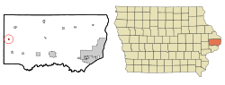 Location of Toronto, Iowa | |
| Coordinates: 41°54′12″N 90°51′47″W / 41.90333°N 90.86306°WCoordinates: 41°54′12″N 90°51′47″W / 41.90333°N 90.86306°W | |
| Country |
|
| State |
|
| County | Clinton |
| Incorporated | July 26, 1909 [1] |
| Area[2] | |
| • Total | 0.19 sq mi (0.49 km2) |
| • Land | 0.19 sq mi (0.49 km2) |
| • Water | 0 sq mi (0 km2) |
| Elevation | 722 ft (220 m) |
| Population (2010)[3] | |
| • Total | 124 |
| • Estimate (2012[4]) | 123 |
| • Density | 652.6/sq mi (252.0/km2) |
| Time zone | Central (CST) (UTC-6) |
| • Summer (DST) | CDT (UTC-5) |
| ZIP code | 52777 |
| Area code(s) | 563 |
| FIPS code | 19-78600 |
| GNIS feature ID | 0462280 |
Toronto is a town in Clinton County, Iowa, United States. The population was 124 at the 2010 census.
History
Toronto was platted in 1853 by George W. Thorne, a former resident of Toronto, Ontario, Canada. Thorne had built a sawmill and gristmill at the site in the 1840s.[5]
Geography
Toronto is located at 41°54′12″N 90°51′47″W / 41.90333°N 90.86306°W (41.903340, -90.863011).[6]
According to the United States Census Bureau, the city has a total area of 0.19 square miles (0.49 km2), all of it land.[2]
Demographics
| Historical populations | ||
|---|---|---|
| Year | Pop. | ±% |
| 1910 | 106 | — |
| 1920 | 139 | +31.1% |
| 1930 | 113 | −18.7% |
| 1940 | 142 | +25.7% |
| 1950 | 165 | +16.2% |
| 1960 | 144 | −12.7% |
| 1970 | 145 | +0.7% |
| 1980 | 172 | +18.6% |
| 1990 | 132 | −23.3% |
| 2000 | 134 | +1.5% |
| 2010 | 124 | −7.5% |
| 2014 | 121 | −2.4% |
| 2015 | 120 | −0.8% |
| Source:"American FactFinder". United States Census Bureau. and Iowa Data Center Source: | ||
2010 census
As of the census[3] of 2010, there were 124 people, 48 households, and 36 families residing in the city. The population density was 652.6 inhabitants per square mile (252.0/km2). There were 59 housing units at an average density of 310.5 per square mile (119.9/km2). The racial makeup of the city was 97.6% White and 2.4% African American. Hispanic or Latino of any race were 2.4% of the population.
There were 48 households of which 27.1% had children under the age of 18 living with them, 66.7% were married couples living together, 2.1% had a female householder with no husband present, 6.3% had a male householder with no wife present, and 25.0% were non-families. 22.9% of all households were made up of individuals and 12.5% had someone living alone who was 65 years of age or older. The average household size was 2.58 and the average family size was 3.03.
The median age in the city was 47 years. 21.8% of residents were under the age of 18; 7.2% were between the ages of 18 and 24; 17.7% were from 25 to 44; 40.4% were from 45 to 64; and 12.9% were 65 years of age or older. The gender makeup of the city was 54.0% male and 46.0% female.
2000 census
As of the census[8] of 2000, there were 134 people, 51 households, and 41 families residing in the city. The population density was 728.6 people per square mile (287.4/km²). There were 55 housing units at an average density of 299.1 per square mile (118.0/km²). The racial makeup of the city was 100.00% White. Hispanic or Latino of any race were 0.75% of the population.
There were 51 households out of which 39.2% had children under the age of 18 living with them, 72.5% were married couples living together, 5.9% had a female householder with no husband present, and 19.6% were non-families. 19.6% of all households were made up of individuals and 5.9% had someone living alone who was 65 years of age or older. The average household size was 2.63 and the average family size was 3.00.
In the city the population was spread out with 24.6% under the age of 18, 10.4% from 18 to 24, 22.4% from 25 to 44, 31.3% from 45 to 64, and 11.2% who were 65 years of age or older. The median age was 42 years. For every 100 females there were 127.1 males. For every 100 females age 18 and over, there were 114.9 males
The median income for a household in the city was $27,500, and the median income for a family was $27,500. Males had a median income of $22,188 versus $13,125 for females. The per capita income for the city was $13,702. There were 5.0% of families and 6.3% of the population living below the poverty line, including 7.7% of under eighteens and none of those over 64.
References
- ↑ "Toronto-Iowa". City-Data. Retrieved May 10, 2011.
- 1 2 "US Gazetteer files 2010". United States Census Bureau. Retrieved 2012-05-11.
- 1 2 "American FactFinder". United States Census Bureau. Retrieved 2012-05-11.
- ↑ "Population Estimates". United States Census Bureau. Retrieved 2013-05-23.
- ↑ Wolfe, Patrick B. (1911). Wolfe's History of Clinton County, Iowa, Volume 1. B. F. Bowen. p. 278.
- ↑ "US Gazetteer files: 2010, 2000, and 1990". United States Census Bureau. 2011-02-12. Retrieved 2011-04-23.
- ↑ "Census of Population and Housing". Census.gov. Retrieved June 4, 2015.
- ↑ "American FactFinder". United States Census Bureau. Retrieved 2008-01-31.
External links
| Wikimedia Commons has media related to Toronto, Iowa. |
- City-Data Comprehensive Statistical Data and more about Toronto
Municipalities and communities of Clinton County, Iowa, United States | ||
|---|---|---|
| Cities | ||
| Townships | ||
| Unincorporated communities | ||
| Footnotes | ‡This populated place also has portions in an adjacent county or counties | |