Spring Rock Township, Clinton County, Iowa
| Spring Rock Township | |
|---|---|
| Township | |
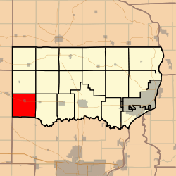 Location in Clinton County | |
| Coordinates: 41°49′00″N 090°51′06″W / 41.81667°N 90.85167°WCoordinates: 41°49′00″N 090°51′06″W / 41.81667°N 90.85167°W | |
| Country |
|
| State |
|
| County | Clinton |
| Area | |
| • Total | 36.25 sq mi (93.9 km2) |
| • Land | 36.25 sq mi (93.9 km2) |
| • Water | 0 sq mi (0 km2) 0% |
| Elevation | 682 ft (208 m) |
| Population (2000) | |
| • Total | 1,142 |
| • Density | 31.5/sq mi (12.2/km2) |
| GNIS feature ID | 0468744 |
Spring Rock Township is a township in Clinton County, Iowa, USA. As of the 2000 census, its population was 1,142.
History
Spring Rock Township was organized in 1844. The township takes its name from a huge rock at found at a spring in Scott County.[1]
Geography
Spring Rock Township covers an area of 36.25 square miles (93.9 km2) and contains one incorporated settlement, Wheatland, along with some unincorporated settlements such as Big Rock. According to the USGS, it contains four cemeteries: Homigrahusen, Pine Hill, Rose Hill and Saint Pauls.
The streams of Calamus Creek, Lizard Creek, Rock Creek and Yankee Run run through this township.
Notes
- ↑ Wolfe, Patrick B. (1911). Wolfe's History of Clinton County, Iowa, Volume 1. B. F. Bowen. p. 329.
References
External links
Municipalities and communities of Clinton County, Iowa, United States | ||
|---|---|---|
| Cities | ||
| Townships | ||
| Unincorporated communities | ||
| Footnotes | ‡This populated place also has portions in an adjacent county or counties | |
This article is issued from Wikipedia - version of the 11/22/2016. The text is available under the Creative Commons Attribution/Share Alike but additional terms may apply for the media files.