Sharon Township, Clinton County, Iowa
| Sharon Township | |
|---|---|
| Township | |
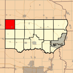 Location in Clinton County | |
| Coordinates: 41°59′19″N 090°50′54″W / 41.98861°N 90.84833°WCoordinates: 41°59′19″N 090°50′54″W / 41.98861°N 90.84833°W | |
| Country |
|
| State |
|
| County | Clinton |
| Area | |
| • Total | 36.28 sq mi (93.96 km2) |
| • Land | 36.28 sq mi (93.96 km2) |
| • Water | 0 sq mi (0 km2) 0% |
| Elevation | 764 ft (233 m) |
| Population (2000) | |
| • Total | 784 |
| • Density | 21.6/sq mi (8.3/km2) |
| GNIS feature ID | 0468685 |
Sharon Township is a township in Clinton County, Iowa, USA. As of the 2000 census, its population was 784. Sharon Methodist Episcopal Church, which is located in the township, is listed on the National Register of Historic Places.
Geography
Sharon Township covers an area of 36.28 square miles (94.0 km2) and contains one incorporated settlement, Lost Nation. According to the USGS, it contains six cemeteries: Busch, Dickman, Lost Nation, Rustic Park, Sacred Heart and Smithtown.
References
External links
Municipalities and communities of Clinton County, Iowa, United States | ||
|---|---|---|
| Cities | ||
| Townships | ||
| Unincorporated communities | ||
| Footnotes | ‡This populated place also has portions in an adjacent county or counties | |
This article is issued from Wikipedia - version of the 11/22/2016. The text is available under the Creative Commons Attribution/Share Alike but additional terms may apply for the media files.