Texas State Highway Spur 10
| ||||
|---|---|---|---|---|
| Route information | ||||
| Length: | 9.100 mi[1] (14.645 km) | |||
| Existed: | 1994 – present | |||
| Major junctions | ||||
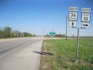
| South end: |
| |||
|
| ||||
| North end: |
| |||
| Highway system | ||||
| ||||

Texas State Highway Spur 10 (Spur 10) is a spur route in the U.S. state of Texas that remains within Fort Bend County. The highway begins at State Highway 36 (SH 36) near Pleak and runs in a northwesterly direction until it ends at SH 36 northwest of Rosenberg. Northbound traffic on SH 36 can use Spur 10 to avoid passing through Rosenberg. The highway goes entirely through rural areas.
History
On September 26, 1939, Spur 10 was designated to run from SH 114 to SH 121 in Grapevine in Tarrant County. Spur 10 was canceled on April 25, 1960 and removed from the highway system.[1]
Spur 10 was revived on September 29, 1994 to start on SH 36 at a distance 5.2 miles (8.4 km) northeast of Rosenberg in Fort Bend County. From that point, the spur ran southeast to end at U.S. Route 59 (US 59). In 2010 the certified distance was 4.236 miles (6.817 km). On August 30, 2012, Spur 10 was extended southeast from US 59 to SH 36 in Pleak to make a total distance of 9.1 miles (14.6 km).[1]
Route description
Spur 10 begins at a stop sign on SH 36 in Pleak. There is a Chevron filling station and market on the corner. From its starting point, Spur 10 heads straight northwest 5.0 miles (8.0 km) to a bridge over US 59 and the Union Pacific Railroad tracks. This stretch of the highway is named Gerken Road near Pleak, but as it goes northwest it becomes known as Hartledge Road. Traffic on Spur 10 can access US 59 to the northeast by a feeder road and to the southwest by a ramp off the overpass. From US 59, the highway continues northeast about 1.0 mile (1.6 km) where it turns to the north. Spur 10 continues for a distance of 1.2 miles (1.9 km) to a bridge over U.S. Route 90 Alternate (US 90A). Traffic on Spur 10 can access US 90A in both directions. From the overpass, the highway continues in a northerly direction for an additional 1.9 miles (3.1 km) before ending at a stop sign on SH 36. In the stretch from US 59 to SH 36, the highway is also known as Patton Road and falls within the city limits of Rosenberg.[2]
 Northern end of Spur 10 on SH 36 looking east-southeast
 Approach to Spur 10 overpass at US 90A looking north
 Approach to Spur 10 overpass at US 59 looking southeast
Major intersections
The entire highway is in Fort Bend County.
| Location | mi | km | Destinations | Notes | |
|---|---|---|---|---|---|
| Pleak | 0.0 | 0.0 | Southern terminus of Spur 10 | ||
| Rosenberg | 5.0 | 8.0 | |||
| 7.2 | 11.6 | ||||
| 9.1 | 14.6 | Northern terminus of Spur 10 | |||
| 1.000 mi = 1.609 km; 1.000 km = 0.621 mi | |||||
References
- 1 2 3 Transportation Planning and Programming Division (n.d.). "State Highway Spur No. 10". Highway Designation Files. Texas Department of Transportation. Retrieved April 9, 2013.
- ↑ Google (April 9, 2013). "Texas State Highway Spur 10" (Map). Google Maps. Google. Retrieved April 9, 2013.